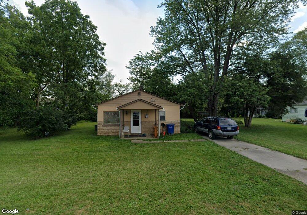
3186 Joan Rd Columbus, OH 43204
Valleyview Heights NeighborhoodEstimated Value: $85,000 - $155,000
1
Bed
1
Bath
576
Sq Ft
$195/Sq Ft
Est. Value
About This Home
This home is located at 3186 Joan Rd, Columbus, OH 43204 and is currently estimated at $112,110, approximately $194 per square foot. 3186 Joan Rd is a home located in Franklin County with nearby schools including Valleyview Elementary School, Westmoor Middle School, and West High School.
Ownership History
Date
Name
Owned For
Owner Type
Purchase Details
Closed on
Nov 27, 2001
Sold by
Estate Of Theodore N Martin Jr
Bought by
Martin Judith A
Current Estimated Value
Purchase Details
Closed on
Nov 17, 2000
Sold by
Martin Theodore N and Martin Judith A
Bought by
Cochenour John E
Home Financials for this Owner
Home Financials are based on the most recent Mortgage that was taken out on this home.
Original Mortgage
$25,000
Interest Rate
8%
Mortgage Type
Seller Take Back
Purchase Details
Closed on
Sep 18, 1984
Bought by
Martin Theodore N
Create a Home Valuation Report for This Property
The Home Valuation Report is an in-depth analysis detailing your home's value as well as a comparison with similar homes in the area
Home Values in the Area
Average Home Value in this Area
Purchase History
| Date | Buyer | Sale Price | Title Company |
|---|---|---|---|
| Martin Judith A | -- | -- | |
| Cochenour John E | $30,000 | Stewart Title Agency Of Colu | |
| Martin Theodore N | -- | -- |
Source: Public Records
Mortgage History
| Date | Status | Borrower | Loan Amount |
|---|---|---|---|
| Previous Owner | Cochenour John E | $25,000 |
Source: Public Records
Tax History Compared to Growth
Tax History
| Year | Tax Paid | Tax Assessment Tax Assessment Total Assessment is a certain percentage of the fair market value that is determined by local assessors to be the total taxable value of land and additions on the property. | Land | Improvement |
|---|---|---|---|---|
| 2024 | $1,059 | $23,100 | $8,750 | $14,350 |
| 2023 | $1,045 | $23,100 | $8,750 | $14,350 |
| 2022 | $603 | $11,340 | $8,400 | $2,940 |
| 2021 | $604 | $11,340 | $8,400 | $2,940 |
| 2020 | $605 | $11,340 | $8,400 | $2,940 |
| 2019 | $588 | $9,450 | $7,000 | $2,450 |
| 2018 | $569 | $9,450 | $7,000 | $2,450 |
| 2017 | $694 | $12,570 | $7,000 | $5,570 |
| 2016 | $607 | $8,930 | $3,080 | $5,850 |
| 2015 | $552 | $8,930 | $3,080 | $5,850 |
| 2014 | $554 | $8,930 | $3,080 | $5,850 |
| 2013 | $304 | $9,940 | $3,430 | $6,510 |
Source: Public Records
Map
Nearby Homes
- 160 N Sylvan Ave
- 3100 Steele Ave
- 355-357 N Algonquin Ave
- 66 N Brinker Ave
- 154-156 N Huron Ave
- 75 N Huron Ave
- 3096 Ellis Place
- 162 S Roys Ave
- 65 N Chase Ave
- 133 S Brinker Ave
- 195 S Sylvan Ave
- 527 N Hague Ave
- 514 N Hague Ave
- 227 S Sylvan Ave
- 104-106 N Hague Ave
- 200-202 N Harris Ave
- 253 Powhatan Ave
- 267 S Westgate Ave
- 0 S Brinker Ave
- 65 S Hague Ave
- 3196 Joan Rd
- 212 N Sylvan Ave
- 238 N Algonquin Ave
- 251 N Algonquin Ave
- 234 N Sylvan Ave
- 199 N Algonquin Ave
- 261 N Algonquin Ave
- 0 N Algonquin Ave
- 250 N Sylvan Ave
- 250 N Algonquin Ave
- 0 N Sylvan Ave
- 3205 Joan Rd
- 260 N Sylvan Ave
- 245 N Brinker Ave
- 241 N Brinker Ave
- 0 N Sylvan Ave
- 221 N Sylvan Ave
- 205 N Sylvan Ave
- 241 N Sylvan Ave
- 260 N Algonquin Ave