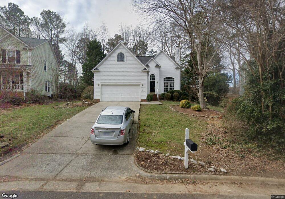
319 Catlin Rd Cary, NC 27519
West Cary NeighborhoodEstimated Value: $505,000 - $538,978
3
Beds
3
Baths
1,860
Sq Ft
$281/Sq Ft
Est. Value
About This Home
This home is located at 319 Catlin Rd, Cary, NC 27519 and is currently estimated at $522,995, approximately $281 per square foot. 319 Catlin Rd is a home located in Wake County with nearby schools including Turner Creek Elementary School, Salem Middle, and Green Level High School.
Ownership History
Date
Name
Owned For
Owner Type
Purchase Details
Closed on
Mar 31, 2006
Sold by
Mims Ashley S and Mims Gregory A
Bought by
Bright Addo Anthony
Current Estimated Value
Home Financials for this Owner
Home Financials are based on the most recent Mortgage that was taken out on this home.
Original Mortgage
$159,920
Outstanding Balance
$91,316
Interest Rate
6.25%
Mortgage Type
Purchase Money Mortgage
Estimated Equity
$431,679
Purchase Details
Closed on
Jul 30, 2004
Sold by
Allen Gary G
Bought by
Watson Ashley S
Home Financials for this Owner
Home Financials are based on the most recent Mortgage that was taken out on this home.
Original Mortgage
$195,573
Interest Rate
6.19%
Mortgage Type
Purchase Money Mortgage
Purchase Details
Closed on
Dec 31, 1997
Sold by
Allen Tammy M
Bought by
Allen Gary G
Create a Home Valuation Report for This Property
The Home Valuation Report is an in-depth analysis detailing your home's value as well as a comparison with similar homes in the area
Home Values in the Area
Average Home Value in this Area
Purchase History
| Date | Buyer | Sale Price | Title Company |
|---|---|---|---|
| Bright Addo Anthony | $200,000 | None Available | |
| Watson Ashley S | $196,000 | -- | |
| Allen Gary G | -- | -- |
Source: Public Records
Mortgage History
| Date | Status | Borrower | Loan Amount |
|---|---|---|---|
| Open | Bright Addo Anthony | $159,920 | |
| Closed | Bright Addo Anthony | $25,000 | |
| Previous Owner | Watson Ashley S | $195,573 |
Source: Public Records
Tax History
| Year | Tax Paid | Tax Assessment Tax Assessment Total Assessment is a certain percentage of the fair market value that is determined by local assessors to be the total taxable value of land and additions on the property. | Land | Improvement |
|---|---|---|---|---|
| 2025 | $4,392 | $510,042 | $230,000 | $280,042 |
| 2024 | $4,297 | $510,042 | $230,000 | $280,042 |
Source: Public Records
Map
Nearby Homes
- 605 Catlin Rd
- 424 Euphoria Cir
- 302 Euphoria Cir
- 103 Bowers Ln
- 203 Caraway Ln
- 307 Affinity Ln
- 702 Unison Ct
- 705 Mildred Oaks Ct
- 701 Mildred Oaks Ct
- 6716 Valley Woods Ln
- 123 Streamview Dr
- 120 Seymour Creek Dr
- 126 Barnes Spring Ct
- 103 Jordan Creek Dr
- 100 Ferncroft Ct
- 105 Catchpenny Ct
- 108 Ferncroft Ct
- 102 Paper Chase Ct
- 100 Wentbridge Rd
- 410 Brook Creek Dr
- 321 Catlin Rd
- 317 Catlin Rd
- 315 Catlin Rd
- 306 Alliance Cir
- 323 Catlin Rd
- 304 Alliance Cir
- 308 Alliance Cir
- 100 Armfield Ct
- 306 Catlin Rd
- 313 Catlin Rd
- 325 Catlin Rd
- 302 Alliance Cir
- 310 Alliance Cir
- 311 Catlin
- 311 Catlin Rd
- 304 Catlin Rd
- 102 Armfield Ct
- 401 Catlin Rd
- 307 Alliance Cir
- 305 Alliance Cir
Your Personal Tour Guide
Ask me questions while you tour the home.