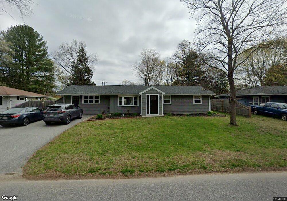
32 Anderson Rd Unit 32 Framingham, MA 01701
Nobscot NeighborhoodEstimated Value: $588,000 - $677,000
4
Beds
2
Baths
1,664
Sq Ft
$386/Sq Ft
Est. Value
About This Home
This home is located at 32 Anderson Rd Unit 32, Framingham, MA 01701 and is currently estimated at $642,798, approximately $386 per square foot. 32 Anderson Rd Unit 32 is a home located in Middlesex County with nearby schools including Framingham High School, MetroWest Jewish Day School, and Saint Bridget School.
Ownership History
Date
Name
Owned For
Owner Type
Purchase Details
Closed on
Mar 21, 2016
Sold by
Murtagh Paul B and Mcmanus Sharon
Bought by
Murtagh Paul B and Walton Rachelle
Current Estimated Value
Purchase Details
Closed on
Sep 27, 2006
Sold by
Quoi-Lee Kevin Kock and Sun Li Juan
Bought by
Fernandez Santo D and Fernandez Dalia
Home Financials for this Owner
Home Financials are based on the most recent Mortgage that was taken out on this home.
Original Mortgage
$270,000
Interest Rate
6.52%
Mortgage Type
Purchase Money Mortgage
Purchase Details
Closed on
May 30, 2002
Sold by
Lee Kevin and Wong Susan
Bought by
Lee Kevin
Purchase Details
Closed on
Jul 19, 1988
Sold by
Shen Andrew
Bought by
Lee Kock Quoi
Home Financials for this Owner
Home Financials are based on the most recent Mortgage that was taken out on this home.
Original Mortgage
$120,000
Interest Rate
10.57%
Mortgage Type
Purchase Money Mortgage
Create a Home Valuation Report for This Property
The Home Valuation Report is an in-depth analysis detailing your home's value as well as a comparison with similar homes in the area
Home Values in the Area
Average Home Value in this Area
Purchase History
| Date | Buyer | Sale Price | Title Company |
|---|---|---|---|
| Murtagh Paul B | -- | -- | |
| Fernandez Santo D | $370,000 | -- | |
| Lee Kevin | $15,000 | -- | |
| Lee Kock Quoi | $174,000 | -- |
Source: Public Records
Mortgage History
| Date | Status | Borrower | Loan Amount |
|---|---|---|---|
| Previous Owner | Fernandez Santo D | $270,000 | |
| Previous Owner | Lee Kock Quoi | $47,000 | |
| Previous Owner | Lee Kock Quoi | $112,000 | |
| Previous Owner | Lee Kock Quoi | $120,000 |
Source: Public Records
Tax History
| Year | Tax Paid | Tax Assessment Tax Assessment Total Assessment is a certain percentage of the fair market value that is determined by local assessors to be the total taxable value of land and additions on the property. | Land | Improvement |
|---|---|---|---|---|
| 2025 | $6,642 | $556,300 | $265,900 | $290,400 |
| 2024 | $6,270 | $503,200 | $237,400 | $265,800 |
| 2023 | $5,981 | $456,900 | $211,900 | $245,000 |
| 2022 | $5,670 | $412,700 | $192,300 | $220,400 |
| 2021 | $5,524 | $393,200 | $184,800 | $208,400 |
| 2020 | $5,510 | $367,800 | $168,000 | $199,800 |
| 2019 | $5,403 | $351,300 | $168,000 | $183,300 |
| 2018 | $5,302 | $324,900 | $161,700 | $163,200 |
| 2017 | $5,158 | $308,700 | $157,000 | $151,700 |
| 2016 | $4,998 | $287,600 | $157,000 | $130,600 |
| 2015 | $4,836 | $271,400 | $157,400 | $114,000 |
Source: Public Records
Map
Nearby Homes
- 32 Anderson Rd
- 32 Anderson Rd Unit 1
- 34 Anderson Rd
- 30 Anderson Rd
- 31 Fairbrook Rd
- 28 Anderson Rd
- 35 Fairbrook Rd
- 29 Fairbrook Rd
- 36 Anderson Rd
- 33 Fairbrook Rd
- 37 Fairbrook Rd
- 29 Anderson Rd
- 31 Anderson Rd
- 27 Anderson Rd
- 27 Fairbrook Rd
- 39 Fairbrook Rd
- 26 Anderson Rd
- 25 Anderson Rd
- 33 Anderson Rd
- 25 Fairbrook Rd
Your Personal Tour Guide
Ask me questions while you tour the home.