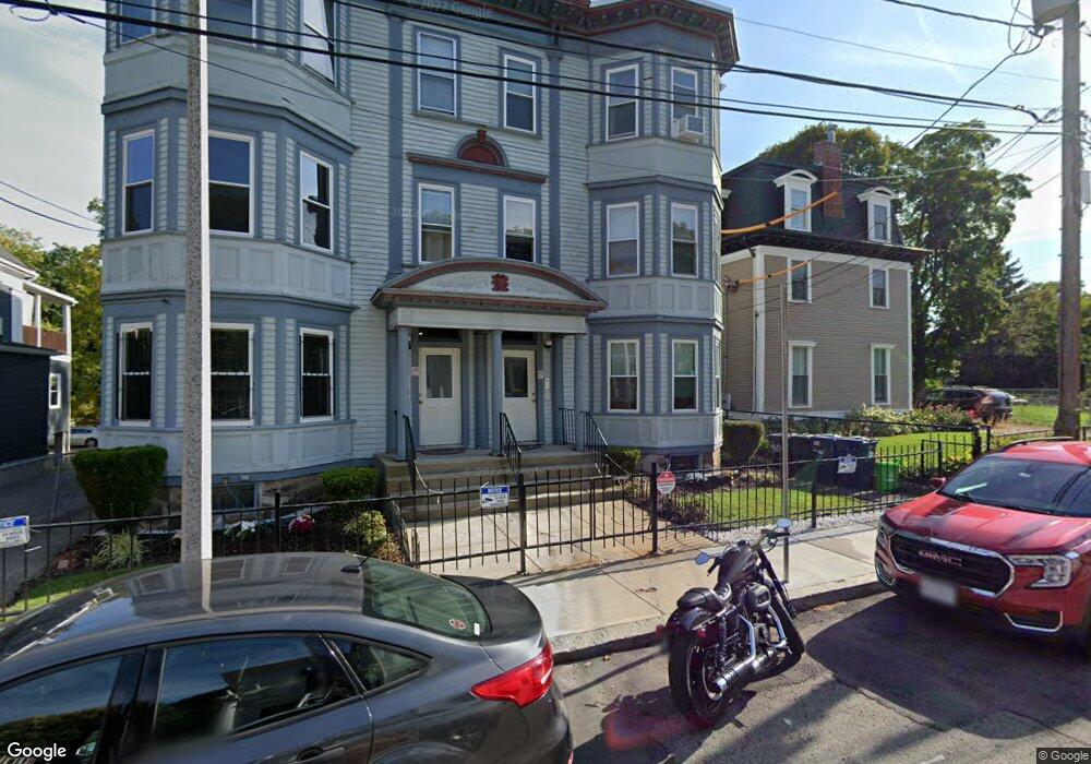
32 Hawthorne St Unit 2 Roxbury, MA 02119
Fort Hill NeighborhoodEstimated Value: $557,661 - $639,000
3
Beds
1
Bath
1,052
Sq Ft
$554/Sq Ft
Est. Value
About This Home
This home is located at 32 Hawthorne St Unit 2, Roxbury, MA 02119 and is currently estimated at $582,665, approximately $553 per square foot. 32 Hawthorne St Unit 2 is a home located in Suffolk County with nearby schools including City on a Hill Charter Public School and Paige Academy.
Ownership History
Date
Name
Owned For
Owner Type
Purchase Details
Closed on
Dec 5, 2008
Sold by
King Christopher R
Bought by
King Christopher R and King Joanne A
Current Estimated Value
Purchase Details
Closed on
Mar 9, 2007
Bought by
King Christopher R
Home Financials for this Owner
Home Financials are based on the most recent Mortgage that was taken out on this home.
Original Mortgage
$130,000
Interest Rate
6.3%
Mortgage Type
Purchase Money Mortgage
Create a Home Valuation Report for This Property
The Home Valuation Report is an in-depth analysis detailing your home's value as well as a comparison with similar homes in the area
Home Values in the Area
Average Home Value in this Area
Purchase History
| Date | Buyer | Sale Price | Title Company |
|---|---|---|---|
| King Christopher R | -- | -- | |
| King Christopher R | -- | -- | |
| King Christopher R | -- | -- | |
| King Christopher R | -- | -- |
Source: Public Records
Mortgage History
| Date | Status | Borrower | Loan Amount |
|---|---|---|---|
| Previous Owner | King Christopher R | $130,000 | |
| Previous Owner | King Christopher R | $54,000 |
Source: Public Records
Tax History Compared to Growth
Tax History
| Year | Tax Paid | Tax Assessment Tax Assessment Total Assessment is a certain percentage of the fair market value that is determined by local assessors to be the total taxable value of land and additions on the property. | Land | Improvement |
|---|---|---|---|---|
| 2025 | $5,534 | $477,900 | $0 | $477,900 |
| 2024 | $5,045 | $462,800 | $0 | $462,800 |
| 2023 | $4,823 | $449,100 | $0 | $449,100 |
| 2022 | $4,653 | $427,700 | $0 | $427,700 |
| 2021 | $4,564 | $427,700 | $0 | $427,700 |
| 2020 | $3,666 | $347,200 | $0 | $347,200 |
| 2019 | $3,388 | $321,400 | $0 | $321,400 |
| 2018 | $3,120 | $297,700 | $0 | $297,700 |
| 2017 | $2,946 | $278,200 | $0 | $278,200 |
| 2016 | $2,834 | $257,600 | $0 | $257,600 |
| 2015 | $2,880 | $237,800 | $0 | $237,800 |
| 2014 | $2,742 | $218,000 | $0 | $218,000 |
Source: Public Records
Map
Nearby Homes
- 9 W Cedar St Unit 1
- 4 Fort Ave Unit 2
- 63 Beech Glen St
- 38 Juniper St
- 9-45 Vale St
- 31 Dorr St
- 51 Beech Glen St Unit 3
- 59 Fort Ave
- 10 Linwood St
- 2856 Washington St
- 8 Brinton St Unit 2
- 49 Norfolk St
- 16 Mayfair St
- 64 Alpine St Unit 104
- 64 Alpine St Unit 304
- 37 Regent St Unit 2
- 51 Saint James St
- 94 Walnut Ave
- 27 Dudley St
- 90 Munroe St
- 30 Hawthorne St Unit 3
- 30 Hawthorne St Unit 2
- 30 Hawthorne St Unit 1
- 32 Hawthorne St Unit 3
- 32 Hawthorne St Unit 1
- 28 Hawthorne St Unit 3
- 28 Hawthorne St Unit 2
- 28 Hawthorne St Unit 1
- 28 Hawthorne St
- 36 Hawthorne St Unit 1
- 36 Hawthorne St
- 28
- 29 Hawthorne St
- 29 Hawthorne St Unit 1
- 29 Hawthorne St Unit 2
- 24-26 Hawthorne St
- 22 Hawthorne St Unit 3
- 22 Hawthorne St Unit 1
- 22 Hawthorne St Unit 22-3
- 24 Hawthorne St Unit 2