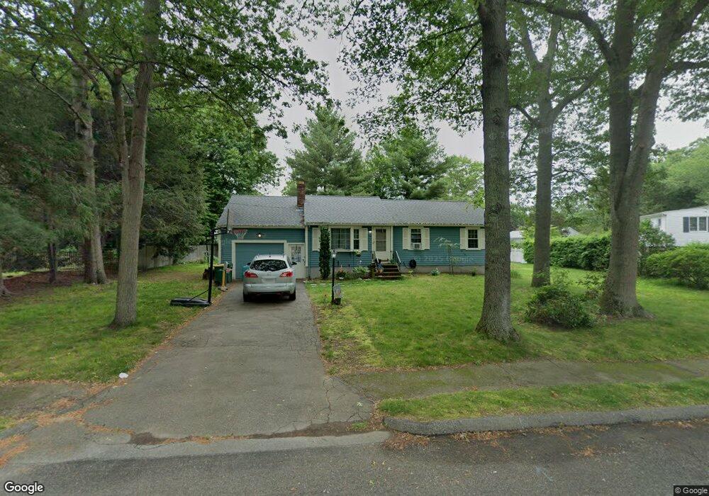
32 Hemlock Ln Mansfield, MA 02048
Estimated Value: $567,166 - $644,000
3
Beds
1
Bath
1,070
Sq Ft
$577/Sq Ft
Est. Value
About This Home
This home is located at 32 Hemlock Ln, Mansfield, MA 02048 and is currently estimated at $617,292, approximately $576 per square foot. 32 Hemlock Ln is a home located in Bristol County with nearby schools including Everett W. Robinson Elementary School, Jordan/Jackson Elementary School, and Harold L. Qualters Middle School.
Ownership History
Date
Name
Owned For
Owner Type
Purchase Details
Closed on
Oct 28, 2011
Sold by
Cunningham Christopher A
Bought by
Ciociolo Dennis M and Dalianis Kelly A
Current Estimated Value
Purchase Details
Closed on
Jul 13, 2011
Sold by
Es Steinbrecher John G
Bought by
Cunningham Christopher A
Create a Home Valuation Report for This Property
The Home Valuation Report is an in-depth analysis detailing your home's value as well as a comparison with similar homes in the area
Home Values in the Area
Average Home Value in this Area
Purchase History
| Date | Buyer | Sale Price | Title Company |
|---|---|---|---|
| Ciociolo Dennis M | $291,000 | -- | |
| Cunningham Christopher A | $210,600 | -- |
Source: Public Records
Tax History
| Year | Tax Paid | Tax Assessment Tax Assessment Total Assessment is a certain percentage of the fair market value that is determined by local assessors to be the total taxable value of land and additions on the property. | Land | Improvement |
|---|---|---|---|---|
| 2025 | $6,273 | $476,300 | $264,000 | $212,300 |
| 2024 | $6,044 | $447,700 | $275,400 | $172,300 |
| 2023 | $5,995 | $425,500 | $275,400 | $150,100 |
| 2022 | $5,834 | $384,600 | $255,000 | $129,600 |
| 2021 | $5,433 | $353,700 | $212,500 | $141,200 |
| 2020 | $5,367 | $349,400 | $212,500 | $136,900 |
| 2019 | $4,887 | $321,100 | $177,100 | $144,000 |
| 2018 | $4,606 | $295,800 | $168,800 | $127,000 |
| 2017 | $4,476 | $298,000 | $163,900 | $134,100 |
| 2016 | $4,406 | $285,900 | $156,100 | $129,800 |
| 2015 | $4,103 | $264,700 | $156,100 | $108,600 |
Source: Public Records
Map
Nearby Homes
- 1 Deer Path Ln
- 14 Windchime Dr
- 7 Fieldstone Dr
- 19 Barberry Rd
- 16 Holly Rd
- 97 East St
- 44 Fairfield Park Unit 44
- 250 Mansfield Ave Unit 11
- 21 Juniper Rd
- 28 Court St
- 46 Hope St
- 122 Samoset Ave
- 268 Reservoir St
- 0 Brook Pkwy
- 150 Rumford Ave Unit 110
- 0 Cobb St
- 157 Mansfield Ave Unit 27
- 157 Mansfield Ave Unit 14
- 22 Pleasant St Unit B
- 212 Mill St
Your Personal Tour Guide
Ask me questions while you tour the home.