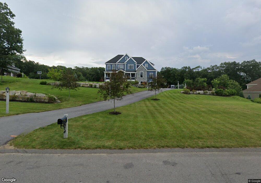
32 London Bridge Rd Windham, NH 03087
Estimated Value: $1,274,000 - $2,266,000
4
Beds
4
Baths
3,615
Sq Ft
$492/Sq Ft
Est. Value
About This Home
This home is located at 32 London Bridge Rd, Windham, NH 03087 and is currently estimated at $1,777,406, approximately $491 per square foot. 32 London Bridge Rd is a home located in Rockingham County with nearby schools including Golden Brook Elementary School, Windham Middle School, and Windham High School.
Ownership History
Date
Name
Owned For
Owner Type
Purchase Details
Closed on
Nov 17, 2022
Sold by
Witkowski Timothy X and Witkowski Diane
Bought by
Boyle Todd B
Current Estimated Value
Purchase Details
Closed on
Jun 21, 2016
Sold by
Kerry Mckenna Rt
Bought by
Boyle Todd B
Home Financials for this Owner
Home Financials are based on the most recent Mortgage that was taken out on this home.
Original Mortgage
$110,000
Interest Rate
3.61%
Mortgage Type
Unknown
Create a Home Valuation Report for This Property
The Home Valuation Report is an in-depth analysis detailing your home's value as well as a comparison with similar homes in the area
Home Values in the Area
Average Home Value in this Area
Purchase History
| Date | Buyer | Sale Price | Title Company |
|---|---|---|---|
| Boyle Todd B | -- | None Available | |
| Boyle Todd B | $210,000 | -- |
Source: Public Records
Mortgage History
| Date | Status | Borrower | Loan Amount |
|---|---|---|---|
| Previous Owner | Boyle Todd B | $110,000 |
Source: Public Records
Tax History Compared to Growth
Tax History
| Year | Tax Paid | Tax Assessment Tax Assessment Total Assessment is a certain percentage of the fair market value that is determined by local assessors to be the total taxable value of land and additions on the property. | Land | Improvement |
|---|---|---|---|---|
| 2024 | $23,756 | $1,049,300 | $217,700 | $831,600 |
| 2023 | $22,378 | $1,045,700 | $217,700 | $828,000 |
| 2022 | $19,689 | $996,400 | $217,700 | $778,700 |
| 2021 | $18,553 | $996,400 | $217,700 | $778,700 |
| 2020 | $19,736 | $1,031,700 | $217,700 | $814,000 |
| 2019 | $7,090 | $314,400 | $182,900 | $131,500 |
| 2018 | $4,260 | $182,900 | $182,900 | $0 |
| 2017 | $3,695 | $182,900 | $182,900 | $0 |
| 2016 | $3,991 | $182,900 | $182,900 | $0 |
| 2015 | $3,973 | $182,900 | $182,900 | $0 |
| 2014 | $4,656 | $194,000 | $194,000 | $0 |
| 2013 | $4,578 | $194,000 | $194,000 | $0 |
Source: Public Records
Map
Nearby Homes
- 6 Lancaster Rd
- 7 Buckhide Rd
- 23 Ryan Farm Rd
- 138 Castle Hill Rd
- 1 Alpine Rd
- 63 Mammoth Rd
- 24 Del Ray Dr Unit 25
- 24 Del Ray Dr
- 14 Woodland Rd
- 2 2nd St
- 7 Cypress Ln Unit 5
- 2 Cypress Ln
- 219 Range Rd
- Lot 5 Plan at Highclere
- 4 Elijah Hill Ln
- 21 Lakeshore Rd
- 11 Venus Way
- 7 Venus Way Unit 22
- 87 Oakridge Dr
- 45 Sharon Rd
- 30 London Bridge Rd
- 34 London Bridge Rd
- 50 Burnham Rd
- 52 Burnham Rd
- 28 London Bridge Rd
- 31 London Bridge Rd
- 29 London Bridge Rd
- 26 London Bridge Rd
- 27 London Bridge Rd
- 4 Winslow Ln
- 101 London Bridge Rd
- 35 Burnham Rd
- 46 Burnham Rd
- 37 Burnham Rd Unit 20-D-2308
- 37 Burnham Rd
- 35 London Bridge Rd
- 2 Winslow Ln
- 37 London Bridge Rd
- 39 Burnham Rd
- 44 Burnham Rd