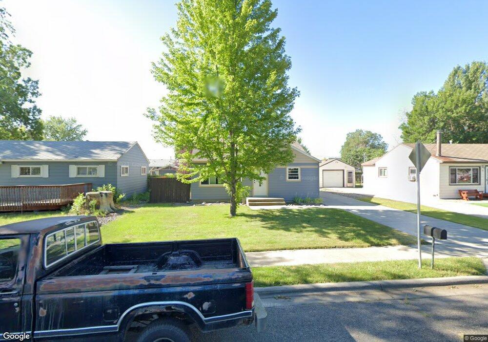
32 Marshall Dr Billings, MT 59101
South Central Billings NeighborhoodEstimated Value: $244,000 - $282,000
2
Beds
1
Bath
942
Sq Ft
$283/Sq Ft
Est. Value
About This Home
This home is located at 32 Marshall Dr, Billings, MT 59101 and is currently estimated at $266,123, approximately $282 per square foot. 32 Marshall Dr is a home located in Yellowstone County with nearby schools including Newman School, Riverside Junior High School, and Billings West High School.
Ownership History
Date
Name
Owned For
Owner Type
Purchase Details
Closed on
Apr 18, 2012
Sold by
Holly Ryan C
Bought by
Dangerfield Max
Current Estimated Value
Home Financials for this Owner
Home Financials are based on the most recent Mortgage that was taken out on this home.
Original Mortgage
$150,160
Outstanding Balance
$104,400
Interest Rate
4.05%
Mortgage Type
VA
Estimated Equity
$161,723
Purchase Details
Closed on
Sep 9, 2009
Sold by
Carrillo Amanda M
Bought by
Holly Ryan C
Home Financials for this Owner
Home Financials are based on the most recent Mortgage that was taken out on this home.
Original Mortgage
$132,554
Interest Rate
5.2%
Mortgage Type
FHA
Purchase Details
Closed on
Oct 20, 2005
Sold by
Lundin Ryan S
Bought by
Carrillo Amanda M
Create a Home Valuation Report for This Property
The Home Valuation Report is an in-depth analysis detailing your home's value as well as a comparison with similar homes in the area
Home Values in the Area
Average Home Value in this Area
Purchase History
| Date | Buyer | Sale Price | Title Company |
|---|---|---|---|
| Dangerfield Max | -- | None Available | |
| Holly Ryan C | -- | St | |
| Carrillo Amanda M | -- | None Available |
Source: Public Records
Mortgage History
| Date | Status | Borrower | Loan Amount |
|---|---|---|---|
| Open | Dangerfield Max | $150,160 | |
| Previous Owner | Holly Ryan C | $132,554 |
Source: Public Records
Tax History
| Year | Tax Paid | Tax Assessment Tax Assessment Total Assessment is a certain percentage of the fair market value that is determined by local assessors to be the total taxable value of land and additions on the property. | Land | Improvement |
|---|---|---|---|---|
| 2025 | $2,104 | $257,400 | $38,347 | $219,053 |
| 2024 | $2,104 | $206,400 | $37,481 | $168,919 |
| 2023 | $2,109 | $206,400 | $37,481 | $168,919 |
| 2022 | $1,998 | $172,700 | $0 | $0 |
| 2021 | $1,900 | $172,700 | $0 | $0 |
| 2020 | $1,779 | $152,200 | $0 | $0 |
| 2019 | $1,703 | $152,200 | $0 | $0 |
| 2018 | $1,663 | $145,700 | $0 | $0 |
| 2017 | $1,349 | $145,700 | $0 | $0 |
| 2016 | $1,494 | $135,000 | $0 | $0 |
| 2015 | $1,463 | $135,000 | $0 | $0 |
| 2014 | $1,299 | $62,858 | $0 | $0 |
Source: Public Records
Map
Nearby Homes
- 226 Moore Ln
- 5327 Frontier Dr Unit 2
- 5437 Frontier Dr
- 1216 Eldorado Dr
- 1204 Eldorado Dr
- 605 Calhoun Ln
- 307 S Billings Blvd Unit 24
- 307 S Billings Blvd Unit 36
- 4531 Phillip St
- 43 Prickett Ln
- 5255 Golden Hollow Rd
- 4530 Lux Ave
- 5233 Golden Hollow Rd
- 1205 Lynn Ave
- 5474 Elysian Rd
- 5238 Golden Hollow Rd
- 4444 Morgan Ave
- 1615 Stony Meadow Ln
- 1132 Saint Johns Ave
- 1616 Island View Dr
- 30 Marshall Dr
- 28 Marshall Dr
- 5327 King Ave E
- 36 Marshall Dr
- 29 Marshall Dr
- 5223 King Ave E
- 5331 King Ave E
- 33 Marshall Dr
- 25 Marshall Dr
- 5335 King Ave E
- 5219 King Ave E
- 26 Marshall Dr
- 21 Patton Ave
- 38 Marshall Dr
- 5339 King Ave E
- 19 Patton Ave
- 40 Marshall Dr
- 24 Marshall Dr
- 5215 King Ave E
- 30 Berg Ave
Your Personal Tour Guide
Ask me questions while you tour the home.