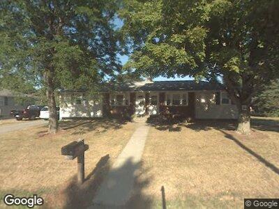
32 Neillian St Unit 34 Bedford, MA 01730
Estimated Value: $790,189 - $866,000
5
Beds
2
Baths
1,884
Sq Ft
$439/Sq Ft
Est. Value
About This Home
This home is located at 32 Neillian St Unit 34, Bedford, MA 01730 and is currently estimated at $827,547, approximately $439 per square foot. 32 Neillian St Unit 34 is a home located in Middlesex County with nearby schools including Lt. Elezer Davis Elementary School, Lt .Job Lane Elementary School, and John Glenn Middle School.
Ownership History
Date
Name
Owned For
Owner Type
Purchase Details
Closed on
May 25, 1989
Sold by
57 Fayette Road T
Bought by
Lafort John
Current Estimated Value
Home Financials for this Owner
Home Financials are based on the most recent Mortgage that was taken out on this home.
Original Mortgage
$168,000
Interest Rate
10.99%
Mortgage Type
Purchase Money Mortgage
Create a Home Valuation Report for This Property
The Home Valuation Report is an in-depth analysis detailing your home's value as well as a comparison with similar homes in the area
Home Values in the Area
Average Home Value in this Area
Purchase History
| Date | Buyer | Sale Price | Title Company |
|---|---|---|---|
| Lafort John | $210,000 | -- |
Source: Public Records
Mortgage History
| Date | Status | Borrower | Loan Amount |
|---|---|---|---|
| Open | 5-7 Fayette Rd Tr | $226,000 | |
| Open | Lafort John E | $625,500 | |
| Closed | Lafort John E | $166,391 | |
| Closed | 5-7 Fayette Rd Tr | $24,000 | |
| Closed | 5-7 Fayette Rd Tr | $151,000 | |
| Closed | 5-7 Fayette Rd Tr | $168,000 |
Source: Public Records
Tax History Compared to Growth
Tax History
| Year | Tax Paid | Tax Assessment Tax Assessment Total Assessment is a certain percentage of the fair market value that is determined by local assessors to be the total taxable value of land and additions on the property. | Land | Improvement |
|---|---|---|---|---|
| 2025 | $79 | $656,000 | $380,000 | $276,000 |
| 2024 | $7,423 | $624,800 | $361,900 | $262,900 |
| 2023 | $7,346 | $588,600 | $337,700 | $250,900 |
| 2022 | $7,333 | $540,000 | $313,600 | $226,400 |
| 2021 | $7,088 | $523,900 | $297,500 | $226,400 |
| 2020 | $6,802 | $516,100 | $297,500 | $218,600 |
| 2019 | $5,710 | $440,600 | $297,500 | $143,100 |
| 2018 | $6,074 | $442,100 | $289,800 | $152,300 |
| 2017 | $6,091 | $411,300 | $265,400 | $145,900 |
| 2016 | $5,916 | $387,162 | $241,200 | $145,962 |
| 2015 | $5,660 | $387,162 | $241,200 | $145,962 |
| 2014 | $5,761 | $366,693 | $209,100 | $157,593 |
Source: Public Records
Map
Nearby Homes
- 39 Neillian St Unit 39
- 52 Summer St Unit B
- 50 Summer St Unit A
- 62 Roberts Dr Unit 62
- 14 Pine Knoll Rd
- 29 Hartwell Rd
- 54 Loomis St Unit 1201
- 54 Loomis St Unit 2202
- 21 Houlton St
- 28 Sullivan St
- 7 Brooksbie Rd Unit 3
- 36 Loomis St Unit 101
- 2 Brooksbie Rd
- 10 Elmbrook Cir
- 10 Webber Ave Unit 4D
- 10 Webber Ave Unit 1A
- 4 Colony Cir
- 23 Crescent Ave
- 15 Calvin St
- 70 Great Rd Unit B
- 32 Neillian St Unit 34
- 32 Neillian St Unit 32
- 34 Neillian St Unit 34
- 28 Neillian St Unit 30
- 38 Neillian St Unit 36
- 38 Neillian St Unit 38
- 36 Neillian St Unit 38
- 31 Neillian St Unit 33
- 31 Neillian St
- 31 Neillian St Unit 1
- 33 Neillian St Unit 1
- 19 Neillian Way Unit 21
- 21 Neillian Way Unit 21
- 40 Neillian St Unit 42
- 35 Neillian St Unit 37
- 23 Neillian Way Unit 25
- 25 Neillian Way Unit 27
- 25 Neillian Way Unit STEET
- 25 Neillian St Unit 27
- 25 Neillian St