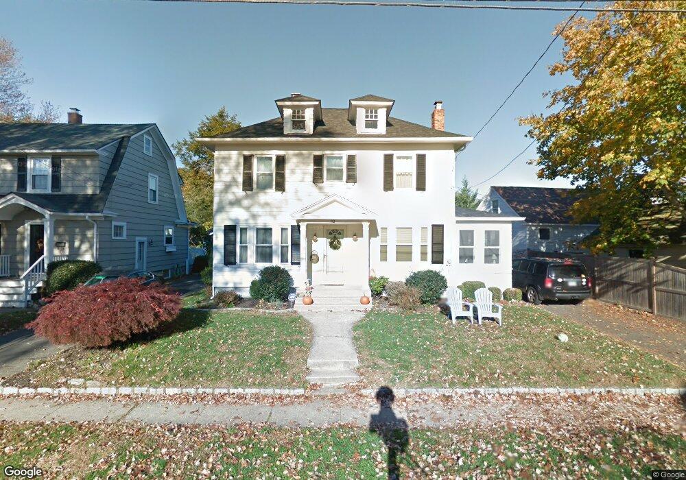
32 Newton St Fairfield, CT 06824
Fairfield Beach NeighborhoodEstimated Value: $1,109,000 - $1,172,000
3
Beds
3
Baths
1,844
Sq Ft
$620/Sq Ft
Est. Value
About This Home
This home is located at 32 Newton St, Fairfield, CT 06824 and is currently estimated at $1,142,427, approximately $619 per square foot. 32 Newton St is a home located in Fairfield County with nearby schools including Roger Sherman Elementary School, Roger Ludlowe Middle School, and Fairfield Ludlowe High School.
Ownership History
Date
Name
Owned For
Owner Type
Purchase Details
Closed on
Dec 24, 2012
Sold by
Mccabe Kenneth
Bought by
Mccabe Annette
Current Estimated Value
Purchase Details
Closed on
Jun 13, 2008
Sold by
Nelson Andrew J and Nelson Leslie S
Bought by
Mccabe Kenneth and Mccabe Annette
Purchase Details
Closed on
Oct 15, 2001
Sold by
Cisneros James T and Cisneros Jennifer D
Bought by
Nelson Andrew J and Nelson Leslie S
Purchase Details
Closed on
Feb 4, 1999
Sold by
Brennan Christopher J and Brennan Elisa A
Bought by
Cisneros James T and Cisneros Jennifer D
Purchase Details
Closed on
Oct 5, 1992
Sold by
Newton St Assoc
Bought by
Brennan Christopher and Brennan Elisa A
Purchase Details
Closed on
Jan 10, 1992
Sold by
Franke Isabel C
Bought by
Newton St Assoc
Create a Home Valuation Report for This Property
The Home Valuation Report is an in-depth analysis detailing your home's value as well as a comparison with similar homes in the area
Home Values in the Area
Average Home Value in this Area
Purchase History
| Date | Buyer | Sale Price | Title Company |
|---|---|---|---|
| Mccabe Annette | -- | -- | |
| Mccabe Annette | -- | -- | |
| Mccabe Kenneth | $805,000 | -- | |
| Mccabe Kenneth | $805,000 | -- | |
| Nelson Andrew J | $546,000 | -- | |
| Nelson Andrew J | $546,000 | -- | |
| Cisneros James T | $400,000 | -- | |
| Cisneros James T | $400,000 | -- | |
| Brennan Christopher | $252,500 | -- | |
| Brennan Christopher | $252,500 | -- | |
| Newton St Assoc | $120,000 | -- | |
| Newton St Assoc | $120,000 | -- |
Source: Public Records
Mortgage History
| Date | Status | Borrower | Loan Amount |
|---|---|---|---|
| Previous Owner | Newton St Assoc | $260,000 | |
| Previous Owner | Newton St Assoc | $377,000 |
Source: Public Records
Tax History
| Year | Tax Paid | Tax Assessment Tax Assessment Total Assessment is a certain percentage of the fair market value that is determined by local assessors to be the total taxable value of land and additions on the property. | Land | Improvement |
|---|---|---|---|---|
| 2025 | $11,693 | $411,880 | $294,490 | $117,390 |
| 2024 | $11,491 | $411,880 | $294,490 | $117,390 |
| 2023 | $11,331 | $411,880 | $294,490 | $117,390 |
| 2022 | $11,220 | $411,880 | $294,490 | $117,390 |
| 2021 | $11,113 | $411,880 | $294,490 | $117,390 |
| 2020 | $10,492 | $391,650 | $261,030 | $130,620 |
| 2019 | $10,492 | $391,650 | $261,030 | $130,620 |
| 2018 | $10,324 | $391,650 | $261,030 | $130,620 |
| 2017 | $10,112 | $391,650 | $261,030 | $130,620 |
| 2016 | $9,967 | $391,650 | $261,030 | $130,620 |
| 2015 | $10,101 | $407,470 | $279,300 | $128,170 |
| 2014 | $9,942 | $407,470 | $279,300 | $128,170 |
Source: Public Records
Map
Nearby Homes
- 855 Riverside Dr
- 598 S Benson Rd
- 164 Wakeman Rd
- 378 Penfield Rd
- 394 Penfield Rd
- 77 Meadowbrook Rd
- 20 Ermine St
- 315 Seaside Ave
- 126 Lalley Blvd
- 90 Clarkson St
- 3250 Fairfield Ave Unit 302
- 377 Midland St
- 15 Barton Rd
- 132 Gilman St
- 345 Reef Rd Unit B6
- 345 Reef Rd Unit C9
- 70 Meadow Ridge Rd
- 245 Unquowa Rd Unit 82
- 97 Fayerweather Terrace
- 610 Unquowa Rd
Your Personal Tour Guide
Ask me questions while you tour the home.