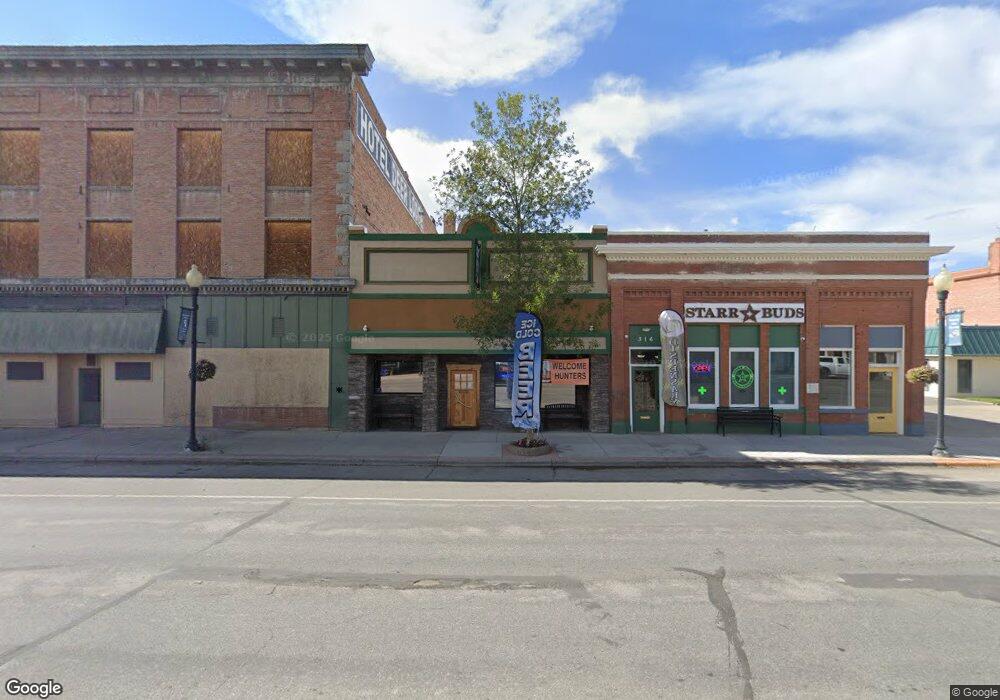
320 Main St Deer Lodge, MT 59722
Studio
--
Bath
3,891
Sq Ft
3,485
Sq Ft Lot
About This Home
This home is located at 320 Main St, Deer Lodge, MT 59722. 320 Main St is a home located in Powell County with nearby schools including Powell County High School.
Ownership History
Date
Name
Owned For
Owner Type
Purchase Details
Closed on
Jun 6, 2022
Sold by
Raver Deeanna R
Bought by
Mount Powell Cattle Company Llc
Purchase Details
Closed on
Jun 29, 2021
Sold by
Pioneer Federal Savings & Loan
Bought by
Mount Powell Real Estate Llc
Home Financials for this Owner
Home Financials are based on the most recent Mortgage that was taken out on this home.
Original Mortgage
$95,000
Interest Rate
2.9%
Mortgage Type
New Conventional
Purchase Details
Closed on
Jan 25, 2021
Sold by
Suenram Andrew P
Bought by
Pioneer Federal Savings & Loan
Purchase Details
Closed on
Sep 7, 2005
Sold by
Greany Paul I and Greany Wilma J
Bought by
The Shack Llc
Create a Home Valuation Report for This Property
The Home Valuation Report is an in-depth analysis detailing your home's value as well as a comparison with similar homes in the area
Home Values in the Area
Average Home Value in this Area
Purchase History
| Date | Buyer | Sale Price | Title Company |
|---|---|---|---|
| Mount Powell Cattle Company Llc | -- | None Listed On Document | |
| Mount Powell Real Estate Llc | -- | Powell County Title | |
| Pioneer Federal Savings & Loan | $387,449 | None Available | |
| The Shack Llc | -- | -- |
Source: Public Records
Mortgage History
| Date | Status | Borrower | Loan Amount |
|---|---|---|---|
| Previous Owner | Mount Powell Real Estate Llc | $95,000 | |
| Previous Owner | Mount Powell Real Estate Llc | $355,000 |
Source: Public Records
Tax History
| Year | Tax Paid | Tax Assessment Tax Assessment Total Assessment is a certain percentage of the fair market value that is determined by local assessors to be the total taxable value of land and additions on the property. | Land | Improvement |
|---|---|---|---|---|
| 2025 | $3,531 | $432,600 | $0 | $0 |
| 2024 | $3,404 | $308,500 | $0 | $0 |
| 2023 | $3,821 | $308,500 | $0 | $0 |
| 2022 | $2,042 | $157,000 | $0 | $0 |
| 2021 | $2,041 | $157,000 | $0 | $0 |
| 2020 | $4,448 | $189,400 | $0 | $0 |
| 2019 | $4,170 | $189,400 | $0 | $0 |
| 2018 | $4,238 | $202,800 | $0 | $0 |
| 2017 | $1,400 | $110,405 | $0 | $0 |
| 2016 | $2,809 | $126,200 | $0 | $0 |
| 2015 | $1,600 | $126,200 | $0 | $0 |
| 2014 | $1,957 | $118,613 | $0 | $0 |
Source: Public Records
Map
Nearby Homes
- 400 Missouri Ave
- 100 4th St
- 210 Clark St
- Lot 1 Block 1 California Ave
- Lot 4 Block 1 California Ave
- 406 Dixon St
- 603 California Ave
- 407 Maryland Ave
- 918 5th St
- 800 St Marys Ave
- 811 Kentucky St
- 819 Kentucky St
- Lot 4 Block 7 Aspen Ln
- Lot 1 Block 7 Aspen Ln
- 1106 5th St
- 825 College Ave
- Lot 2 Block 3 Horseshoe Loop
- 1200 4th St
- 622 Sagebrush Ln
- 1203 4th St
- 310 Main St
- 400 Main St
- 321 Main St
- 322 Missouri Ave
- 329 Main St
- 201 Missouri Ave
- 321 Cottonwood Ave
- 403 Main St
- 410 Main St Unit 412
- 410 Main St
- 201 Cottonwood Ave
- 201 Cottonwood Ave Unit NAPA Auto Parts
- 304 2nd St
- 306 4th St
- 304 Cottonwood Ave
- 400 2nd St
- 310 4th St
- 302 2nd St
- 318 4th St
- 308 4th St
Your Personal Tour Guide
Ask me questions while you tour the home.