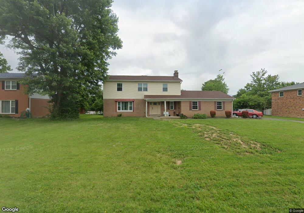
3200 Patrisal Ct Cincinnati, OH 45236
Estimated Value: $342,000 - $476,000
4
Beds
4
Baths
2,027
Sq Ft
$202/Sq Ft
Est. Value
About This Home
This home is located at 3200 Patrisal Ct, Cincinnati, OH 45236 and is currently estimated at $408,888, approximately $201 per square foot. 3200 Patrisal Ct is a home located in Hamilton County with nearby schools including Pleasant Ridge Montessori School, Shroder High School, and Clark Montessori High School.
Ownership History
Date
Name
Owned For
Owner Type
Purchase Details
Closed on
Jul 19, 1999
Sold by
Hardin Vincent L and Hardin Teresa
Bought by
State Of Ohio
Current Estimated Value
Purchase Details
Closed on
Oct 31, 1996
Sold by
Montgomery Anthony W and Montgomery Anita L
Bought by
Hardin Vincent L and Hardin Teresa
Home Financials for this Owner
Home Financials are based on the most recent Mortgage that was taken out on this home.
Original Mortgage
$132,900
Interest Rate
8.26%
Create a Home Valuation Report for This Property
The Home Valuation Report is an in-depth analysis detailing your home's value as well as a comparison with similar homes in the area
Home Values in the Area
Average Home Value in this Area
Purchase History
| Date | Buyer | Sale Price | Title Company |
|---|---|---|---|
| State Of Ohio | $50,000 | -- | |
| Hardin Vincent L | $139,900 | Midland Title Security Inc |
Source: Public Records
Mortgage History
| Date | Status | Borrower | Loan Amount |
|---|---|---|---|
| Previous Owner | Hardin Vincent L | $132,900 |
Source: Public Records
Tax History
| Year | Tax Paid | Tax Assessment Tax Assessment Total Assessment is a certain percentage of the fair market value that is determined by local assessors to be the total taxable value of land and additions on the property. | Land | Improvement |
|---|---|---|---|---|
| 2025 | $6,592 | $109,253 | $15,418 | $93,835 |
| 2024 | $6,392 | $109,253 | $15,418 | $93,835 |
| 2023 | $6,535 | $109,253 | $15,418 | $93,835 |
| 2022 | $5,738 | $83,129 | $12,443 | $70,686 |
| 2021 | $5,588 | $83,129 | $12,443 | $70,686 |
| 2020 | $5,676 | $83,129 | $12,443 | $70,686 |
| 2019 | $5,539 | $73,567 | $11,011 | $62,556 |
| 2018 | $5,549 | $73,567 | $11,011 | $62,556 |
| 2017 | $5,299 | $73,567 | $11,011 | $62,556 |
| 2016 | $4,303 | $57,222 | $11,011 | $46,211 |
| 2015 | $3,903 | $57,222 | $11,011 | $46,211 |
| 2014 | $3,930 | $57,222 | $11,011 | $46,211 |
| 2013 | $3,989 | $57,222 | $11,011 | $46,211 |
Source: Public Records
Map
Nearby Homes
- 1128 Oldwick Dr
- 2127 Longmeadow Ln
- 867 E Columbia Ave
- 1283 Alwil Dr
- 1216 Alwil Dr
- 2113 Bolser Dr
- 1320 Thurnridge Dr
- 2258 Hunt Rd
- 9007 Rolling Ln
- 3647 Guam Ct
- 0 Hill St Unit 1616370
- 3275 Legacy Trace
- 1904 Hunt Rd
- 103 W Crest Dr
- 234 Mcguire Ln
- 134 W Crest Dr
- 2590 Hunt Rd
- 797 4th St
- 221 E Mechanic St
- 654 3rd St
- 3210 Patrisal Ct
- 3190 Patrisal Ct
- 3220 Patrisal Ct
- 3180 Patrisal Ct
- 3200 Lamarque Dr
- 1066 Fuhrman Rd
- 1062 Fuhrman Rd
- 3210 Lamarque Dr
- 3195 Patrisal Ct
- 1100 Fuhrman Rd
- 3170 Patrisal Ct
- 3185 Patrisal Ct
- 8535 Kentland Ct
- 1058 Fuhrman Rd
- 8555 Kentland Ct
- 1104 Fuhrman Rd
- 3220 Lamarque Dr
- 1111 Oldwick Dr
- 1104 Oldwick Dr
- 3175 Patrisal Ct
Your Personal Tour Guide
Ask me questions while you tour the home.