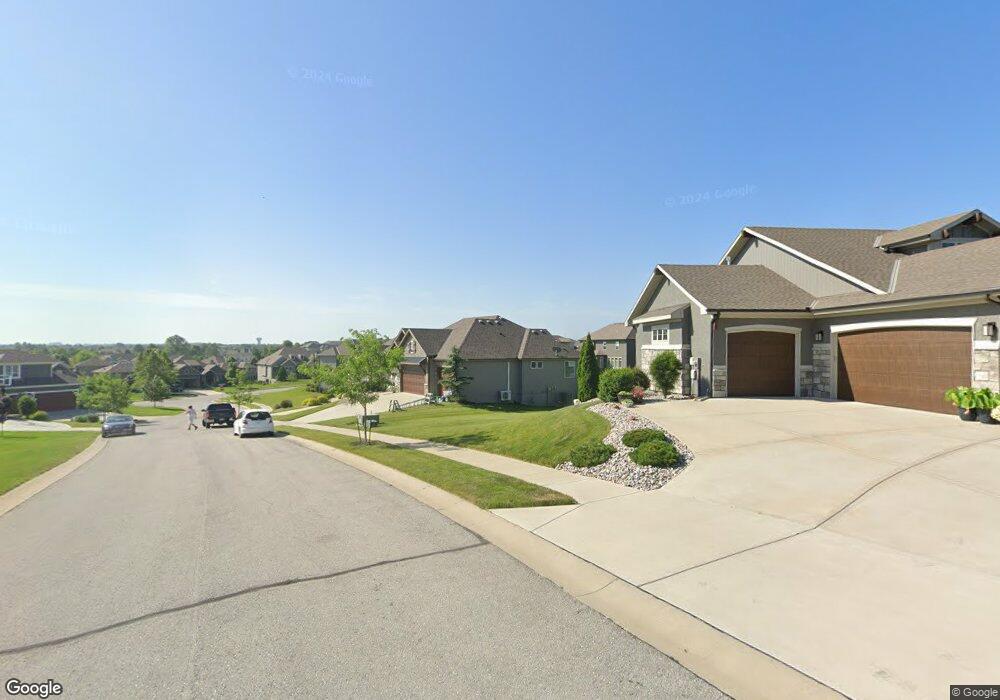
3201 SW Mowat Dr Lees Summit, MO 64081
Estimated Value: $585,780 - $702,000
3
Beds
3
Baths
1,769
Sq Ft
$367/Sq Ft
Est. Value
About This Home
This home is located at 3201 SW Mowat Dr, Lees Summit, MO 64081 and is currently estimated at $649,445, approximately $367 per square foot. 3201 SW Mowat Dr is a home with nearby schools including Cedar Creek Elementary School, Pleasant Lea Middle School, and Lee's Summit Senior High School.
Ownership History
Date
Name
Owned For
Owner Type
Purchase Details
Closed on
May 26, 2020
Sold by
Galehomes Ii Inc
Bought by
Peterson David J and Peterson Raquel M
Current Estimated Value
Home Financials for this Owner
Home Financials are based on the most recent Mortgage that was taken out on this home.
Original Mortgage
$400,000
Outstanding Balance
$354,455
Interest Rate
3.3%
Mortgage Type
New Conventional
Estimated Equity
$294,990
Purchase Details
Closed on
Jan 18, 2018
Sold by
Signature Builders Kc Llc
Bought by
Oehrke Michael
Home Financials for this Owner
Home Financials are based on the most recent Mortgage that was taken out on this home.
Original Mortgage
$525,894
Interest Rate
3.94%
Mortgage Type
New Conventional
Purchase Details
Closed on
Mar 22, 2017
Sold by
Winterset 6 Llc
Bought by
Signature Builders Kc Llc
Home Financials for this Owner
Home Financials are based on the most recent Mortgage that was taken out on this home.
Original Mortgage
$410,400
Interest Rate
4.17%
Mortgage Type
Construction
Create a Home Valuation Report for This Property
The Home Valuation Report is an in-depth analysis detailing your home's value as well as a comparison with similar homes in the area
Home Values in the Area
Average Home Value in this Area
Purchase History
| Date | Buyer | Sale Price | Title Company |
|---|---|---|---|
| Peterson David J | -- | Coffelt Land Title Llc | |
| Oehrke Michael | -- | None Available | |
| Signature Builders Kc Llc | -- | None Available |
Source: Public Records
Mortgage History
| Date | Status | Borrower | Loan Amount |
|---|---|---|---|
| Open | Peterson David J | $400,000 | |
| Previous Owner | Oehrke Michael | $525,894 | |
| Previous Owner | Signature Builders Kc Llc | $410,400 |
Source: Public Records
Tax History
| Year | Tax Paid | Tax Assessment Tax Assessment Total Assessment is a certain percentage of the fair market value that is determined by local assessors to be the total taxable value of land and additions on the property. | Land | Improvement |
|---|---|---|---|---|
| 2025 | $6,616 | $105,370 | $15,629 | $89,741 |
| 2024 | $6,568 | $91,628 | $11,894 | $79,734 |
| 2023 | $6,568 | $91,627 | $15,838 | $75,789 |
| 2022 | $7,960 | $98,610 | $21,273 | $77,337 |
| 2021 | $8,125 | $98,610 | $21,273 | $77,337 |
| 2020 | $7,811 | $93,874 | $21,273 | $72,601 |
| 2019 | $7,598 | $93,874 | $21,273 | $72,601 |
| 2018 | $1,982,861 | $55,372 | $18,514 | $36,858 |
| 2017 | $1,615 | $18,514 | $18,514 | $0 |
| 2016 | $1,590 | $18,050 | $18,050 | $0 |
Source: Public Records
Map
Nearby Homes
- 214 SW Roosevelt Ridge
- 216 SW Ansel Adams Dr
- 2905 SW Muir Dr
- 205 NW Lovins
- 451 SW Longview Blvd
- 441 SW Longview Blvd
- 325 NW Earle Ln
- 316 NW Earle Ln
- 308 NW Earle Ln
- 445 SW Longview Blvd
- 453 SW Longview Blvd
- 447 SW Longview Blvd
- 459 SW Longview Blvd
- 449 SW Longview Blvd
- 300 NW Earle Ln
- 448 SW Brummel Rd
- 444 SW Brummel Rd
- 442 SW Brummel Rd
- 317 NW Lovins
- 316 NW Lovins
- 3197 SW Mo Wat Dr
- 3197 SW Mowat Dr
- 203 SW Roosevelt Ridge
- 207 SW Roosevelt Ridge
- 211 SW Roosevelt Ridge
- 3196 SW Mo Wat Dr
- 3196 SW Mowat Dr
- 183 SW Roosevelt Ridge
- 3192 SW Mo Wat Dr
- 199 SW Roosevelt Ridge N A
- 200 SW Mackenzie Dr
- 215 SW Roosevelt Ridge
- 179 SW Roosevelt Ridge
- 192 SW Mackenzie
- 190 SW Roosevelt Ridge
- 186 SW Roosevelt Ridge
- 202 SW Roosevelt Ridge
- 210 SW Roosevelt Ridge
- 194 SW Roosevelt Ridge
- 206 SW Roosevelt Ridge
Your Personal Tour Guide
Ask me questions while you tour the home.