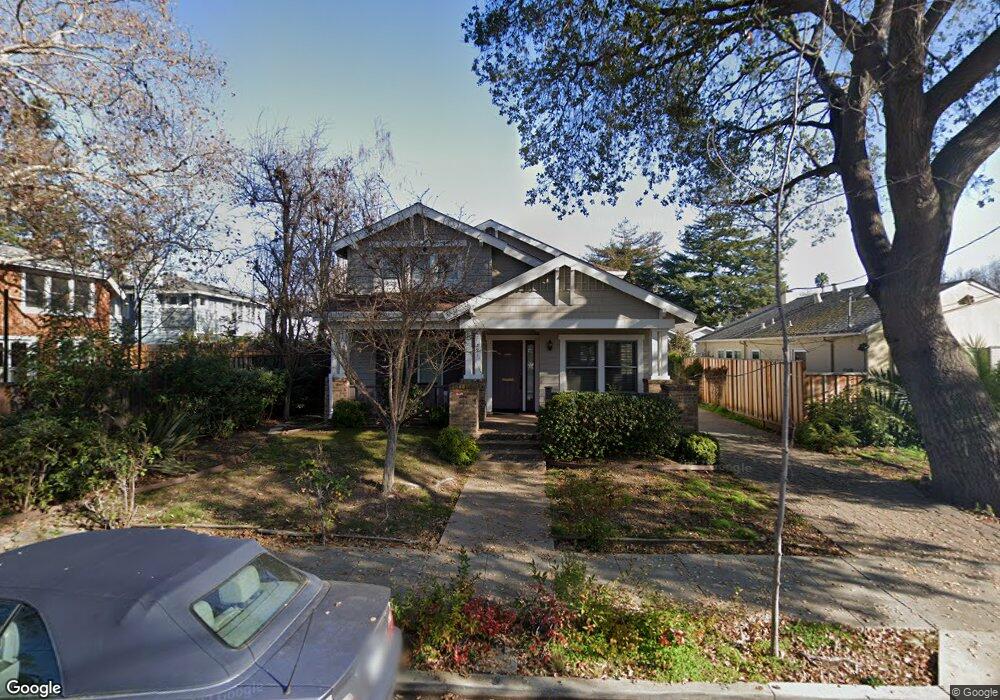
321 Byron St Palo Alto, CA 94301
Downtown North NeighborhoodEstimated Value: $3,103,000 - $4,276,000
3
Beds
3
Baths
1,849
Sq Ft
$1,920/Sq Ft
Est. Value
About This Home
This home is located at 321 Byron St, Palo Alto, CA 94301 and is currently estimated at $3,550,864, approximately $1,920 per square foot. 321 Byron St is a home located in Santa Clara County with nearby schools including Addison Elementary School, Frank S. Greene Jr. Middle, and Palo Alto High School.
Ownership History
Date
Name
Owned For
Owner Type
Purchase Details
Closed on
Feb 13, 2019
Sold by
Ahn James C
Bought by
Ahn James C and James C Ahn And Shirley S Yu 2
Current Estimated Value
Purchase Details
Closed on
Aug 15, 1997
Sold by
Everett Court Ltd Partnership
Bought by
Spencer Graham F
Home Financials for this Owner
Home Financials are based on the most recent Mortgage that was taken out on this home.
Original Mortgage
$649,000
Interest Rate
8%
Create a Home Valuation Report for This Property
The Home Valuation Report is an in-depth analysis detailing your home's value as well as a comparison with similar homes in the area
Home Values in the Area
Average Home Value in this Area
Purchase History
| Date | Buyer | Sale Price | Title Company |
|---|---|---|---|
| Ahn James C | -- | None Available | |
| Spencer Graham F | $870,000 | First American Title Guarant |
Source: Public Records
Mortgage History
| Date | Status | Borrower | Loan Amount |
|---|---|---|---|
| Previous Owner | Spencer Graham F | $649,000 |
Source: Public Records
Tax History Compared to Growth
Tax History
| Year | Tax Paid | Tax Assessment Tax Assessment Total Assessment is a certain percentage of the fair market value that is determined by local assessors to be the total taxable value of land and additions on the property. | Land | Improvement |
|---|---|---|---|---|
| 2025 | $20,611 | $1,701,778 | $1,425,591 | $276,187 |
| 2024 | $20,611 | $1,668,411 | $1,397,639 | $270,772 |
| 2023 | $20,306 | $1,635,698 | $1,370,235 | $265,463 |
| 2022 | $20,068 | $1,603,626 | $1,343,368 | $260,258 |
| 2021 | $19,673 | $1,572,183 | $1,317,028 | $255,155 |
| 2020 | $19,273 | $1,556,063 | $1,303,524 | $252,539 |
| 2019 | $18,976 | $1,525,553 | $1,277,965 | $247,588 |
| 2018 | $18,461 | $1,495,641 | $1,252,907 | $242,734 |
| 2017 | $18,135 | $1,466,316 | $1,228,341 | $237,975 |
| 2016 | $17,657 | $1,437,565 | $1,204,256 | $233,309 |
| 2015 | $17,481 | $1,415,972 | $1,186,167 | $229,805 |
| 2014 | $17,093 | $1,388,236 | $1,162,932 | $225,304 |
Source: Public Records
Map
Nearby Homes
- 251 Middlefield Rd
- 678 Hawthorne Ave
- 660 Palo Alto Ave
- 555 Byron St Unit 104
- 115 Waverley St
- 160 Waverley St
- 707 Webster St
- 167 Mckendry Dr
- 162 Waverley St
- 755 Homer Ave
- 759 Cowper St
- 447 Homer Ave
- 637 Channing Ave
- 756 Waverley St
- 1101 Hamilton Ave
- 111 Emerson St
- 203 Pearl Ln
- 315 Homer Ave Unit 105
- 237 High St
- 1049 Woodland Ave
- 333 Byron St
- 654 Everett Ave
- 664 Everett Ave
- 343 Byron St
- 676 Everett Ave
- 318 Middlefield Rd
- 328 Middlefield Rd
- 320 Byron St
- 336 Middlefield Rd
- 688 Everett Ave
- 634 Everett Ave
- 328 Byron St
- 344 Middlefield Rd
- 334 Byron St
- 626 Everett Ave
- 645 Lytton Ave
- 649 Lytton Ave
- 667 Lytton Ave
- 336 Byron St
- 352 Middlefield Rd