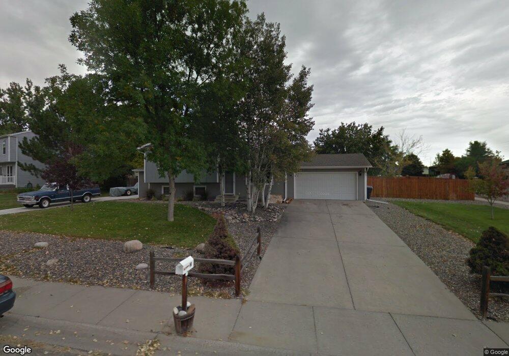
321 Caravan Ave Billings, MT 59105
Billings Heights NeighborhoodEstimated Value: $346,000 - $368,000
4
Beds
2
Baths
1,004
Sq Ft
$356/Sq Ft
Est. Value
About This Home
This home is located at 321 Caravan Ave, Billings, MT 59105 and is currently estimated at $357,574, approximately $356 per square foot. 321 Caravan Ave is a home located in Yellowstone County with nearby schools including Alkali Creek School, Castle Rock Junior High School, and Skyview High School.
Ownership History
Date
Name
Owned For
Owner Type
Purchase Details
Closed on
Mar 23, 2010
Sold by
Rossow Aaron and Rossow Chrissy
Bought by
Messer Greg L
Current Estimated Value
Home Financials for this Owner
Home Financials are based on the most recent Mortgage that was taken out on this home.
Original Mortgage
$169,569
Outstanding Balance
$112,499
Interest Rate
5%
Mortgage Type
VA
Estimated Equity
$245,075
Create a Home Valuation Report for This Property
The Home Valuation Report is an in-depth analysis detailing your home's value as well as a comparison with similar homes in the area
Home Values in the Area
Average Home Value in this Area
Purchase History
| Date | Buyer | Sale Price | Title Company |
|---|---|---|---|
| Messer Greg L | -- | None Available |
Source: Public Records
Mortgage History
| Date | Status | Borrower | Loan Amount |
|---|---|---|---|
| Open | Messer Greg L | $169,569 |
Source: Public Records
Tax History
| Year | Tax Paid | Tax Assessment Tax Assessment Total Assessment is a certain percentage of the fair market value that is determined by local assessors to be the total taxable value of land and additions on the property. | Land | Improvement |
|---|---|---|---|---|
| 2025 | $3,064 | $355,000 | $67,121 | $287,879 |
| 2024 | $3,064 | $294,200 | $65,429 | $228,771 |
| 2023 | $3,081 | $294,200 | $65,429 | $228,771 |
| 2022 | $1,962 | $207,900 | $0 | $0 |
| 2021 | $2,400 | $207,900 | $0 | $0 |
| 2020 | $2,436 | $202,300 | $0 | $0 |
| 2019 | $2,335 | $202,300 | $0 | $0 |
| 2018 | $2,323 | $198,100 | $0 | $0 |
| 2017 | $1,834 | $198,100 | $0 | $0 |
| 2016 | $2,059 | $180,600 | $0 | $0 |
| 2015 | $2,016 | $180,600 | $0 | $0 |
| 2014 | $1,869 | $88,192 | $0 | $0 |
Source: Public Records
Map
Nearby Homes
- 361 Tabriz Dr
- 325 Sahara Dr
- 636 Antelope Cir
- 66 Antelope Trail W Unit 5
- 66 Antelope Trail W Unit 10
- NKN Antelope
- 914 Aronson Ave
- 373 Stewart Ct S
- Lot C Alkali Creek Rd
- 126 Crestline Dr
- 961 Governors Blvd
- 2011 Gleneagles Blvd
- 2059 Gleneagles Blvd
- 2027 Gleneagles Blvd
- 2019 Gleneagles Blvd
- 2067 Gleneagles Blvd
- 1017 Toole Cir
- 540 Pinon Dr
- 1152 Toole Ct
- 600 Tumbleweed Dr
- 610 Aronson Ave
- 339 Caravan Ave
- 546 Aronson Ave
- 589 Sudan Place
- 332 Caravan Ave
- 603 Aronson Ave
- 618 Aronson Ave
- 346 Caravan Ave
- 609 Aronson Ave
- 583 Sudan Place
- 533 Pyramid Place
- 597 Sudan Place
- 528 Aronson Ave
- 360 Caravan Ave
- 615 Aronson Ave
- 624 Aronson Ave
- 279 Caravan Ave
- 521 Pyramid Place
- 530 Pyramid Place
- 274 Sphinx Place
Your Personal Tour Guide
Ask me questions while you tour the home.