Estimated Value: $457,390 - $531,000
3
Beds
3
Baths
2,235
Sq Ft
$220/Sq Ft
Est. Value
About This Home
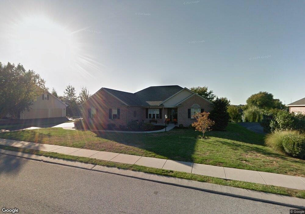
This home is located at 321 Dew Drop Rd, York, PA 17402 and is currently estimated at $490,848, approximately $219 per square foot. 321 Dew Drop Rd is a home located in York County with nearby schools including York Township Elementary School, Dallastown Area Middle School, and Dallastown Area High School.
Ownership History
Date
Name
Owned For
Owner Type
Purchase Details
Closed on
Jan 6, 2011
Sold by
Lawson Betty J and Boeckel Beatrice M
Bought by
Mumford Randy A and Mumford Andrea J
Current Estimated Value
Home Financials for this Owner
Home Financials are based on the most recent Mortgage that was taken out on this home.
Original Mortgage
$143,000
Outstanding Balance
$95,704
Interest Rate
4.4%
Mortgage Type
New Conventional
Estimated Equity
$395,144
Create a Home Valuation Report for This Property
The Home Valuation Report is an in-depth analysis detailing your home's value as well as a comparison with similar homes in the area
Home Values in the Area
Average Home Value in this Area
Purchase History
| Date | Buyer | Sale Price | Title Company |
|---|---|---|---|
| Mumford Randy A | $260,000 | None Available |
Source: Public Records
Mortgage History
| Date | Status | Borrower | Loan Amount |
|---|---|---|---|
| Open | Mumford Randy A | $143,000 |
Source: Public Records
Tax History Compared to Growth
Tax History
| Year | Tax Paid | Tax Assessment Tax Assessment Total Assessment is a certain percentage of the fair market value that is determined by local assessors to be the total taxable value of land and additions on the property. | Land | Improvement |
|---|---|---|---|---|
| 2025 | $8,434 | $245,710 | $58,260 | $187,450 |
| 2024 | $8,311 | $245,710 | $58,260 | $187,450 |
| 2023 | $8,311 | $245,710 | $58,260 | $187,450 |
| 2022 | $8,040 | $245,710 | $58,260 | $187,450 |
| 2021 | $7,659 | $245,710 | $58,260 | $187,450 |
| 2020 | $7,659 | $245,710 | $58,260 | $187,450 |
| 2019 | $7,634 | $245,710 | $58,260 | $187,450 |
| 2018 | $7,583 | $245,710 | $58,260 | $187,450 |
| 2017 | $7,280 | $245,710 | $58,260 | $187,450 |
| 2016 | $0 | $245,710 | $58,260 | $187,450 |
| 2015 | -- | $245,710 | $58,260 | $187,450 |
| 2014 | -- | $245,710 | $58,260 | $187,450 |
Source: Public Records
Map
Nearby Homes
- 2214 S Queen St
- 2458 Schultz Way Unit 30
- 146 Lexington Rd
- 119 Lexington Rd
- 110 Oak Ridge Ln Unit 110
- 114 Dew Drop Ct Unit 114
- 1818 Roxboro Rd
- 224 Wheatfield Way Unit 71D
- 229 Wheatfield Way Unit 76C
- 30 Fox Run Dr
- 519 Middleview Dr
- 1899 Powder Mill Rd Unit B
- 245 Leaders Heights Rd
- 2178 Springwood Rd
- 2723 S Queen St Unit 96
- 553 Green Spring Rd
- 189 Tuscarora Dr
- 125 Verna Dr
- Kipling Plan at The Views at Bridgewater
- Woodford Plan at The Views at Bridgewater
- 325 Dew Drop Rd
- 315 Dew Drop Rd
- 310 Dew Drop Rd
- 2255 S Queen St Unit 60X168
- 2255 S Queen St
- 2259 S Queen St
- 2257 S Queen St
- 2253 S Queen St
- 312 Dew Drop Rd
- 101 Homestead Rd
- 2251 S Queen St
- 2200 May Apple Dr
- 2265 S Queen St
- 2160 May Apple Dr
- 2180 May Apple Dr
- 304 Dew Drop Rd
- 2140 May Apple Dr
- 2249 S Queen St
- 306 Dew Drop Rd
- 2230 May Apple Dr