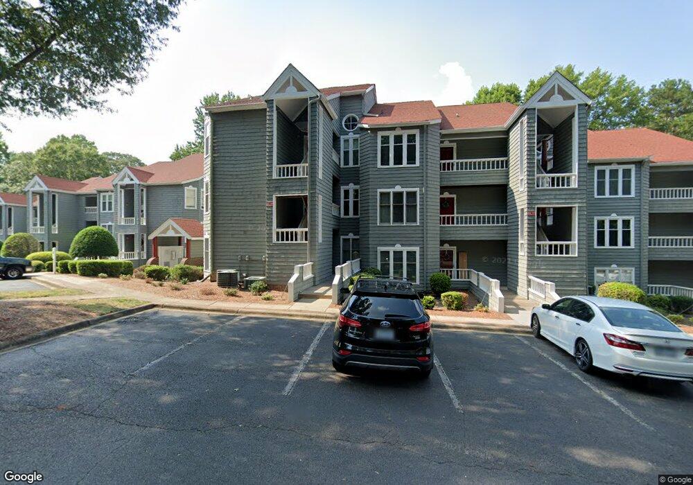
321 Northwest Dr Unit 21 Davidson, NC 28036
Estimated Value: $409,851 - $510,000
2
Beds
2
Baths
930
Sq Ft
$495/Sq Ft
Est. Value
About This Home
This home is located at 321 Northwest Dr Unit 21, Davidson, NC 28036 and is currently estimated at $460,713, approximately $495 per square foot. 321 Northwest Dr Unit 21 is a home located in Mecklenburg County with nearby schools including Davidson Elementary School, William Amos Hough High School, and Davidson Day School.
Ownership History
Date
Name
Owned For
Owner Type
Purchase Details
Closed on
Oct 26, 2012
Sold by
Katyal Michael S
Bought by
Tarbet Richard and Tarbet Carol
Current Estimated Value
Purchase Details
Closed on
Aug 25, 2006
Sold by
Kamp Barbara Ann
Bought by
Katyal Michael S
Home Financials for this Owner
Home Financials are based on the most recent Mortgage that was taken out on this home.
Original Mortgage
$183,750
Interest Rate
6.67%
Mortgage Type
Purchase Money Mortgage
Purchase Details
Closed on
Apr 19, 2006
Sold by
Bender John D and Bender Barbara L
Bought by
Kamp Barbara Ann
Home Financials for this Owner
Home Financials are based on the most recent Mortgage that was taken out on this home.
Original Mortgage
$207,000
Interest Rate
6.31%
Mortgage Type
Fannie Mae Freddie Mac
Purchase Details
Closed on
Feb 3, 2006
Sold by
Martin Keith R and Martin Elaine A
Bought by
Bender John D and Bender Barbara L
Purchase Details
Closed on
Jun 20, 2002
Sold by
Hammill Rebecca B
Bought by
Martin Keith R
Create a Home Valuation Report for This Property
The Home Valuation Report is an in-depth analysis detailing your home's value as well as a comparison with similar homes in the area
Home Values in the Area
Average Home Value in this Area
Purchase History
| Date | Buyer | Sale Price | Title Company |
|---|---|---|---|
| Tarbet Richard | $170,000 | None Available | |
| Katyal Michael S | $262,500 | None Available | |
| Kamp Barbara Ann | $230,000 | None Available | |
| Bender John D | $169,500 | None Available | |
| Martin Keith R | $110,000 | -- |
Source: Public Records
Mortgage History
| Date | Status | Borrower | Loan Amount |
|---|---|---|---|
| Previous Owner | Katyal Michael S | $183,750 | |
| Previous Owner | Kamp Barbara Ann | $207,000 |
Source: Public Records
Tax History
| Year | Tax Paid | Tax Assessment Tax Assessment Total Assessment is a certain percentage of the fair market value that is determined by local assessors to be the total taxable value of land and additions on the property. | Land | Improvement |
|---|---|---|---|---|
| 2025 | $3,021 | $396,667 | -- | $396,667 |
| 2024 | $3,021 | $396,667 | -- | $396,667 |
| 2023 | $2,976 | $396,667 | $0 | $396,667 |
| 2022 | $1,986 | $206,700 | $0 | $206,700 |
| 2021 | $1,974 | $206,700 | $0 | $206,700 |
| 2020 | $1,914 | $206,700 | $0 | $206,700 |
| 2019 | $2,361 | $206,700 | $0 | $206,700 |
| 2018 | $2,361 | $193,800 | $91,000 | $102,800 |
| 2017 | $2,343 | $193,800 | $91,000 | $102,800 |
| 2016 | $2,340 | $193,800 | $91,000 | $102,800 |
| 2015 | $2,336 | $193,800 | $91,000 | $102,800 |
| 2014 | $2,334 | $193,800 | $91,000 | $102,800 |
Source: Public Records
Map
Nearby Homes
- 345 Northwest Dr Unit 45
- 306 Northwest Dr
- 367 Northwest Dr Unit 67
- 633 Portside Dr
- 753 Southwest Dr Unit 4
- 754 Southwest Dr Unit 5
- 765 Southwest Dr Unit 15
- 854 Southwest Dr Unit 54
- 706 Northeast Dr
- 921 Northeast Dr Unit 38
- 1018 Southwest Dr Unit 18
- 714 Northeast Dr Unit 44
- 714 Northeast Dr Unit 53
- 1113 Torrence Cir Unit 61
- 1125 Torrence Cir Unit 67
- 930 Jetton St Unit 20
- 1331 Torrence Cir Unit 1331
- 245 Davidson Gateway Dr
- 143 Park Forest St
- 229 Davidson Gateway Dr
- 320 Northwest Dr Unit 320
- 320 Northwest Dr
- 320 Northwest Dr Unit 20
- 323 Northwest Dr
- 324 Northwest Dr
- 316 Northwest Dr
- 317 Northwest Dr Unit 17
- 319 Northwest Dr Unit 19
- 322 Northwest Dr Unit 22
- 318 Northwest Dr Unit 18
- 326 Northwest Dr Unit 26
- 326 Northwest Dr Unit 326
- 327 Northwest Dr
- 325 Northwest Dr Unit 25
- 315 Northwest Dr
- 314 Northwest Dr
- 313 Northwest Dr Unit 13
- 328 Northwest Dr
- 330 Northwest Dr Unit 30
- 331 Northwest Dr Unit 31
Your Personal Tour Guide
Ask me questions while you tour the home.