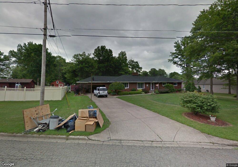
321 S Yorkshire Blvd Youngstown, OH 44515
Austintown NeighborhoodEstimated Value: $211,000 - $314,000
3
Beds
3
Baths
2,938
Sq Ft
$95/Sq Ft
Est. Value
About This Home
This home is located at 321 S Yorkshire Blvd, Youngstown, OH 44515 and is currently estimated at $277,807, approximately $94 per square foot. 321 S Yorkshire Blvd is a home located in Mahoning County with nearby schools including Austintown Elementary School, Austintown Intermediate School, and Austintown Middle School.
Ownership History
Date
Name
Owned For
Owner Type
Purchase Details
Closed on
Sep 30, 2017
Sold by
Mcmullen John W
Bought by
Mcmullen John W and Mcmullen Amy Marie
Current Estimated Value
Home Financials for this Owner
Home Financials are based on the most recent Mortgage that was taken out on this home.
Original Mortgage
$154,400
Outstanding Balance
$83,902
Interest Rate
3.82%
Mortgage Type
New Conventional
Estimated Equity
$193,905
Purchase Details
Closed on
Jan 15, 2007
Sold by
Parker Harry D and Parker Jacqueline
Bought by
Mcmullen John W
Home Financials for this Owner
Home Financials are based on the most recent Mortgage that was taken out on this home.
Original Mortgage
$146,300
Interest Rate
6.16%
Mortgage Type
Purchase Money Mortgage
Purchase Details
Closed on
Jan 1, 1990
Bought by
Parker Harry and Parker Jacquelyn
Create a Home Valuation Report for This Property
The Home Valuation Report is an in-depth analysis detailing your home's value as well as a comparison with similar homes in the area
Home Values in the Area
Average Home Value in this Area
Purchase History
| Date | Buyer | Sale Price | Title Company |
|---|---|---|---|
| Mcmullen John W | -- | Servicelink | |
| Mcmullen John W | $154,000 | Attorney | |
| Parker Harry | -- | -- |
Source: Public Records
Mortgage History
| Date | Status | Borrower | Loan Amount |
|---|---|---|---|
| Open | Mcmullen John W | $154,400 | |
| Closed | Mcmullen John W | $146,300 |
Source: Public Records
Tax History Compared to Growth
Tax History
| Year | Tax Paid | Tax Assessment Tax Assessment Total Assessment is a certain percentage of the fair market value that is determined by local assessors to be the total taxable value of land and additions on the property. | Land | Improvement |
|---|---|---|---|---|
| 2024 | $3,909 | $85,430 | $6,500 | $78,930 |
| 2023 | $3,848 | $85,430 | $6,500 | $78,930 |
| 2022 | $3,380 | $60,170 | $5,450 | $54,720 |
| 2021 | $3,382 | $60,170 | $5,450 | $54,720 |
| 2020 | $3,396 | $60,170 | $5,450 | $54,720 |
| 2019 | $3,186 | $51,430 | $4,660 | $46,770 |
| 2018 | $3,065 | $51,430 | $4,660 | $46,770 |
| 2017 | $3,129 | $51,430 | $4,660 | $46,770 |
| 2016 | $3,197 | $53,170 | $4,660 | $48,510 |
| 2015 | $3,099 | $53,170 | $4,660 | $48,510 |
| 2014 | $3,113 | $53,170 | $4,660 | $48,510 |
| 2013 | $3,080 | $53,170 | $4,660 | $48,510 |
Source: Public Records
Map
Nearby Homes
- 0 Elmwood Ave
- 603 S Raccoon Rd Unit 14
- 603 S Raccoon Rd Unit 9
- 603 S Raccoon Rd Unit 61
- 603 S Raccoon Rd Unit 13
- 0 S Raccoon Rd Unit 5142489
- 210 S Beverly Ave
- 446 S Edgehill Ave
- 263 S Main St
- 122 S Edgehill Ave
- 252 Rosemont Ave
- 4234 Burkey Rd
- 102 Parkgate Ave
- 81 S Edgehill Ave
- 258 S Navarre Ave
- 136 Rosemont Ave
- 532 Westgate Blvd
- 4102 Burkey Rd
- 4258 Mahoning Ave
- 97 Idlewood Rd
- 4295 Elmwood Ave
- 4285 Elmwood Ave
- 603 S Raccoon Rd Unit A
- 603 S Raccoon Rd Unit 28
- 603 S Raccoon Rd Unit 19
- 603 S Raccoon Rd
- 603 S Raccoon Rd Unit 52
- 603 S Raccoon Rd
- 603 S Raccoon Rd Unit 50
- 603 S Raccoon Rd Unit 48
- 603 S Raccoon Rd Unit 46
- 603 S Raccoon Rd Unit 31
- 603 S Raccoon Rd Unit 30
- 603 S Raccoon Rd Unit 20
- 603 S Raccoon Rd Unit 18
- 603 S Raccoon Rd Unit 17
- 603 S Raccoon Rd Unit 16
- 603 S Raccoon Rd Unit 11
- 603 S Raccoon Rd Unit 29
- 603 S Raccoon Rd Unit 49