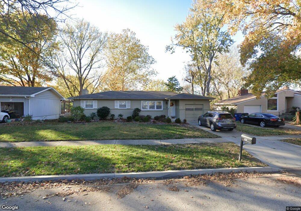
321 Yorkshire Dr Lawrence, KS 66049
Estimated Value: $288,000 - $322,000
4
Beds
3
Baths
1,274
Sq Ft
$244/Sq Ft
Est. Value
About This Home
This home is located at 321 Yorkshire Dr, Lawrence, KS 66049 and is currently estimated at $311,058, approximately $244 per square foot. 321 Yorkshire Dr is a home located in Douglas County with nearby schools including Deerfield Elementary School, West Middle School, and Lawrence Free State High School.
Ownership History
Date
Name
Owned For
Owner Type
Purchase Details
Closed on
Oct 18, 2016
Sold by
Rounda Daniel L and Rounda Judith M
Bought by
Mchenry Bryce and Mchenry Roslyn K
Current Estimated Value
Home Financials for this Owner
Home Financials are based on the most recent Mortgage that was taken out on this home.
Original Mortgage
$108,000
Outstanding Balance
$86,527
Interest Rate
3.44%
Mortgage Type
New Conventional
Estimated Equity
$224,531
Purchase Details
Closed on
Dec 4, 2004
Sold by
Davis Yolanda G and Davis Jon A
Bought by
Rounda Daniel L and Rounda Judith M
Create a Home Valuation Report for This Property
The Home Valuation Report is an in-depth analysis detailing your home's value as well as a comparison with similar homes in the area
Home Values in the Area
Average Home Value in this Area
Purchase History
| Date | Buyer | Sale Price | Title Company |
|---|---|---|---|
| Mchenry Bryce | -- | Kansas Secured Title | |
| Rounda Daniel L | -- | Commerce Title |
Source: Public Records
Mortgage History
| Date | Status | Borrower | Loan Amount |
|---|---|---|---|
| Open | Mchenry Bryce | $108,000 |
Source: Public Records
Tax History Compared to Growth
Tax History
| Year | Tax Paid | Tax Assessment Tax Assessment Total Assessment is a certain percentage of the fair market value that is determined by local assessors to be the total taxable value of land and additions on the property. | Land | Improvement |
|---|---|---|---|---|
| 2025 | $3,779 | $32,936 | $7,475 | $25,461 |
| 2024 | $3,779 | $30,797 | $7,475 | $23,322 |
| 2023 | $3,910 | $30,556 | $6,900 | $23,656 |
| 2022 | $3,444 | $26,789 | $6,900 | $19,889 |
| 2021 | $3,046 | $22,897 | $5,980 | $16,917 |
| 2020 | $2,881 | $21,781 | $5,980 | $15,801 |
| 2019 | $2,674 | $20,263 | $5,060 | $15,203 |
| 2018 | $2,618 | $19,700 | $4,600 | $15,100 |
| 2017 | $2,520 | $18,768 | $4,600 | $14,168 |
| 2016 | $2,390 | $18,596 | $3,680 | $14,916 |
| 2015 | -- | $17,722 | $3,680 | $14,042 |
| 2014 | -- | $17,308 | $3,680 | $13,628 |
Source: Public Records
Map
Nearby Homes
- 209 Yorkshire Dr
- 2412 Stowe Dr
- 2305 Brett Dr
- 515 McDonald Dr
- 214 Lawrence Ave
- 229 Deerfield Ln
- 255 N Michigan St Unit 22
- 212 N Minnesota St
- 203 Summertree Ln
- 1515 Pinewood Dr
- 120 Minnesota St
- 110 Glenview Dr
- 322 Birch Ln
- 121 Florida St
- 1316 N 1750 Rd
- Lot 3 Peterson Rd
- Lot 2 Peterson Rd
- 307 Wisconsin St
- Lot 5 Weatherhill Cir
- 1757 E 1318 Rd
- 315 Yorkshire Dr
- 403 Yorkshire Dr
- 309 Yorkshire Dr
- 312 N Crestline Dr
- 308 N Crestline Dr
- 316 N Crestline Dr
- 413 Yorkshire Dr
- 2415 Westchester Rd
- 303 Yorkshire Dr
- 402 Yorkshire Dr
- 304 N Crestline Dr
- 320 N Crestline Dr
- 308 Yorkshire Dr
- 408 Yorkshire Dr
- 227 Yorkshire Dr
- 300 N Crestline Dr
- 414 Yorkshire Dr
- 2426 Danbury Place
- 2409 Westchester Rd
- 2601 Pickwick Place