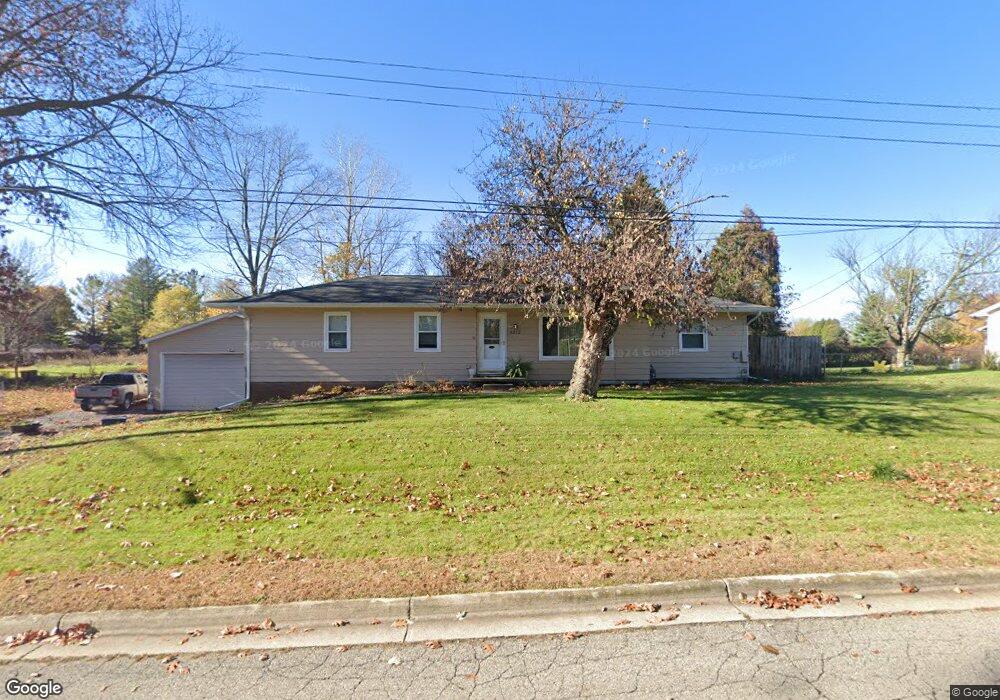
3212 Leawood Dr Lansing, MI 48910
Forest View NeighborhoodEstimated Value: $224,433 - $247,000
--
Bed
1
Bath
1,430
Sq Ft
$164/Sq Ft
Est. Value
About This Home
This home is located at 3212 Leawood Dr, Lansing, MI 48910 and is currently estimated at $235,108, approximately $164 per square foot. 3212 Leawood Dr is a home located in Ingham County with nearby schools including Forest View School, Pattengill Academy, and Eastern High School.
Ownership History
Date
Name
Owned For
Owner Type
Purchase Details
Closed on
Jan 4, 2023
Sold by
Shaw Sam and Shaw Joanne
Bought by
Shaw Joanne M
Current Estimated Value
Purchase Details
Closed on
Jul 20, 2000
Sold by
Steinbach Anna and Steinbach Fritz H
Bought by
Shaw Sam and Shaw Joanne
Home Financials for this Owner
Home Financials are based on the most recent Mortgage that was taken out on this home.
Original Mortgage
$18,000
Interest Rate
8.19%
Mortgage Type
Unknown
Create a Home Valuation Report for This Property
The Home Valuation Report is an in-depth analysis detailing your home's value as well as a comparison with similar homes in the area
Home Values in the Area
Average Home Value in this Area
Purchase History
| Date | Buyer | Sale Price | Title Company |
|---|---|---|---|
| Shaw Joanne M | -- | None Listed On Document | |
| Shaw Sam | $90,000 | -- |
Source: Public Records
Mortgage History
| Date | Status | Borrower | Loan Amount |
|---|---|---|---|
| Previous Owner | Shaw Sam | $18,000 | |
| Previous Owner | Shaw Sam | $72,000 |
Source: Public Records
Tax History Compared to Growth
Tax History
| Year | Tax Paid | Tax Assessment Tax Assessment Total Assessment is a certain percentage of the fair market value that is determined by local assessors to be the total taxable value of land and additions on the property. | Land | Improvement |
|---|---|---|---|---|
| 2025 | $3,266 | $106,300 | $14,200 | $92,100 |
| 2024 | $26 | $95,600 | $14,200 | $81,400 |
| 2023 | $3,062 | $83,000 | $14,200 | $68,800 |
| 2022 | $2,760 | $74,800 | $13,000 | $61,800 |
| 2021 | $2,702 | $68,100 | $9,400 | $58,700 |
| 2020 | $2,686 | $67,000 | $9,400 | $57,600 |
| 2019 | $2,575 | $60,200 | $9,400 | $50,800 |
| 2018 | $2,412 | $49,600 | $9,400 | $40,200 |
| 2017 | $2,310 | $49,600 | $9,400 | $40,200 |
| 2016 | $2,210 | $42,600 | $9,400 | $33,200 |
| 2015 | $2,210 | $39,900 | $18,898 | $21,002 |
| 2014 | $2,210 | $39,300 | $10,394 | $28,906 |
Source: Public Records
Map
Nearby Homes
- 3222 Leawood Dr
- 2901 Staten Ave Unit 14
- 3016 Manley Dr
- 2741 Trudy Ln Unit 6
- 2520 Forest Rd
- 2727 Aurora Dr
- 3205 Aurelius Rd
- 2528 Windbreak Ln Unit 13
- 2017 Greenwich Ct Unit 20
- 4207 Aurelius Rd
- 3726 Ruth Ave
- 2018 Worden St
- 000 Dunckel Rd
- 2237 Sunnyside Ave
- 2300 Sunnyside Ave
- 2338 Harding Ave
- 0 E Mount Hope Ave
- 0 N Aurelius Rd
- 1121 Maplehill Ave
- 2011 Clifton Ave
- 3200 Leawood Dr
- 3219 Leawood Dr
- 3205 Leawood Dr
- 3227 Leawood Dr
- 3128 Leawood Dr
- 2743 Wabash Rd
- 3133 Leawood Dr
- 2735 Wabash Rd
- 2725 Wabash Rd
- 3118 Leawood Dr
- 3123 Leawood Dr
- 2717 Wabash Rd
- 2707 Wabash Rd
- 2736 Wabash Rd
- 2746 Wabash Rd
- 2742 Fireside Dr
- 2726 Wabash Rd
- 2804 Wabash Rd
- 2724 Fireside Dr
- 2718 Wabash Rd