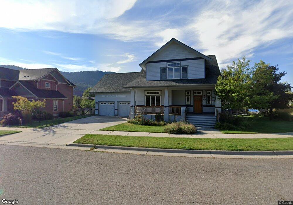
3214 Cummins Way Missoula, MT 59802
Upper Rattlesnake NeighborhoodEstimated Value: $841,000 - $1,190,000
3
Beds
2
Baths
1,286
Sq Ft
$809/Sq Ft
Est. Value
About This Home
This home is located at 3214 Cummins Way, Missoula, MT 59802 and is currently estimated at $1,040,441, approximately $809 per square foot. 3214 Cummins Way is a home located in Missoula County with nearby schools including Rattlesnake Elementary School, Washington Middle School, and Hellgate High School.
Ownership History
Date
Name
Owned For
Owner Type
Purchase Details
Closed on
Apr 6, 2006
Sold by
Riverworks Inc
Bought by
Ware Andrew and Coleman Sherry
Current Estimated Value
Home Financials for this Owner
Home Financials are based on the most recent Mortgage that was taken out on this home.
Original Mortgage
$332,450
Outstanding Balance
$189,278
Interest Rate
6.2%
Mortgage Type
Fannie Mae Freddie Mac
Estimated Equity
$851,163
Purchase Details
Closed on
Feb 10, 2005
Sold by
Aislinge Llc
Bought by
Riverworks Inc
Home Financials for this Owner
Home Financials are based on the most recent Mortgage that was taken out on this home.
Original Mortgage
$244,083
Interest Rate
5.81%
Mortgage Type
Purchase Money Mortgage
Create a Home Valuation Report for This Property
The Home Valuation Report is an in-depth analysis detailing your home's value as well as a comparison with similar homes in the area
Home Values in the Area
Average Home Value in this Area
Purchase History
| Date | Buyer | Sale Price | Title Company |
|---|---|---|---|
| Ware Andrew | -- | Insured Titles Llc | |
| Riverworks Inc | -- | -- |
Source: Public Records
Mortgage History
| Date | Status | Borrower | Loan Amount |
|---|---|---|---|
| Open | Ware Andrew | $332,450 | |
| Previous Owner | Riverworks Inc | $244,083 |
Source: Public Records
Tax History Compared to Growth
Tax History
| Year | Tax Paid | Tax Assessment Tax Assessment Total Assessment is a certain percentage of the fair market value that is determined by local assessors to be the total taxable value of land and additions on the property. | Land | Improvement |
|---|---|---|---|---|
| 2025 | $10,350 | $983,600 | $342,632 | $640,968 |
| 2024 | $9,896 | $813,200 | $293,046 | $520,154 |
| 2023 | $9,572 | $813,200 | $293,046 | $520,154 |
| 2022 | $8,503 | $626,400 | $0 | $0 |
| 2021 | $8,077 | $626,400 | $0 | $0 |
| 2020 | $7,259 | $585,362 | $0 | $0 |
| 2019 | $7,669 | $585,362 | $0 | $0 |
| 2018 | $6,612 | $490,300 | $0 | $0 |
| 2017 | $5,875 | $490,300 | $0 | $0 |
| 2016 | $5,493 | $432,200 | $0 | $0 |
| 2015 | $5,083 | $432,200 | $0 | $0 |
| 2014 | $4,877 | $233,518 | $0 | $0 |
Source: Public Records
Map
Nearby Homes
- 18 Brookside Way
- 6 Brookside Way
- 7 Brookside Way
- 1306 Lily Ct
- 45 Brookside Way
- 1655 Sunflower Dr
- 1625 Sunflower Dr
- 3807 Lincoln Rd
- 8 Columbine Rd
- 19 Columbine Rd
- 3825 Lincoln Rd
- 1561 Mountain View Dr
- 2606 Sycamore St
- 521 Arbor Dr
- 4175 Rattlesnake Dr
- 2411 Raymond Ave
- 4280 Fox Farm Rd
- 13 Contour Rd
- 11 Contour Rd
- 2215 Raymond Ave
- 3208 Cummins Way
- Lot 41 Cummins Way
- 3204 Cummins Way
- 3227 Cummins Way
- 3223 Cummins Way
- 3231 Cummins Way
- 3211 Cummins Way
- 3215 Cummins Way
- 3223 Meagher Ln
- 3207 Cummins Way
- 3130 Cummins Way
- 3235 Cummins Way
- 3213 Meagher Ln
- 3233 Cummins Way
- 3203 Cummins Way
- 19 Brookside Way
- 21 Brookside Way
- 20 Brookside Way
- 3124 Cummins Way
- 3239 Cummins Way