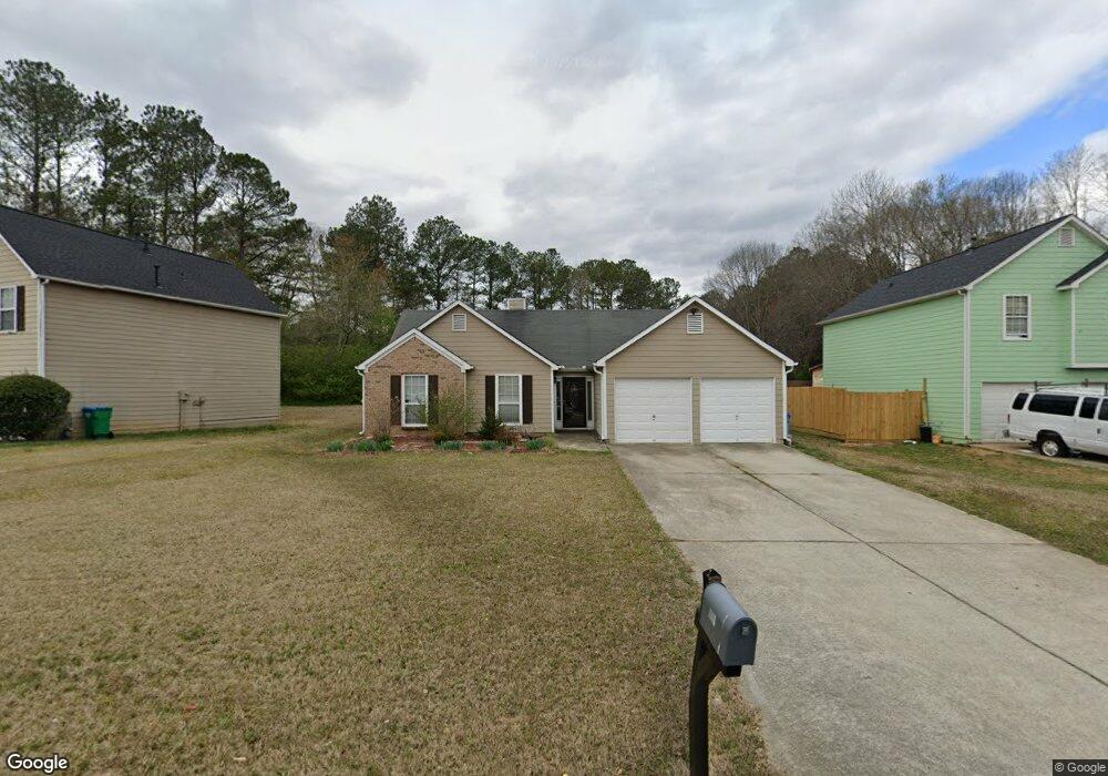
3220 Brookfield Dr Unit 1 Austell, GA 30106
Estimated Value: $279,000 - $334,000
3
Beds
3
Baths
1,478
Sq Ft
$207/Sq Ft
Est. Value
About This Home
This home is located at 3220 Brookfield Dr Unit 1, Austell, GA 30106 and is currently estimated at $305,715, approximately $206 per square foot. 3220 Brookfield Dr Unit 1 is a home located in Cobb County with nearby schools including Deerwood Elementary School, Hendricks Elementary School, and Garrett Middle School.
Ownership History
Date
Name
Owned For
Owner Type
Purchase Details
Closed on
Oct 31, 2001
Sold by
Four Star Building Group Inc
Bought by
Dupuy Walnere
Current Estimated Value
Home Financials for this Owner
Home Financials are based on the most recent Mortgage that was taken out on this home.
Original Mortgage
$116,460
Outstanding Balance
$44,853
Interest Rate
6.67%
Mortgage Type
New Conventional
Estimated Equity
$260,862
Create a Home Valuation Report for This Property
The Home Valuation Report is an in-depth analysis detailing your home's value as well as a comparison with similar homes in the area
Home Values in the Area
Average Home Value in this Area
Purchase History
| Date | Buyer | Sale Price | Title Company |
|---|---|---|---|
| Dupuy Walnere | $129,400 | -- | |
| Four Star Building Group Inc | -- | -- |
Source: Public Records
Mortgage History
| Date | Status | Borrower | Loan Amount |
|---|---|---|---|
| Open | Four Star Building Group Inc | $116,460 |
Source: Public Records
Tax History Compared to Growth
Tax History
| Year | Tax Paid | Tax Assessment Tax Assessment Total Assessment is a certain percentage of the fair market value that is determined by local assessors to be the total taxable value of land and additions on the property. | Land | Improvement |
|---|---|---|---|---|
| 2025 | $367 | $109,968 | $16,000 | $93,968 |
| 2024 | $2,237 | $109,968 | $16,000 | $93,968 |
| 2023 | $1,748 | $109,968 | $16,000 | $93,968 |
| 2022 | $1,675 | $79,176 | $16,000 | $63,176 |
| 2021 | $1,685 | $79,176 | $16,000 | $63,176 |
| 2020 | $1,479 | $68,376 | $16,000 | $52,376 |
| 2019 | $1,311 | $59,524 | $16,000 | $43,524 |
| 2018 | $1,311 | $59,524 | $16,000 | $43,524 |
| 2017 | $1,170 | $55,972 | $6,800 | $49,172 |
| 2016 | $860 | $43,252 | $6,800 | $36,452 |
| 2015 | $882 | $43,252 | $6,800 | $36,452 |
| 2014 | $780 | $39,124 | $0 | $0 |
Source: Public Records
Map
Nearby Homes
- 3667 Humphries Hill Rd
- 5954 Tate Dr
- 3536 Perry Point
- 6031 Falcon Ct
- 6309 Wellington Way
- 6277 N Sweetwater Rd
- 6503 Jackie Ln
- 3020 Ben Blvd
- 6230 Kensington Ct
- 3903 Doe Run Dr
- 2070 Bonny Glen Cir
- TBD Sullivan Rd
- 0 Garrett Rd SW Unit 7648220
- 0 Garrett Rd SW Unit 10603275
- 6358 Gordon St
- 5961 John St
- 5990 John St
- 4022 Creel Dr
- 3912 Garrett Springs Dr
- 6531 Temple St
- 3210 Brookfield Dr
- 3230 Brookfield Dr
- 3200 Brookfield Dr Unit 1
- 3920 Humphries Hill Rd
- 3305 Brookfield Dr
- 3240 Brookfield Dr
- 3295 Brookfield Dr
- 3295 Brookfield Dr Unit 35
- 3190 Brookfield Dr
- 3930 Humphries Hill Rd
- 3325 Brookfield Dr
- 3910 Humphries Hill Rd
- 3901 Humphries Hill Rd
- 3285 Brookfield Dr
- 3275 Brookfield Dr
- 3180 Brookfield Dr
- 6001 Windchase Ct
- 6005 Windchase Ct
- 3265 Brookfield Dr
- 6007 Windchase Ct SW