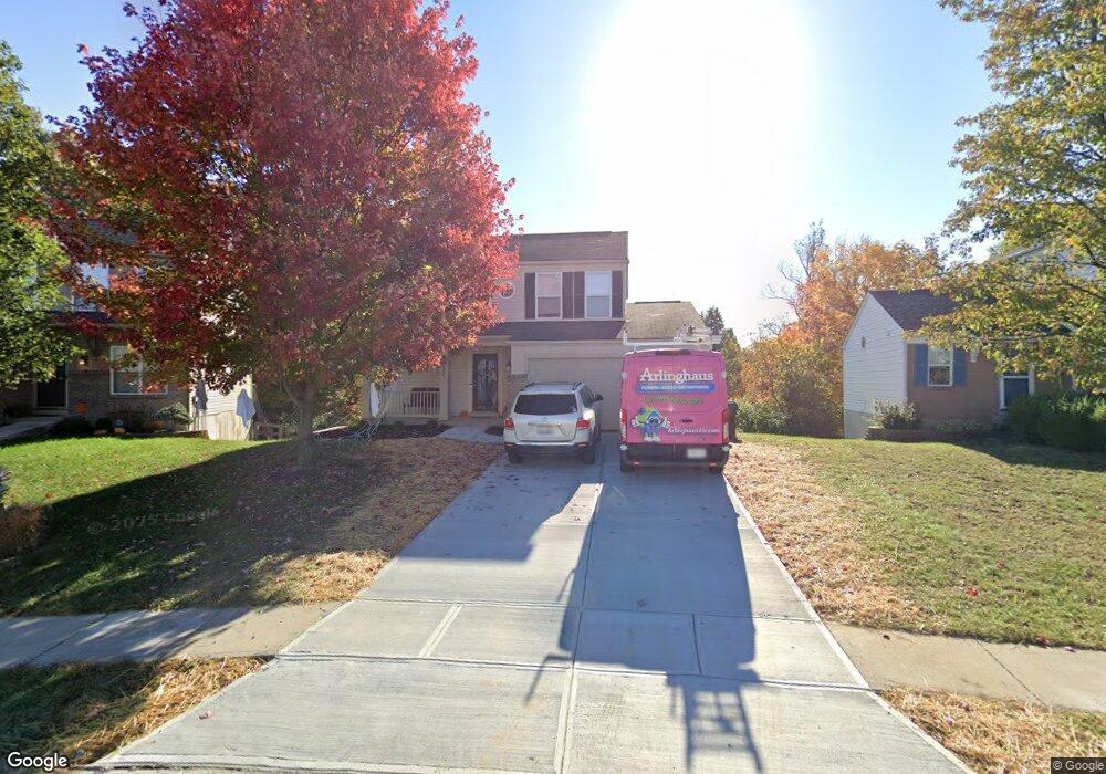
3225 Summit Run Dr Independence, KY 41051
Estimated Value: $269,000 - $284,166
3
Beds
3
Baths
1,443
Sq Ft
$192/Sq Ft
Est. Value
About This Home
This home is located at 3225 Summit Run Dr, Independence, KY 41051 and is currently estimated at $277,042, approximately $191 per square foot. 3225 Summit Run Dr is a home located in Kenton County with nearby schools including Taylor Mill Elementary School, Woodland Middle School, and Scott High School.
Ownership History
Date
Name
Owned For
Owner Type
Purchase Details
Closed on
Jul 9, 2016
Sold by
The Secretary Of Housing & Urban Develop
Bought by
Eclipse Properties Llc
Current Estimated Value
Purchase Details
Closed on
Apr 8, 2016
Sold by
Wells Fargo Bank Na
Bought by
Secretary Of Housing & Urban Development
Purchase Details
Closed on
Feb 8, 2016
Sold by
Rolph Amy M
Bought by
Wells Fargo Bank Na
Purchase Details
Closed on
Aug 13, 2003
Sold by
Maple Street Homes Llc
Bought by
Rolph Christian A and Rolph Amy M
Home Financials for this Owner
Home Financials are based on the most recent Mortgage that was taken out on this home.
Original Mortgage
$143,991
Interest Rate
5.42%
Mortgage Type
FHA
Purchase Details
Closed on
May 20, 2003
Sold by
Grand Communities Ltd
Bought by
Maple Street Homes Llc
Create a Home Valuation Report for This Property
The Home Valuation Report is an in-depth analysis detailing your home's value as well as a comparison with similar homes in the area
Home Values in the Area
Average Home Value in this Area
Purchase History
| Date | Buyer | Sale Price | Title Company |
|---|---|---|---|
| Eclipse Properties Llc | $117,061 | Kentucky Land Title Agency I | |
| Secretary Of Housing & Urban Development | -- | Attorney | |
| Wells Fargo Bank Na | $96,000 | None Available | |
| Rolph Christian A | $145,130 | Homestead Title Agency Ltd | |
| Maple Street Homes Llc | $98,804 | -- |
Source: Public Records
Mortgage History
| Date | Status | Borrower | Loan Amount |
|---|---|---|---|
| Previous Owner | Rolph Christian A | $143,991 |
Source: Public Records
Tax History
| Year | Tax Paid | Tax Assessment Tax Assessment Total Assessment is a certain percentage of the fair market value that is determined by local assessors to be the total taxable value of land and additions on the property. | Land | Improvement |
|---|---|---|---|---|
| 2025 | $2,695 | $231,700 | $35,000 | $196,700 |
| 2024 | $1,762 | $143,800 | $30,000 | $113,800 |
| 2023 | $1,815 | $143,800 | $30,000 | $113,800 |
| 2022 | $1,879 | $143,800 | $30,000 | $113,800 |
| 2021 | $1,906 | $143,800 | $30,000 | $113,800 |
| 2020 | $1,701 | $125,000 | $30,000 | $95,000 |
| 2019 | $1,706 | $125,000 | $30,000 | $95,000 |
| 2018 | $1,715 | $125,000 | $30,000 | $95,000 |
| 2017 | $1,567 | $117,000 | $30,000 | $87,000 |
| 2015 | $1,867 | $145,100 | $30,000 | $115,100 |
| 2014 | $1,841 | $145,100 | $30,000 | $115,100 |
Source: Public Records
Map
Nearby Homes
- 9738 Cloveridge Dr
- 1479 Hands Pike
- 838 Stablewatch Dr
- 907 Stablewatch Dr
- 951 Stablewatch Dr
- 968 Stablewatch Dr
- 83 Pitman Ct
- 6376 Stonemill Dr
- 748 Stablewatch Dr
- 111 Green Hill Dr
- 798 Stonybrook Ct
- 3563 Capel Ct
- 794 Stonybrook Ct
- 718 Willow Green Dr
- 714 Willow Green Dr
- 3576 Gilford Ct
- 789 Stonybrook Ct
- 10171 Desmond Ct
- 6500 Meadow Creek Dr
- 6519 Meadow Creek Dr
- 3225 Summitrun Dr
- 3221 Summitrun Dr
- 3229 Summitrun Dr
- 3233 Summitrun Dr
- 3230 Summitrun Dr
- 3215 Summit Run Dr
- 3215 Summitrun Dr
- 3220 Summit Run Dr
- 3220 Summitrun Dr
- 3237 Summitrun Dr
- 3244 Summitrun Dr
- 3211 Summitrun Dr
- 3216 Summitrun Dr
- 3241 Summitrun Dr
- 3248 Summitrun Dr
- 3212 Summitrun Dr
- 3248 Summit Run Dr
- 3245 Summitrun Dr
- 3207 Summitrun Dr
- 3205 Meadoway Ct
Your Personal Tour Guide
Ask me questions while you tour the home.