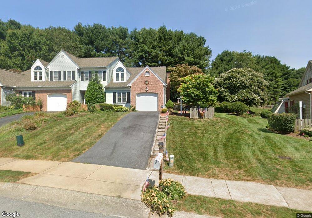
3247 Glengreen Dr Lancaster, PA 17601
Oyster Point NeighborhoodEstimated Value: $257,095 - $304,000
2
Beds
2
Baths
1,398
Sq Ft
$201/Sq Ft
Est. Value
About This Home
This home is located at 3247 Glengreen Dr, Lancaster, PA 17601 and is currently estimated at $280,774, approximately $200 per square foot. 3247 Glengreen Dr is a home located in Lancaster County with nearby schools including Landisville Primary Center, Landisville Middle School, and Hempfield High School.
Ownership History
Date
Name
Owned For
Owner Type
Purchase Details
Closed on
Oct 2, 2018
Sold by
Reese Julie K and Thompson Julie K
Bought by
Thompson Julie K and Thompson Ernest E
Current Estimated Value
Purchase Details
Closed on
Dec 22, 2010
Sold by
Wardell Edward G
Bought by
Reese Julie K
Home Financials for this Owner
Home Financials are based on the most recent Mortgage that was taken out on this home.
Original Mortgage
$100,000
Outstanding Balance
$65,900
Interest Rate
4.17%
Mortgage Type
New Conventional
Estimated Equity
$214,874
Purchase Details
Closed on
Feb 28, 2005
Sold by
Latta Mary E
Bought by
Wardell Edward G
Home Financials for this Owner
Home Financials are based on the most recent Mortgage that was taken out on this home.
Original Mortgage
$70,000
Interest Rate
5.66%
Mortgage Type
Purchase Money Mortgage
Create a Home Valuation Report for This Property
The Home Valuation Report is an in-depth analysis detailing your home's value as well as a comparison with similar homes in the area
Home Values in the Area
Average Home Value in this Area
Purchase History
| Date | Buyer | Sale Price | Title Company |
|---|---|---|---|
| Thompson Julie K | -- | None Available | |
| Reese Julie K | $130,000 | None Available | |
| Wardell Edward G | $139,500 | -- |
Source: Public Records
Mortgage History
| Date | Status | Borrower | Loan Amount |
|---|---|---|---|
| Open | Reese Julie K | $100,000 | |
| Previous Owner | Wardell Edward G | $70,000 |
Source: Public Records
Tax History
| Year | Tax Paid | Tax Assessment Tax Assessment Total Assessment is a certain percentage of the fair market value that is determined by local assessors to be the total taxable value of land and additions on the property. | Land | Improvement |
|---|---|---|---|---|
| 2025 | $3,231 | $143,300 | $27,300 | $116,000 |
| 2024 | $3,231 | $143,300 | $27,300 | $116,000 |
| 2023 | $3,170 | $143,300 | $27,300 | $116,000 |
| 2022 | $3,086 | $143,300 | $27,300 | $116,000 |
| 2021 | $3,025 | $143,300 | $27,300 | $116,000 |
| 2020 | $3,025 | $143,300 | $27,300 | $116,000 |
| 2019 | $2,976 | $143,300 | $27,300 | $116,000 |
| 2018 | $3,538 | $143,300 | $27,300 | $116,000 |
| 2017 | $3,077 | $119,700 | $39,600 | $80,100 |
| 2016 | $3,016 | $119,700 | $39,600 | $80,100 |
| 2015 | $607 | $119,700 | $39,600 | $80,100 |
| 2014 | $2,329 | $119,700 | $39,600 | $80,100 |
Source: Public Records
Map
Nearby Homes
- 3059 Buckthorn Dr
- 3301 Marietta Ave
- 319 Druid Hill Rd
- 86 Village Dr
- 825 Robin Rd
- 26 E Main St
- 900 Cardinal Rd
- 16 Cedar Chase Dr
- 204 Post Oak Rd
- 3481 Coronet Ave
- 906 Snapper Dam Rd
- 3710 Little Mac Dr
- 250 Huntington Dr
- 923 Jade Ave
- 39 Spring Hill Ln
- 24 Spring Hill Ln
- 2808 Spring Valley Rd
- 415 LOT # 1 Hempfield Hill Rd
- 6 Spring Hill Ln
- 2816 Mimosa Ln Unit 33
- 3251 Glengreen Dr
- 3253 Glengreen Dr
- 3241 Glengreen Dr
- 3239 Glengreen Dr
- 3227 Pinewyn Cir
- 3255 Glengreen Dr
- 3208 Greenridge Dr
- 3206 Greenridge Dr
- 3237 Glengreen Dr
- 3225 Pinewyn Cir
- 3263 Glengreen Dr
- 3223 Pinewyn Cir
- 3235 Glengreen Dr
- 3265 Glengreen Dr
- 3210 Greenridge Dr
- 3204 Greenridge Dr
- 3221 Pinewyn Cir
- 3269 Glengreen Dr
- 315 N Donerville Rd
Your Personal Tour Guide
Ask me questions while you tour the home.