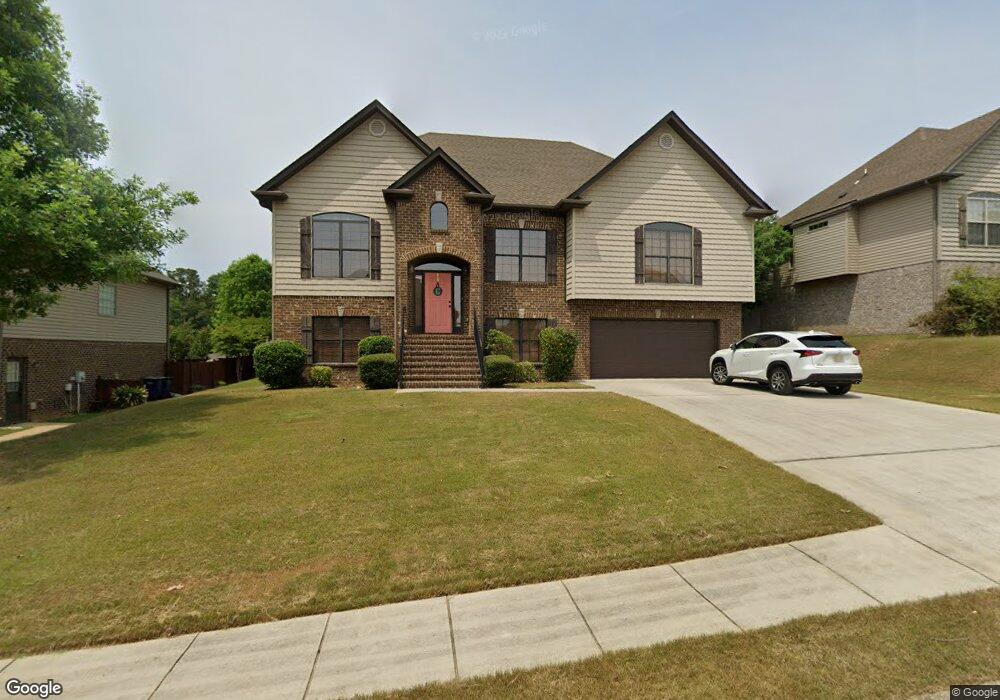
325 Cromwell Unit 363 Alabaster, AL 35114
Estimated Value: $380,534 - $407,000
5
Beds
4
Baths
2,464
Sq Ft
$158/Sq Ft
Est. Value
About This Home
This home is located at 325 Cromwell Unit 363, Alabaster, AL 35114 and is currently estimated at $390,134, approximately $158 per square foot. 325 Cromwell Unit 363 is a home located in Shelby County with nearby schools including Thompson Intermediate School, Thompson Middle School, and Thompson High School.
Ownership History
Date
Name
Owned For
Owner Type
Purchase Details
Closed on
Jun 28, 2023
Sold by
Sdh Alabama Llc
Bought by
Ferguson Beverly A and Ferguson Janice M
Current Estimated Value
Purchase Details
Closed on
Apr 30, 2010
Sold by
Professional Homebuilders Inc
Bought by
Cole Stephen Eugene and Cole Stacy Scott
Home Financials for this Owner
Home Financials are based on the most recent Mortgage that was taken out on this home.
Original Mortgage
$209,900
Interest Rate
4.94%
Mortgage Type
New Conventional
Create a Home Valuation Report for This Property
The Home Valuation Report is an in-depth analysis detailing your home's value as well as a comparison with similar homes in the area
Home Values in the Area
Average Home Value in this Area
Purchase History
| Date | Buyer | Sale Price | Title Company |
|---|---|---|---|
| Ferguson Beverly A | $276,725 | None Listed On Document | |
| Cole Stephen Eugene | $234,900 | None Available |
Source: Public Records
Mortgage History
| Date | Status | Borrower | Loan Amount |
|---|---|---|---|
| Previous Owner | Cole Stephen Eugene | $209,900 |
Source: Public Records
Tax History Compared to Growth
Tax History
| Year | Tax Paid | Tax Assessment Tax Assessment Total Assessment is a certain percentage of the fair market value that is determined by local assessors to be the total taxable value of land and additions on the property. | Land | Improvement |
|---|---|---|---|---|
| 2024 | $1,900 | $35,180 | $0 | $0 |
| 2023 | $1,719 | $32,600 | $0 | $0 |
| 2022 | $1,587 | $30,140 | $0 | $0 |
| 2021 | $1,439 | $27,400 | $0 | $0 |
| 2020 | $1,381 | $26,340 | $0 | $0 |
| 2019 | $1,367 | $26,080 | $0 | $0 |
| 2017 | $1,241 | $23,740 | $0 | $0 |
| 2015 | $1,193 | $22,860 | $0 | $0 |
| 2014 | $1,164 | $22,320 | $0 | $0 |
Source: Public Records
Map
Nearby Homes
- 493 Ramsgate Dr
- 109 Kingsley Cir
- 217 Mayfair Park
- 256 Cedar Meadow
- 304 Mayfair Cir
- 233 Norwick Forest Dr
- 220 Cedar Meadow
- 112 Kingsley Ct
- 236 Queens Gate
- 537 Ramsgate Dr
- 208 Queens Gate
- 2014 1st Ave W
- 501 Ramsgate Dr
- 309 Cedar Grove Ct
- 545 Ramsgate Dr
- 202 Stoney Trail
- 549 Ramsgate Dr
- 155 Victoria Station
- 280 Cedar Grove Pkwy Unit 34
- 1805 Mohawk Dr
- 320 Cromwell Unit 354
- 329 Cromwell
- 324 Cromwell
- 324 Cromwell Unit 353
- 321 Cromwell
- 321 Cromwell Unit 362
- 328 Cromwell
- 328 Cromwell Unit 352
- 316 Cromwell
- 316 Cromwell Unit 355
- 440 Ramsgate Dr
- 440 Ramsgate Dr Unit 366
- 333 Cromwell
- 333 Cromwell Unit 365
- 436 Ramsgate Dr
- 436 Ramsgate Dr Unit 367
- 317 Cromwell
- 317 Cromwell Unit 361
- 432 Ramsgate Dr
- 332 Cromwell