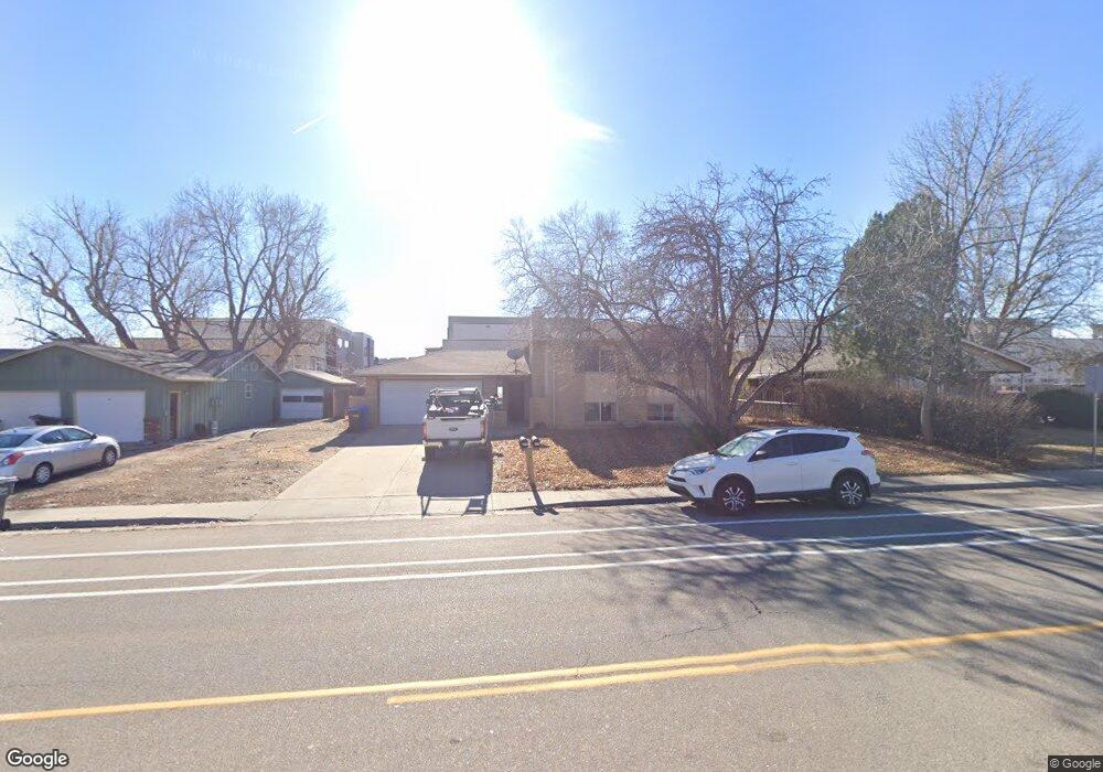
325 E Swallow Rd Fort Collins, CO 80525
Village East NeighborhoodEstimated Value: $562,615 - $662,000
4
Beds
2
Baths
2,036
Sq Ft
$301/Sq Ft
Est. Value
About This Home
This home is located at 325 E Swallow Rd, Fort Collins, CO 80525 and is currently estimated at $612,404, approximately $300 per square foot. 325 E Swallow Rd is a home located in Larimer County with nearby schools including O'Dea Elementary School, Boltz Middle School, and Fort Collins High School.
Ownership History
Date
Name
Owned For
Owner Type
Purchase Details
Closed on
Aug 30, 2013
Sold by
Mooney Richard J
Bought by
Holmes Nicole Z and Holmes Daniel A
Current Estimated Value
Home Financials for this Owner
Home Financials are based on the most recent Mortgage that was taken out on this home.
Original Mortgage
$198,750
Outstanding Balance
$148,079
Interest Rate
4.36%
Mortgage Type
New Conventional
Estimated Equity
$464,325
Purchase Details
Closed on
May 13, 2008
Sold by
Mooney Walter T and Mooney Marilyn
Bought by
Mooney Richard J
Purchase Details
Closed on
Sep 1, 1986
Bought by
Mooney Walter T
Create a Home Valuation Report for This Property
The Home Valuation Report is an in-depth analysis detailing your home's value as well as a comparison with similar homes in the area
Home Values in the Area
Average Home Value in this Area
Purchase History
| Date | Buyer | Sale Price | Title Company |
|---|---|---|---|
| Holmes Nicole Z | $265,000 | Unified Title Company | |
| Mooney Richard J | $219,000 | None Available | |
| Mooney Walter T | -- | -- |
Source: Public Records
Mortgage History
| Date | Status | Borrower | Loan Amount |
|---|---|---|---|
| Open | Holmes Nicole Z | $198,750 |
Source: Public Records
Tax History
| Year | Tax Paid | Tax Assessment Tax Assessment Total Assessment is a certain percentage of the fair market value that is determined by local assessors to be the total taxable value of land and additions on the property. | Land | Improvement |
|---|---|---|---|---|
| 2025 | $3,513 | $35,794 | $2,375 | $33,419 |
| 2024 | $3,342 | $40,294 | $2,546 | $37,748 |
| 2022 | $2,769 | $29,328 | $2,584 | $26,744 |
| 2021 | $2,860 | $30,838 | $2,717 | $28,121 |
| 2020 | $3,081 | $32,933 | $2,717 | $30,216 |
| 2019 | $3,095 | $32,933 | $2,717 | $30,216 |
| 2018 | $2,291 | $25,142 | $2,736 | $22,406 |
| 2017 | $2,284 | $25,142 | $2,736 | $22,406 |
| 2016 | $1,918 | $21,007 | $3,025 | $17,982 |
| 2015 | $1,904 | $21,000 | $3,020 | $17,980 |
| 2014 | $1,676 | $18,370 | $3,020 | $15,350 |
Source: Public Records
Map
Nearby Homes
- 3006 Stanford Rd
- 3400 Stanford Rd Unit A129
- 3400 Stanford Rd Unit A120
- 2800 Tulane Dr
- 512 E Monroe Dr Unit C-C331
- 2725 Harvard St Unit 5
- 301 E Thunderbird Dr
- 2701 Stover St Unit C10
- 801 Parkview Dr
- 3008 Southmoor Ct
- 705 E Drake Rd Unit Q22
- 412 Baylor St
- 2800 Ringneck Dr
- 375 E Horsetooth Rd
- 3248 Camelot Dr
- 400 Bobolink Ct
- 330 Leeward Ct
- 1001 Strachan Dr Unit 22
- 1024 E Swallow Rd Unit B234
- 3421 Meadowlark Ave
- 321 E Swallow Rd
- 329 E Swallow Rd
- 317 E Swallow Rd
- 328 E Swallow Rd
- 3024 Phoenix Dr
- 401 E Swallow Rd
- 313 E Swallow Rd
- 3025 Tulane Dr
- 3020 Phoenix Dr
- 309 E Swallow Rd
- 3032 Tulane Dr
- 312 E Swallow Rd
- 405 E Swallow Rd
- 3021 Tulane Dr
- 3016 Phoenix Dr
- 3028 Tulane Dr
- 3017 Tulane Dr
- 305 E Swallow Rd
- 409 E Swallow Rd
- 3024 Tulane Dr
Your Personal Tour Guide
Ask me questions while you tour the home.