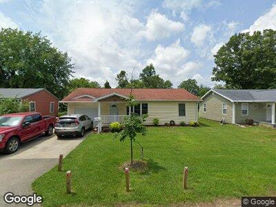
325 N Clark St Bloomington, IN 47408
Green Acres NeighborhoodEstimated Value: $282,000 - $311,000
2
Beds
2
Baths
1,096
Sq Ft
$271/Sq Ft
Est. Value
About This Home
This home is located at 325 N Clark St, Bloomington, IN 47408 and is currently estimated at $297,284, approximately $271 per square foot. 325 N Clark St is a home located in Monroe County with nearby schools including University Elementary School, Tri-North Middle School, and Bloomington High School North.
Ownership History
Date
Name
Owned For
Owner Type
Purchase Details
Closed on
Mar 4, 2005
Sold by
Songstad Virginia H
Bought by
Unger Aaron F
Current Estimated Value
Home Financials for this Owner
Home Financials are based on the most recent Mortgage that was taken out on this home.
Original Mortgage
$61,880
Interest Rate
5.7%
Mortgage Type
New Conventional
Create a Home Valuation Report for This Property
The Home Valuation Report is an in-depth analysis detailing your home's value as well as a comparison with similar homes in the area
Home Values in the Area
Average Home Value in this Area
Purchase History
| Date | Buyer | Sale Price | Title Company |
|---|---|---|---|
| Unger Aaron F | -- | None Available |
Source: Public Records
Mortgage History
| Date | Status | Borrower | Loan Amount |
|---|---|---|---|
| Closed | Unger Aaron F | $1,128,500 | |
| Closed | Unger Aaron F | $109,500 | |
| Closed | Unger Aaron F | $73,000 | |
| Closed | Unger Aaron F | $61,880 |
Source: Public Records
Tax History Compared to Growth
Tax History
| Year | Tax Paid | Tax Assessment Tax Assessment Total Assessment is a certain percentage of the fair market value that is determined by local assessors to be the total taxable value of land and additions on the property. | Land | Improvement |
|---|---|---|---|---|
| 2023 | $5,592 | $263,600 | $99,000 | $164,600 |
| 2022 | $5,008 | $246,800 | $99,000 | $147,800 |
| 2021 | $4,568 | $219,900 | $77,900 | $142,000 |
| 2020 | $4,391 | $212,800 | $73,700 | $139,100 |
| 2019 | $3,640 | $173,100 | $54,800 | $118,300 |
| 2018 | $3,694 | $175,300 | $60,500 | $114,800 |
| 2017 | $3,502 | $165,800 | $55,800 | $110,000 |
| 2016 | $3,302 | $158,900 | $55,800 | $103,100 |
| 2014 | $2,883 | $138,200 | $55,800 | $82,400 |
Source: Public Records
Map
Nearby Homes
- 2210 E 7th St
- 2214 E 7th St
- 4975 E State Road 46 Bypass
- 2627 E Dekist St
- 110 S Overhill Dr
- 312 S Arbutus Dr
- 4205 S Red Pine Dr
- 1924 E 2nd St
- 500 S Arbutus Dr
- 2604 E 2nd Unit C St
- 3230 E John Hinkle Place Unit D4
- 3230 E John Hinkle Place Unit 3
- 2606 E 2nd St Unit E
- 504 S Eastside Dr
- 520 S Eagleson Ave
- 402 S Highland Ave
- 1901 E Maxwell Ln
- 812 S Rose Ave
- 1307 E 2nd St
- 2101 E Woodstock Place
- 325 N Clark St
- 313 N Clark St
- 333 N Clark St
- 311 N Clark St
- 330 N Roosevelt St
- 324 N Roosevelt St
- 320 N Roosevelt St
- 320 N Clark St
- 320 N Roosevelt St
- 310 N Roosevelt St
- 309 N Clark St
- 2400 E 8th St
- 324 N Clark St
- 2304 E 8th St
- 401 N Clark St
- 312 N Roosevelt St
- 310 N Clark St
- 2404 E 8th St
- 400 N Roosevelt St
- 402 N Clark St