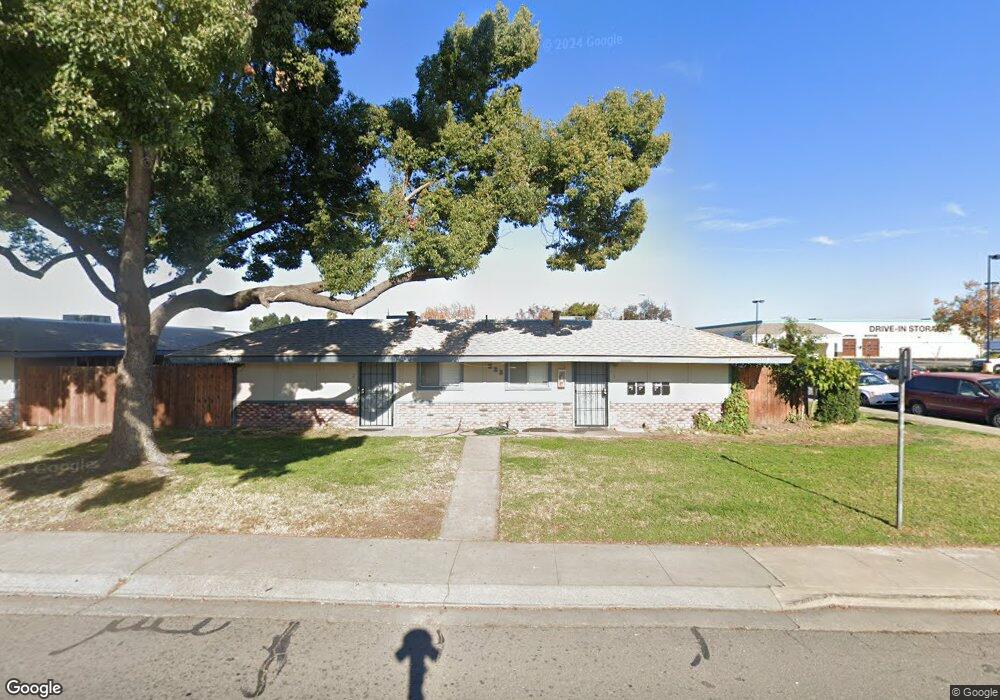
325 Northgate Dr Manteca, CA 95336
Downtown Manteca NeighborhoodEstimated Value: $472,000 - $517,000
Studio
--
Bath
--
Sq Ft
10,890
Sq Ft Lot
About This Home
This home is located at 325 Northgate Dr, Manteca, CA 95336 and is currently estimated at $494,500. 325 Northgate Dr is a home located in San Joaquin County with nearby schools including Neil Hafley Elementary School, East Union High School, and St. Anthony's Catholic School.
Ownership History
Date
Name
Owned For
Owner Type
Purchase Details
Closed on
Feb 9, 2013
Sold by
Lin Stephen and Lin Family Irrevocable Trust
Bought by
Andrew & Annie Lin Family Limited Partne
Current Estimated Value
Purchase Details
Closed on
Dec 13, 2012
Sold by
Lin Andrew E and Lin Annie
Bought by
Lin Stephen and Lin Family Irrevocable Trust
Purchase Details
Closed on
Sep 12, 2002
Sold by
Andrew & Annie Lin Family Ltd Prtnrship
Bought by
Lin Andrew E and Lin Annie
Create a Home Valuation Report for This Property
The Home Valuation Report is an in-depth analysis detailing your home's value as well as a comparison with similar homes in the area
Home Values in the Area
Average Home Value in this Area
Purchase History
| Date | Buyer | Sale Price | Title Company |
|---|---|---|---|
| Andrew & Annie Lin Family Limited Partne | -- | None Available | |
| Lin Stephen | -- | None Available | |
| Lin Andrew E | -- | -- |
Source: Public Records
Tax History
| Year | Tax Paid | Tax Assessment Tax Assessment Total Assessment is a certain percentage of the fair market value that is determined by local assessors to be the total taxable value of land and additions on the property. | Land | Improvement |
|---|---|---|---|---|
| 2025 | $1,524 | $132,704 | $18,557 | $114,147 |
| 2024 | $1,482 | $130,103 | $18,194 | $111,909 |
| 2023 | $1,464 | $127,553 | $17,838 | $109,715 |
| 2022 | $1,442 | $125,053 | $17,489 | $107,564 |
| 2021 | $1,427 | $122,602 | $17,147 | $105,455 |
| 2020 | $1,371 | $121,346 | $16,972 | $104,374 |
| 2019 | $1,354 | $118,968 | $16,640 | $102,328 |
| 2018 | $1,336 | $116,636 | $16,314 | $100,322 |
| 2017 | $1,317 | $114,350 | $15,995 | $98,355 |
| 2016 | $1,285 | $112,107 | $15,681 | $96,426 |
| 2014 | $1,191 | $108,260 | $15,142 | $93,118 |
Source: Public Records
Map
Nearby Homes
- 403 Curtwood Ct
- 1701 Maywood Ave
- 1479 Santini Ave
- 133 Joseph Rd
- 1648 Olivewood Ave
- 365 Diane Ct
- 1859 Elmwood Ln
- 1449 Dorona Ln
- 1414 Pajaro Ave Unit 41
- 1415 Crimson Ln
- 1350 Laurel Dr
- 1496 Crimson Ln
- 2016 Westboro Ln
- 1275 Sweetbrier Place
- 6288 E Lathrop Rd
- 1460 Ridgecrest Dr
- 484 Pinehurst St
- 819 Brandywine St
- 396 Lancaster Dr
- 598 Southland Rd
- 355 Northgate Dr
- 375 Northgate Dr
- 405 Northgate Dr
- 414 Grantwood Ct
- 400 Grantwood Ct
- 415 Northgate Dr
- 415 Grantwood Ct
- 424 Grantwood Ct
- 425 Northgate Dr
- 414 Allenwood Ct
- 425 Grantwood Ct
- 390 Laurelwood Cir Unit CI
- 390 Laurelwood Cir
- 382 Laurelwood Cir
- 378 Laurelwood Cir
- 400 Allenwood Ct
- 390 Northgate Dr
- 374 Laurelwood Cir
- 366 Laurelwood Cir
- 362 Laurelwood Cir
Your Personal Tour Guide
Ask me questions while you tour the home.