Estimated Value: $363,000 - $416,000
2
Beds
2
Baths
1,846
Sq Ft
$213/Sq Ft
Est. Value
About This Home
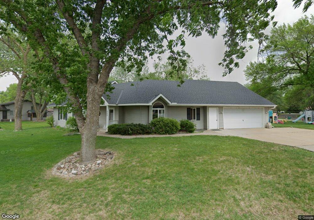
This home is located at 325 Ridge Rd, Mayer, MN 55360 and is currently estimated at $392,752, approximately $212 per square foot. 325 Ridge Rd is a home located in Carver County with nearby schools including Watertown-Mayer Elementary School, Watertown-Mayer Middle School, and Watertown Mayer High School.
Ownership History
Date
Name
Owned For
Owner Type
Purchase Details
Closed on
Jul 16, 2014
Sold by
Hahn Blake E and Hahn Jill A
Bought by
Hahn Properties Llc
Current Estimated Value
Purchase Details
Closed on
May 8, 2014
Sold by
Hahn Blake E and Hahn Stephen M
Bought by
Hahn Blake E and Hahn Jill A
Home Financials for this Owner
Home Financials are based on the most recent Mortgage that was taken out on this home.
Original Mortgage
$154,400
Interest Rate
4.34%
Mortgage Type
Future Advance Clause Open End Mortgage
Create a Home Valuation Report for This Property
The Home Valuation Report is an in-depth analysis detailing your home's value as well as a comparison with similar homes in the area
Home Values in the Area
Average Home Value in this Area
Purchase History
| Date | Buyer | Sale Price | Title Company |
|---|---|---|---|
| Hahn Properties Llc | -- | None Available | |
| Hahn Blake E | $193,400 | None Available |
Source: Public Records
Mortgage History
| Date | Status | Borrower | Loan Amount |
|---|---|---|---|
| Closed | Hahn Blake E | $154,400 |
Source: Public Records
Tax History
| Year | Tax Paid | Tax Assessment Tax Assessment Total Assessment is a certain percentage of the fair market value that is determined by local assessors to be the total taxable value of land and additions on the property. | Land | Improvement |
|---|---|---|---|---|
| 2025 | $4,352 | $396,300 | $55,000 | $341,300 |
| 2024 | $4,314 | $393,300 | $52,000 | $341,300 |
| 2023 | $4,406 | $387,200 | $52,000 | $335,200 |
| 2022 | $4,136 | $375,000 | $52,000 | $323,000 |
| 2021 | $4,150 | $294,700 | $43,400 | $251,300 |
| 2020 | $4,230 | $294,700 | $43,400 | $251,300 |
| 2019 | $3,970 | $280,800 | $41,300 | $239,500 |
| 2018 | $3,954 | $280,800 | $41,300 | $239,500 |
| 2017 | $4,758 | $264,300 | $41,300 | $223,000 |
| 2016 | $4,866 | $226,200 | $0 | $0 |
| 2015 | $3,930 | $204,700 | $0 | $0 |
| 2014 | $3,930 | $178,600 | $0 | $0 |
Source: Public Records
Map
Nearby Homes
- 337 2nd St NW
- 190 Morning Dr
- 2083 River Bend Trail
- 2091 River Bend Trail
- 2095 River Bend Trail
- XXX 62nd St
- 2102 River Bend Trail
- 2103 River Bend Trail
- 2107 River Bend Trail
- 2119 River Bend Trail
- 1518 Hidden Trail
- 2127 River Bend Trail
- 2200 Timber Dr
- 2146 River Bend Trail
- 1379 Birch Dr
- 5875 Highway 25
- 7250 Rutz Lake Rd
- 127XX 58th St
- 14680 County Road 32
- 5225 Upland Ave
Your Personal Tour Guide
Ask me questions while you tour the home.