325 Upper Rd Deerfield, MA 01342
Estimated Value: $340,000 - $448,000
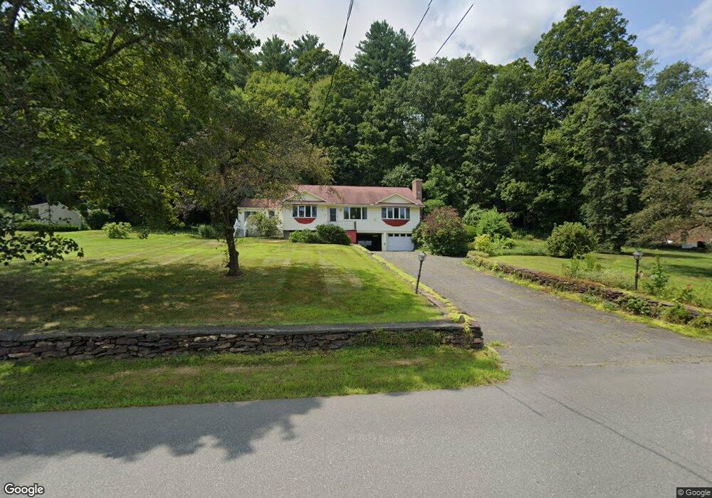
About This Home
This home is located at 325 Upper Rd, Deerfield, MA 01342 and is currently estimated at $401,490, approximately $251 per square foot. 325 Upper Rd is a home located in Franklin County with nearby schools including Deerfield Elementary School, Frontier Regional School, and Four Rivers Charter Public School.
Ownership History
We collect this data history from publicly available records. To have your information removed, we recommend requesting removal directly through your county’s website.
Purchase Details
Purchase Details
Home Financials for this Owner
Home Financials are based on the most recent Mortgage that was taken out on this home.Purchase Details
Home Financials for this Owner
Home Financials are based on the most recent Mortgage that was taken out on this home.Purchase Details
Home Financials for this Owner
Home Financials are based on the most recent Mortgage that was taken out on this home.Home Values in the Area
Average Home Value in this Area
Purchase History
We collect this data history from publicly available records. To have your information removed, we recommend requesting removal directly through your county’s website.
| Date | Buyer | Sale Price | Title Company |
|---|---|---|---|
| $270,000 | -- | ||
| -- | -- | ||
| -- | -- | ||
| $132,500 | -- |
Mortgage History
We collect this data history from publicly available records. To have your information removed, we recommend requesting removal directly through your county’s website.
| Date | Status | Borrower | Loan Amount |
|---|---|---|---|
| Previous Owner | $94,720 | ||
| Previous Owner | $10,000 | ||
| Previous Owner | $100,000 |
Tax History
We collect this data history from publicly available records. To have your information removed, we recommend requesting removal directly through your county’s website.
| Year | Tax Paid | Tax Assessment Tax Assessment Total Assessment is a certain percentage of the fair market value that is determined by local assessors to be the total taxable value of land and additions on the property. | Land | Improvement |
|---|---|---|---|---|
| 2025 | $4,820 | $363,800 | $135,300 | $228,500 |
| 2024 | $4,550 | $328,500 | $123,000 | $205,500 |
| 2023 | $4,178 | $279,100 | $96,700 | $182,400 |
| 2022 | $4,061 | $267,700 | $96,700 | $171,000 |
| 2021 | $4,031 | $254,300 | $96,700 | $157,600 |
| 2020 | $4,299 | $274,000 | $96,700 | $177,300 |
| 2019 | $4,149 | $260,800 | $96,700 | $164,100 |
| 2018 | $3,967 | $248,700 | $92,700 | $156,000 |
| 2017 | $3,842 | $249,500 | $92,700 | $156,800 |
| 2016 | $3,758 | $246,400 | $88,700 | $157,700 |
| 2015 | $3,669 | $245,600 | $88,700 | $156,900 |
Map
- 240 Upper Rd
- 271 Lower Rd
- 167 S Shelburne Rd
- 76 Laurel St Unit A
- 68 Laurel St Unit B
- TBD Lower Rd
- 23 Robbins Rd
- 13 River St
- 2 Water St
- 22 Conway Dr
- 97 Shelburne Rd
- 30 Mohawk Trail
- 427-429 Deerfield St
- 77 Washington St
- 0 Marshall St
- 11 Conway St
- 21 Prospect Ave
- 59-61 Conway St
- 24 Phillips St
- 77 Conway St
Ask me questions while you tour the home.