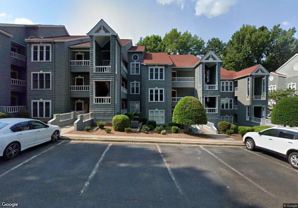
326 Northwest Dr Unit 26 Davidson, NC 28036
Estimated Value: $402,203 - $453,000
2
Beds
2
Baths
900
Sq Ft
$476/Sq Ft
Est. Value
About This Home
This home is located at 326 Northwest Dr Unit 26, Davidson, NC 28036 and is currently estimated at $428,301, approximately $475 per square foot. 326 Northwest Dr Unit 26 is a home located in Mecklenburg County with nearby schools including Davidson Elementary School, William Amos Hough High School, and Davidson Day School.
Ownership History
Date
Name
Owned For
Owner Type
Purchase Details
Closed on
Aug 5, 2016
Sold by
Osteen Ralph S and Osteen Barbara C
Bought by
Lld Holdings Llc
Current Estimated Value
Purchase Details
Closed on
Jan 31, 2003
Sold by
Sheggrud Larry Keith and Sheggrud Betty R
Bought by
Osteen Ralph S and Osteen Barbara C
Home Financials for this Owner
Home Financials are based on the most recent Mortgage that was taken out on this home.
Original Mortgage
$88,000
Interest Rate
5.98%
Mortgage Type
Purchase Money Mortgage
Create a Home Valuation Report for This Property
The Home Valuation Report is an in-depth analysis detailing your home's value as well as a comparison with similar homes in the area
Home Values in the Area
Average Home Value in this Area
Purchase History
| Date | Buyer | Sale Price | Title Company |
|---|---|---|---|
| Lld Holdings Llc | $183,000 | None Available | |
| Osteen Ralph S | $116,000 | -- |
Source: Public Records
Mortgage History
| Date | Status | Borrower | Loan Amount |
|---|---|---|---|
| Previous Owner | Osteen Ralph S | $88,000 |
Source: Public Records
Tax History Compared to Growth
Tax History
| Year | Tax Paid | Tax Assessment Tax Assessment Total Assessment is a certain percentage of the fair market value that is determined by local assessors to be the total taxable value of land and additions on the property. | Land | Improvement |
|---|---|---|---|---|
| 2025 | $2,731 | $357,934 | -- | $357,934 |
| 2024 | $2,731 | $357,934 | -- | $357,934 |
| 2023 | $2,690 | $357,934 | $0 | $357,934 |
| 2022 | $1,784 | $196,700 | $0 | $196,700 |
| 2021 | $1,784 | $196,700 | $0 | $196,700 |
| 2020 | $1,784 | $196,700 | $0 | $196,700 |
| 2019 | $1,877 | $196,700 | $0 | $196,700 |
| 2018 | $2,301 | $188,700 | $91,000 | $97,700 |
| 2017 | $2,284 | $188,700 | $91,000 | $97,700 |
| 2016 | $2,280 | $188,700 | $91,000 | $97,700 |
| 2015 | $2,277 | $188,700 | $91,000 | $97,700 |
| 2014 | $2,275 | $188,700 | $91,000 | $97,700 |
Source: Public Records
Map
Nearby Homes
- 368 Northwest Dr
- 657 Portside Dr
- 719 Southwest Dr Unit 19
- 725 Southwest Dr Unit 25
- 765 Southwest Dr Unit 15
- 854 Southwest Dr Unit 54
- 706 Northeast Dr
- 714 Northeast Dr Unit 53
- 1018 Southwest Dr Unit 18
- 941 Southwest Dr Unit 41
- 1125 Torrence Cir Unit 67
- 930 Jetton St
- 950 Jetton St Unit 3
- 907 Southwest Dr Unit 7
- 1238 Torrence Cir
- 1331 Torrence Cir Unit 1331
- 21528 Norman Shores Dr
- 795 Peninsula Dr
- 522 Jetton St Unit 49
- 21216 Norman Shores Dr
- 326 Northwest Dr Unit 326
- 327 Northwest Dr
- 325 Northwest Dr Unit 25
- 324 Northwest Dr
- 323 Northwest Dr
- 328 Northwest Dr
- 330 Northwest Dr Unit 30
- 332 Northwest Dr
- 331 Northwest Dr Unit 31
- 322 Northwest Dr Unit 22
- 321 Northwest Dr Unit 21
- 333 Northwest Dr Unit 33
- 334 Northwest Dr Unit 34
- 320 Northwest Dr Unit 320
- 320 Northwest Dr
- 320 Northwest Dr Unit 20
- 335 Northwest Dr
- 319 Northwest Dr Unit 19
- 316 Northwest Dr
- 317 Northwest Dr Unit 17