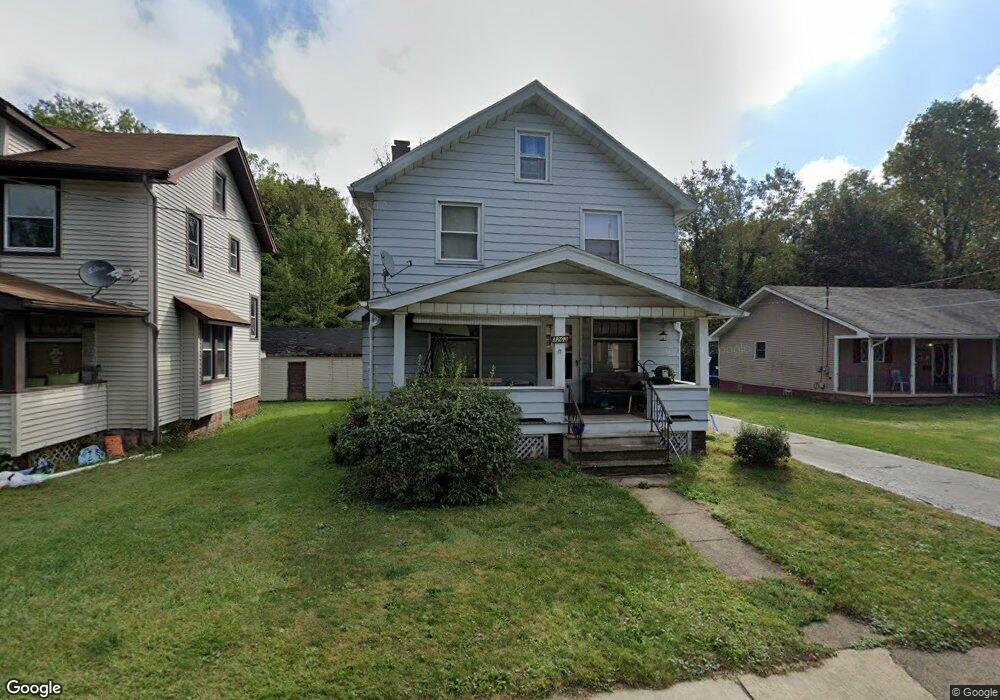
3263 Sheridan Rd Youngstown, OH 44502
Buckeye Plat NeighborhoodEstimated Value: $42,947 - $88,000
3
Beds
2
Baths
1,325
Sq Ft
$54/Sq Ft
Est. Value
About This Home
This home is located at 3263 Sheridan Rd, Youngstown, OH 44502 and is currently estimated at $71,737, approximately $54 per square foot. 3263 Sheridan Rd is a home located in Mahoning County with nearby schools including Paul C. Bunn Elementary School, Chaney High School, and Youngstown Academy of Excellence.
Ownership History
Date
Name
Owned For
Owner Type
Purchase Details
Closed on
Mar 29, 2022
Bought by
Rivers Johnny W
Current Estimated Value
Purchase Details
Closed on
Mar 10, 2022
Sold by
Korda Frank
Bought by
Rivers Johnny W and Rivers Sarah A
Purchase Details
Closed on
Sep 1, 2010
Sold by
Kralj Barbara Ann and Kralj Adolf
Bought by
Korda Frank
Purchase Details
Closed on
Nov 2, 1978
Bought by
Bobovecz Louis J
Create a Home Valuation Report for This Property
The Home Valuation Report is an in-depth analysis detailing your home's value as well as a comparison with similar homes in the area
Home Values in the Area
Average Home Value in this Area
Purchase History
| Date | Buyer | Sale Price | Title Company |
|---|---|---|---|
| Rivers Johnny W | $17,500 | -- | |
| Rivers Johnny W | $17,500 | None Listed On Document | |
| Rivers Johnny W | $17,500 | None Listed On Document | |
| Korda Frank | $33,000 | Attorney | |
| Bobovecz Louis J | -- | -- |
Source: Public Records
Tax History Compared to Growth
Tax History
| Year | Tax Paid | Tax Assessment Tax Assessment Total Assessment is a certain percentage of the fair market value that is determined by local assessors to be the total taxable value of land and additions on the property. | Land | Improvement |
|---|---|---|---|---|
| 2024 | $270 | $5,610 | $1,280 | $4,330 |
| 2023 | $268 | $5,610 | $1,280 | $4,330 |
| 2022 | $528 | $8,570 | $1,280 | $7,290 |
| 2021 | $528 | $8,570 | $1,280 | $7,290 |
| 2020 | $531 | $8,570 | $1,280 | $7,290 |
| 2019 | $541 | $7,800 | $1,170 | $6,630 |
| 2018 | $631 | $7,800 | $1,170 | $6,630 |
| 2017 | $543 | $7,800 | $1,170 | $6,630 |
| 2016 | $670 | $10,320 | $1,170 | $9,150 |
| 2015 | $688 | $10,320 | $1,170 | $9,150 |
| 2014 | $651 | $10,320 | $1,170 | $9,150 |
| 2013 | $642 | $10,320 | $1,170 | $9,150 |
Source: Public Records
Map
Nearby Homes
- 3222 Sheridan Rd
- 3337 Powers Way
- 3448 Neilson Ave
- 3509 Lenox Ave
- 2016 Pointview Ave
- 1313 Humbolt Ave
- 3551 Shirley Rd
- 2007 E Midlothian Blvd
- 0 Tampa Ave Unit 4420178
- 1954 Everett Ave
- 939 E Florida Ave
- 0 Weston Ave
- 0 Crescent Dr Unit 5124984
- 1928 Medford Ave
- 2510 E Midlothian Blvd
- 2562 Mount Vernon Ave
- 941 E Dewey Ave
- 919 E Dewey Ave
- 1653 Brownlee Ave
- 2001 Brownlee Ave
- 3259 Sheridan Rd
- 3267 Sheridan Rd
- 3301 Sheridan Rd
- 3256 Sheridan Rd
- 3307 Sheridan Rd
- 3262 Sheridan Rd
- 3268 Sheridan Rd
- 3274 Sheridan Rd
- 3311 Sheridan Rd
- 3322 Neilson Ave
- 3239 Sheridan Rd
- 3318 Neilson Ave
- 3306 Sheridan Rd
- 3319 Sheridan Rd
- 3242 Sheridan Rd
- 3340 Neilson Ave
- 3323 Sheridan Rd
- 3325 Neilson Ave
- 3310 Sheridan Rd
- 3333 Neilson Ave