Estimated Value: $168,651 - $490,000
3
Beds
--
Bath
1,232
Sq Ft
$325/Sq Ft
Est. Value
About This Home
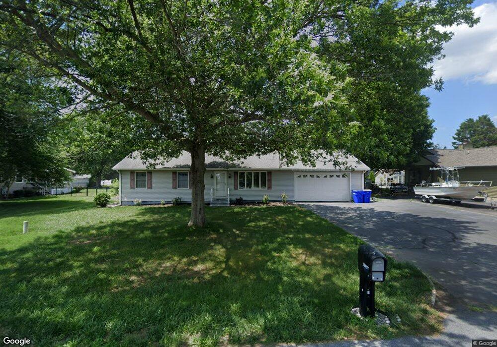
This home is located at 32657 Minnesota St, Lewes, DE 19958 and is currently estimated at $400,663, approximately $325 per square foot. 32657 Minnesota St is a home with nearby schools including Lewes Elementary School, Mariner Middle School, and Cape Henlopen High School.
Ownership History
Date
Name
Owned For
Owner Type
Purchase Details
Closed on
Mar 6, 2017
Sold by
Bensing Betty L and Bensing Robert M
Bought by
Bensing Travis Benjamin and Bensing Wesley Matthew
Current Estimated Value
Home Financials for this Owner
Home Financials are based on the most recent Mortgage that was taken out on this home.
Original Mortgage
$80,000
Outstanding Balance
$66,377
Interest Rate
4.19%
Mortgage Type
New Conventional
Estimated Equity
$334,286
Purchase Details
Closed on
Jun 9, 1986
Bought by
Bensing Robert M Sr Betty L Bensing
Create a Home Valuation Report for This Property
The Home Valuation Report is an in-depth analysis detailing your home's value as well as a comparison with similar homes in the area
Home Values in the Area
Average Home Value in this Area
Purchase History
| Date | Buyer | Sale Price | Title Company |
|---|---|---|---|
| Bensing Travis Benjamin | $100,000 | None Available | |
| Bensing Robert M Sr Betty L Bensing | $15,000 | -- |
Source: Public Records
Mortgage History
| Date | Status | Borrower | Loan Amount |
|---|---|---|---|
| Open | Bensing Travis Benjamin | $80,000 |
Source: Public Records
Tax History Compared to Growth
Tax History
| Year | Tax Paid | Tax Assessment Tax Assessment Total Assessment is a certain percentage of the fair market value that is determined by local assessors to be the total taxable value of land and additions on the property. | Land | Improvement |
|---|---|---|---|---|
| 2025 | $1,018 | $15,050 | $2,050 | $13,000 |
| 2024 | $742 | $15,050 | $2,050 | $13,000 |
| 2023 | $741 | $15,050 | $2,050 | $13,000 |
| 2022 | $715 | $15,050 | $2,050 | $13,000 |
| 2021 | $709 | $15,050 | $2,050 | $13,000 |
| 2020 | $707 | $15,050 | $2,050 | $13,000 |
| 2019 | $708 | $15,050 | $2,050 | $13,000 |
| 2018 | $661 | $15,050 | $0 | $0 |
| 2017 | $633 | $15,050 | $0 | $0 |
| 2016 | $601 | $15,050 | $0 | $0 |
| 2015 | $574 | $15,050 | $0 | $0 |
| 2014 | $570 | $15,050 | $0 | $0 |
Source: Public Records
Map
Nearby Homes
- 18047 Sawhill Dr
- 18045 Sawhill Dr
- 18037 Sawhill Dr
- 31198 Wiltbank Ave
- 31208 Wiltbank Ave
- 31199 Wiltbank Ave
- 31216 Wiltbank Ave
- 31207 Wiltbank Ave
- 16516 New Rd
- 31224 Wiltbank Ave
- 31215 Wiltbank Ave
- 22076 Kintersburg Dr
- 31223 Wiltbank
- 31232 Wiltbank Ave
- 32911 Nassau Loop
- 31240 Wiltbank Ave
- 31231 Wiltbank Ave
- 31239 Wiltbank
- 17318 King Phillip Way Unit 40
- 31248 Wiltbank Ave
- 32665 Minnesota St
- 32647 Minnesota St
- 32646 Minnesota St
- 32635 Minnesota St
- 32679 Minnesota St
- 32612 Sand Dune Dr
- 16958 Idaho Ct
- 16958 Idaho Ct
- 32602 Sand Dune Dr
- 32622 Sand Dune Dr
- 32590 Sand Dune Dr
- 32632 Sand Dune Dr
- 32628 Minnesota St
- 17015 Colorado Ct
- 32687 Minnesota St
- 32690 Minnesota St
- 32582 Sand Dune Dr
- 32619 Minnesota St
- 16974 Idaho Ct
- 17016 Colorado Ct