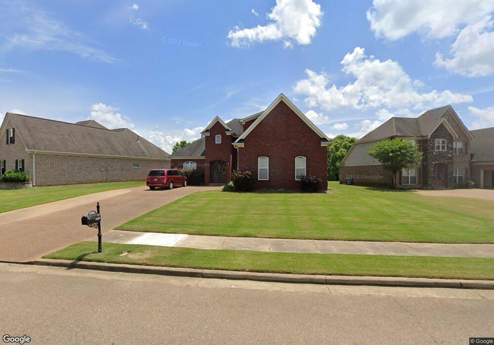
3269 Emery Cir N Nesbit, MS 38651
Pleasant Hill NeighborhoodEstimated Value: $397,000 - $454,000
5
Beds
3
Baths
3,307
Sq Ft
$131/Sq Ft
Est. Value
About This Home
This home is located at 3269 Emery Cir N, Nesbit, MS 38651 and is currently estimated at $433,813, approximately $131 per square foot. 3269 Emery Cir N is a home located in DeSoto County with nearby schools including DeSoto Central Primary School, DeSoto Central Elementary School, and DeSoto Central Middle School.
Ownership History
Date
Name
Owned For
Owner Type
Purchase Details
Closed on
Jun 18, 2008
Sold by
Residential Building Assistance Llc
Bought by
Gelineau Richard W and Gelineau Rhonda M
Current Estimated Value
Home Financials for this Owner
Home Financials are based on the most recent Mortgage that was taken out on this home.
Original Mortgage
$174,000
Interest Rate
6.04%
Mortgage Type
Purchase Money Mortgage
Purchase Details
Closed on
Feb 29, 2008
Sold by
Hhh Homes Llc
Bought by
Residential Building Assistance Llc
Home Financials for this Owner
Home Financials are based on the most recent Mortgage that was taken out on this home.
Original Mortgage
$57,690
Interest Rate
5.46%
Mortgage Type
Purchase Money Mortgage
Create a Home Valuation Report for This Property
The Home Valuation Report is an in-depth analysis detailing your home's value as well as a comparison with similar homes in the area
Home Values in the Area
Average Home Value in this Area
Purchase History
| Date | Buyer | Sale Price | Title Company |
|---|---|---|---|
| Gelineau Richard W | -- | Realty Title & Escrow Co Inc | |
| Residential Building Assistance Llc | -- | Southern Trust Title Company |
Source: Public Records
Mortgage History
| Date | Status | Borrower | Loan Amount |
|---|---|---|---|
| Previous Owner | Gelineau Richard W | $174,000 | |
| Previous Owner | Residential Building Assistance Llc | $57,690 |
Source: Public Records
Tax History
| Year | Tax Paid | Tax Assessment Tax Assessment Total Assessment is a certain percentage of the fair market value that is determined by local assessors to be the total taxable value of land and additions on the property. | Land | Improvement |
|---|---|---|---|---|
| 2025 | $1,135 | $21,262 | $3,200 | $18,062 |
| 2024 | $1,376 | $21,262 | $3,200 | $18,062 |
| 2023 | $1,376 | $21,262 | $0 | $0 |
| 2022 | $1,826 | $21,262 | $3,200 | $18,062 |
| 2021 | $1,826 | $21,262 | $3,200 | $18,062 |
| 2020 | $1,688 | $19,883 | $3,200 | $16,683 |
| 2019 | $1,688 | $19,883 | $3,200 | $16,683 |
| 2017 | $1,798 | $38,468 | $20,834 | $17,634 |
| 2016 | $1,798 | $20,834 | $3,200 | $17,634 |
| 2015 | $2,098 | $38,468 | $20,834 | $17,634 |
| 2014 | $1,798 | $20,834 | $0 | $0 |
| 2013 | $1,798 | $20,834 | $0 | $0 |
Source: Public Records
Map
Nearby Homes
- 3456 Susie Cir
- 4055 Bakersfield Dr
- 1721 Baisley Dr
- 1811 Baisley Dr
- 1835 Baisley Dr
- Lot 99 Baisley Dr
- 1722 Baisley Dr
- Lot 107 Brooke Dr
- 4232 Brooke Dr
- 4209 Edison Dr
- 4020 Maryan Ct
- 4276 Brooke Dr
- 3770 Malone Rd
- 3771 Malone Rd
- 1755 Bakersfield Way
- 1735 Bakersfield Way
- 401 Getwell Rd
- 403 Getwell Rd
- 3491 Hatton Dr
- 1762 Bakersfield Way
Your Personal Tour Guide
Ask me questions while you tour the home.