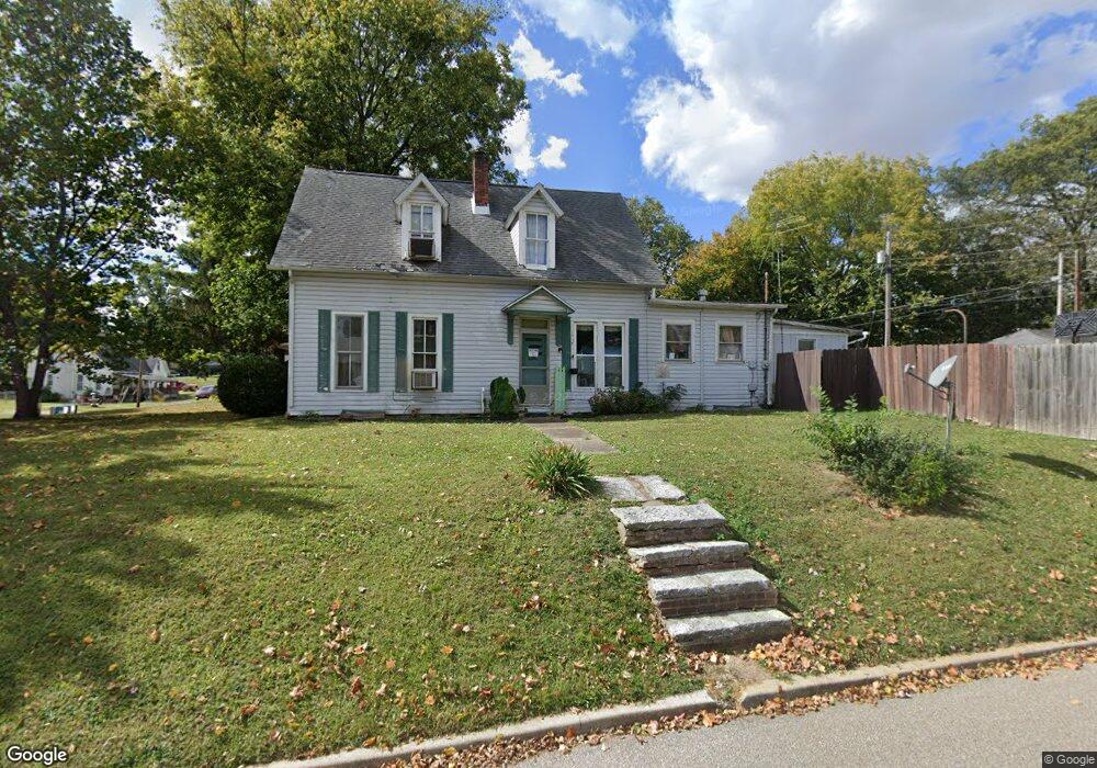
327 E 9th St Mount Vernon, IN 47620
Estimated Value: $151,475 - $192,000
3
Beds
2
Baths
2,237
Sq Ft
$78/Sq Ft
Est. Value
About This Home
This home is located at 327 E 9th St, Mount Vernon, IN 47620 and is currently estimated at $174,119, approximately $77 per square foot. 327 E 9th St is a home located in Posey County with nearby schools including Mount Vernon Junior High School, Mount Vernon High School, and St. Matthew Elementary School.
Ownership History
Date
Name
Owned For
Owner Type
Purchase Details
Closed on
Oct 4, 2019
Sold by
Barnett Brandon W and Barnett Carmen C
Bought by
Johnson Jeffrey C and Johnson Holly
Current Estimated Value
Purchase Details
Closed on
Aug 3, 2007
Sold by
Us Bank Na
Bought by
Johnson Jeffrey C and Johnson Holly
Purchase Details
Closed on
Mar 12, 2007
Sold by
Jarvis Ray I and Jarvis Teresa K
Bought by
U S Bank Na
Create a Home Valuation Report for This Property
The Home Valuation Report is an in-depth analysis detailing your home's value as well as a comparison with similar homes in the area
Home Values in the Area
Average Home Value in this Area
Purchase History
| Date | Buyer | Sale Price | Title Company |
|---|---|---|---|
| Johnson Jeffrey C | -- | None Available | |
| Johnson Jeffrey C | $16,500 | Resource Title Agency Inc | |
| U S Bank Na | $33,595 | Resource Title Agency Inc |
Source: Public Records
Tax History Compared to Growth
Tax History
| Year | Tax Paid | Tax Assessment Tax Assessment Total Assessment is a certain percentage of the fair market value that is determined by local assessors to be the total taxable value of land and additions on the property. | Land | Improvement |
|---|---|---|---|---|
| 2024 | $1,254 | $98,900 | $10,800 | $88,100 |
| 2023 | $302 | $81,100 | $10,800 | $70,300 |
| 2022 | $204 | $76,200 | $10,800 | $65,400 |
| 2021 | $56 | $68,800 | $10,800 | $58,000 |
| 2020 | $0 | $66,000 | $10,500 | $55,500 |
| 2019 | $480 | $63,900 | $10,500 | $53,400 |
| 2018 | $480 | $62,000 | $10,500 | $51,500 |
| 2017 | $447 | $61,400 | $10,500 | $50,900 |
| 2016 | $1,241 | $61,700 | $10,500 | $51,200 |
| 2014 | $469 | $58,200 | $10,500 | $47,700 |
| 2013 | $469 | $61,900 | $13,900 | $48,000 |
Source: Public Records
Map
Nearby Homes
- 321 E 9th St Unit E
- 902 Locust St
- 328 E 10th St
- 324 E 10th St
- 912 Locust St
- 910 Mulberry St
- 320 E 10th St
- 912 Mulberry St
- 829 Locust St
- 315 E 9th St Unit E
- 918 Mulberry St
- 920 Locust St
- 830 Locust St
- 900 Mulberry St
- 830 Mulberry St
- 926 Mulberry St
- 419 E 9th St
- 826 Locust St
- 924 Mulberry St
- 930 Mulberry St