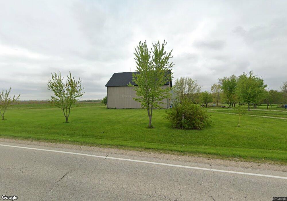
3279 Us Highway 52 Minooka, IL 60447
North Minooka NeighborhoodEstimated Value: $442,000 - $586,000
--
Bed
1
Bath
1,368
Sq Ft
$372/Sq Ft
Est. Value
About This Home
This home is located at 3279 Us Highway 52, Minooka, IL 60447 and is currently estimated at $509,289, approximately $372 per square foot. 3279 Us Highway 52 is a home located in Kendall County with nearby schools including Jones Elementary School, Minooka Junior High School, and Minooka Intermediate School.
Ownership History
Date
Name
Owned For
Owner Type
Purchase Details
Closed on
Apr 18, 2023
Sold by
Corona Jose
Bought by
Corona Jose
Current Estimated Value
Purchase Details
Closed on
Mar 3, 2021
Sold by
Corona Jose and Corona Martin
Bought by
Corona Jose
Purchase Details
Closed on
Mar 13, 2017
Sold by
Corona Jose
Bought by
Corona Jose and Corona Martin
Purchase Details
Closed on
Oct 4, 2006
Sold by
Rhodes John R
Bought by
Corona Jose and Corona Ruben
Purchase Details
Closed on
Mar 20, 2000
Sold by
Vuinovich Sharon L
Bought by
Ingenuity Llc
Create a Home Valuation Report for This Property
The Home Valuation Report is an in-depth analysis detailing your home's value as well as a comparison with similar homes in the area
Home Values in the Area
Average Home Value in this Area
Purchase History
| Date | Buyer | Sale Price | Title Company |
|---|---|---|---|
| Corona Jose | -- | None Listed On Document | |
| Corona Jose | -- | Attorney | |
| Corona Jose | -- | None Listed On Document | |
| Corona Jose | $412,000 | Chicago Title Insurance Co | |
| Ingenuity Llc | -- | -- | |
| Interlude Llc | -- | -- |
Source: Public Records
Tax History Compared to Growth
Tax History
| Year | Tax Paid | Tax Assessment Tax Assessment Total Assessment is a certain percentage of the fair market value that is determined by local assessors to be the total taxable value of land and additions on the property. | Land | Improvement |
|---|---|---|---|---|
| 2024 | $9,510 | $138,053 | $41,497 | $96,556 |
| 2023 | $8,856 | $129,129 | $37,170 | $91,959 |
| 2022 | $8,856 | $119,145 | $33,477 | $85,668 |
| 2021 | $8,727 | $114,518 | $33,987 | $80,531 |
| 2020 | $8,392 | $107,722 | $31,970 | $75,752 |
| 2019 | $8,217 | $103,063 | $30,587 | $72,476 |
| 2018 | $7,970 | $99,369 | $30,587 | $68,782 |
| 2017 | $7,910 | $95,171 | $30,587 | $64,584 |
| 2016 | $7,482 | $89,348 | $30,209 | $59,139 |
| 2015 | $7,543 | $89,348 | $30,209 | $59,139 |
| 2014 | -- | $60,990 | $7,788 | $53,202 |
| 2013 | -- | $60,940 | $7,738 | $53,202 |
Source: Public Records
Map
Nearby Homes
- 1133 Coneflower Ct
- 2041 Isabella Ln
- 2033 Isabella
- 194 acres W Holt Rd
- Lot 1 Minooka Ridge & Jones Rd
- 8102 Wood River St
- 8010 Wood River St
- 8508 Sawyer Ct
- 409 Rockfish St
- 8513 Sawyer Ct
- 8413 Eva Ave
- 8304 Coop Ave
- 911 Bluebell Cir
- 1045 Heron Cir
- 15771 Brisbin Rd
- 1028 Heron Cir
- 1003 Plaintain Dr
- 7911 Indigo Dr
- 914 Salvia Ln
- 814 Daniel Dr
- 3147 Us Highway 52
- 3045 Us Highway 52
- 3055 Us Highway 52
- 3055 U S 52
- 3035 Us Highway 52
- 3024 Us Highway 52
- 3024 Us Highway 52
- 3478 Us Highway 52
- 3040 Us Highway 52
- 13990 Mckanna Rd
- 14476 Mckanna Rd
- 2735 Us Highway 52
- 2800 W 52 Hwy
- 2795 Us Highway 52
- 2652 Us Highway 52
- 2530 Us Highway 52
- 13975 Mckanna Rd
- 14625 Jughandle Rd
- 14655 Jughandle Rd
- 14725 Jughandle Rd