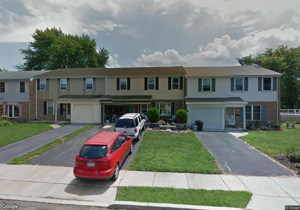
3287 Independence Ct Bensalem, PA 19020
Neshaminy Valley NeighborhoodEstimated Value: $351,000 - $399,000
3
Beds
2
Baths
1,752
Sq Ft
$217/Sq Ft
Est. Value
About This Home
This home is located at 3287 Independence Ct, Bensalem, PA 19020 and is currently estimated at $379,637, approximately $216 per square foot. 3287 Independence Ct is a home located in Bucks County with nearby schools including Valley Elementary School, St. Ephrem School, and Bensalem Baptist School.
Ownership History
Date
Name
Owned For
Owner Type
Purchase Details
Closed on
May 20, 1994
Sold by
Vitelli Raymond and Vitelli Lindalorraine
Bought by
Vitelli Linda L
Current Estimated Value
Home Financials for this Owner
Home Financials are based on the most recent Mortgage that was taken out on this home.
Original Mortgage
$57,000
Interest Rate
7.98%
Purchase Details
Closed on
Aug 13, 1980
Bought by
Vitelli Raymond and Vitelli Lindalorraine
Create a Home Valuation Report for This Property
The Home Valuation Report is an in-depth analysis detailing your home's value as well as a comparison with similar homes in the area
Home Values in the Area
Average Home Value in this Area
Purchase History
| Date | Buyer | Sale Price | Title Company |
|---|---|---|---|
| Vitelli Linda L | -- | -- | |
| Vitelli Raymond | $50,500 | -- |
Source: Public Records
Mortgage History
| Date | Status | Borrower | Loan Amount |
|---|---|---|---|
| Closed | Vitelli Linda L | $57,000 |
Source: Public Records
Tax History Compared to Growth
Tax History
| Year | Tax Paid | Tax Assessment Tax Assessment Total Assessment is a certain percentage of the fair market value that is determined by local assessors to be the total taxable value of land and additions on the property. | Land | Improvement |
|---|---|---|---|---|
| 2025 | $4,191 | $19,200 | $2,560 | $16,640 |
| 2024 | $4,191 | $19,200 | $2,560 | $16,640 |
| 2023 | $4,073 | $19,200 | $2,560 | $16,640 |
| 2022 | $4,049 | $19,200 | $2,560 | $16,640 |
| 2021 | $4,049 | $19,200 | $2,560 | $16,640 |
| 2020 | $4,009 | $19,200 | $2,560 | $16,640 |
| 2019 | $3,919 | $19,200 | $2,560 | $16,640 |
| 2018 | $3,828 | $19,200 | $2,560 | $16,640 |
| 2017 | $3,804 | $19,200 | $2,560 | $16,640 |
| 2016 | $3,804 | $19,200 | $2,560 | $16,640 |
| 2015 | -- | $19,200 | $2,560 | $16,640 |
| 2014 | -- | $19,200 | $2,560 | $16,640 |
Source: Public Records
Map
Nearby Homes
- 6257 Nathan Hale Ct
- 3191 Drexel Rd
- 3162 Sheppard Rd
- 6561 Neshaminy Valley Dr
- 6369 Powder Horn Ct
- 2548 Nashua Rd
- 3021 Claridge Rd
- 3011 Claridge Rd
- 4828 Oxford Ct
- 4912 Oxford Ct Unit 2
- 5178 Neshaminy Blvd
- 4525 Winding Brook Dr Unit 4525
- 4902 Oxford Ct
- 3200 Ellington Ct
- 2493 Barnsleigh Dr
- 223 Saddlebrook Dr
- 225 Saddlebrook Dr
- 3782 Grandview Ave
- 927 Bellevue Ave
- 440 Dehaven Ave
- 3283 Independence Ct
- 3291 Independence Ct
- 3279 Independence Ct
- 3275 Independence Ct
- 3271 Independence Ct
- 3267 Independence Ct
- 3290 Independence Ct
- 3286 Independence Ct
- 3282 Independence Ct
- 3278 Independence Ct
- 3250 Independence Ct
- 3201 Pasqualone Blvd
- 3246 Independence Ct
- 3263 Independence Ct
- 3211 Neshaminy Blvd
- 3211 Pasqualone Blvd
- 3242 Independence Ct
- 3147 Pasqualone Blvd
- 3238 Independence Ct
- 3208 Independence Ct