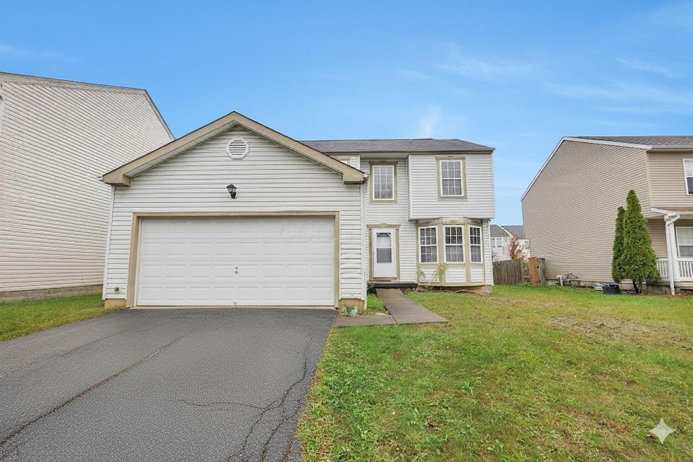
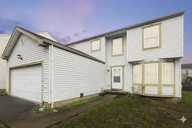
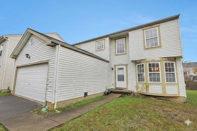
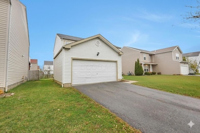
3289 Kady Ln Columbus, OH 43232
East Columbus-White Ash NeighborhoodEstimated payment $1,697/month
Highlights
- Traditional Architecture
- 1 Fireplace
- Fenced Yard
- Loft
- No HOA
- Cul-De-Sac
About This Home
Spacious home with Great Potential!
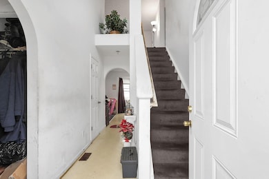
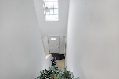
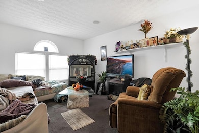
Welcome to this 3-bedroom, 2.5-bath home offering over 1,800 square feet of living space plus a full basement and 2-car garage. Built in 2004, this property features a smart and versatile layout with two spacious living areas, a large dining room, and an upstairs loft—perfect for a home office or playroom.
The fenced-in backyard offers plenty of room for pets, entertaining, or gardening, and the neighborhood backs up to a wooded walking trail for peaceful outdoor enjoyment. The home includes a newer hot water tank and solid bones, making it a great opportunity for investors or owner-occupants looking for a cosmetic project or flip.
Home Details
Home Type
- Single Family
Est. Annual Taxes
- $3,988
Year Built
- Built in 2004
Lot Details
- 6,534 Sq Ft Lot
- Cul-De-Sac
- Fenced Yard
Parking
- 2 Car Attached Garage
Home Design
- Traditional Architecture
- Block Foundation
- Vinyl Siding
Interior Spaces
- 1,840 Sq Ft Home
- 2-Story Property
- 1 Fireplace
- Insulated Windows
- Family Room
- Loft
- Basement Fills Entire Space Under The House
- Laundry on lower level
Kitchen
- Electric Range
- Microwave
- Dishwasher
Flooring
- Carpet
- Laminate
- Vinyl
Bedrooms and Bathrooms
- 3 Bedrooms
Utilities
- Central Air
- Heating System Uses Gas
- Gas Water Heater
Community Details
- No Home Owners Association
Listing and Financial Details
- Assessor Parcel Number 010-264933
Map
Home Values in the Area
Average Home Value in this Area
Tax History
| Year | Tax Paid | Tax Assessment Tax Assessment Total Assessment is a certain percentage of the fair market value that is determined by local assessors to be the total taxable value of land and additions on the property. | Land | Improvement |
|---|---|---|---|---|
| 2024 | $3,988 | $88,870 | $23,870 | $65,000 |
| 2023 | $3,937 | $88,865 | $23,870 | $64,995 |
| 2022 | $2,669 | $51,460 | $5,780 | $45,680 |
| 2021 | $2,674 | $51,460 | $5,780 | $45,680 |
| 2020 | $2,677 | $51,460 | $5,780 | $45,680 |
| 2019 | $2,573 | $42,420 | $4,830 | $37,590 |
| 2018 | $2,178 | $42,420 | $4,830 | $37,590 |
| 2017 | $2,572 | $42,420 | $4,830 | $37,590 |
| 2016 | $1,971 | $29,750 | $7,000 | $22,750 |
| 2015 | $1,789 | $29,750 | $7,000 | $22,750 |
| 2014 | $1,793 | $29,750 | $7,000 | $22,750 |
| 2013 | $885 | $29,750 | $7,000 | $22,750 |
Property History
| Date | Event | Price | List to Sale | Price per Sq Ft |
|---|---|---|---|---|
| 11/11/2025 11/11/25 | For Sale | $259,000 | -- | $141 / Sq Ft |
Purchase History
| Date | Type | Sale Price | Title Company |
|---|---|---|---|
| Warranty Deed | $85,000 | Stewart Ti | |
| Sheriffs Deed | $90,000 | None Available | |
| Warranty Deed | $126,900 | Chicago Tit | |
| Warranty Deed | $1,695,000 | -- |
Mortgage History
| Date | Status | Loan Amount | Loan Type |
|---|---|---|---|
| Previous Owner | $82,845 | FHA | |
| Previous Owner | $120,500 | Purchase Money Mortgage |
Source: Columbus and Central Ohio Regional MLS
MLS Number: 225042678
APN: 010-264933
Disclaimer: Certain information contained herein is derived from information provided by parties other than Homes.com. All information provided is deemed reliable, but is not guaranteed to be accurate and should be independently verified.
![]() IDX information is provided exclusively for personal, non-commercial use, and may not be used for any purpose other than to identify prospective properties consumers may be interested in purchasing.
IDX information is provided exclusively for personal, non-commercial use, and may not be used for any purpose other than to identify prospective properties consumers may be interested in purchasing.
Information is deemed reliable but not guaranteed.
- 3148 Aldgate St
- 3198 Gallant Dr
- 5397 Jack Russell Way
- 3387 Retriever Rd
- St Martin Plan at Chatterton Commons
- 3310 Joshstock Dr
- 3304 Joshstock Dr
- 5882 Abernathy Ln Unit 5882F
- 3298 Joshstock Dr
- 5936 Abernathy Ln
- 5999 Bears Run Rd
- 5938 Abernathy Ln
- 5944 Abernathy Ln
- 5946 Abernathy Ln
- 5960 Abernathy Ln
- 5401 Spire Ln
- 5962 Abernathy Ln
- 5968 Abernathy Ln
- 5970 Abernathy Ln
- 5976 Abernathy Ln
- 5555 Tinley Park
- 3117 Falcon Bridge Dr
- 3174 Gallant Dr
- 5335 Brayton Ave
- 5411 Baynard Dr
- 3044 Kings Realm Ave
- 3461 Huddle Way
- 3053 Kings Realm Ave
- 5969 Hollett Dr S
- 3208 Sundale Rd
- 3302 Sundale Rd
- 5904 Annaberg Dr
- 3675 Cross Ridge Ln
- 6150 Kensington Glen Dr
- 3609 Upperridge Ct
- 5040 Norcrest Dr
- 5020 Chatterton Rd
- 3425 Olde Cape St E
- 6300 Refugee Rd
- 2680 Silver Oak Dr
