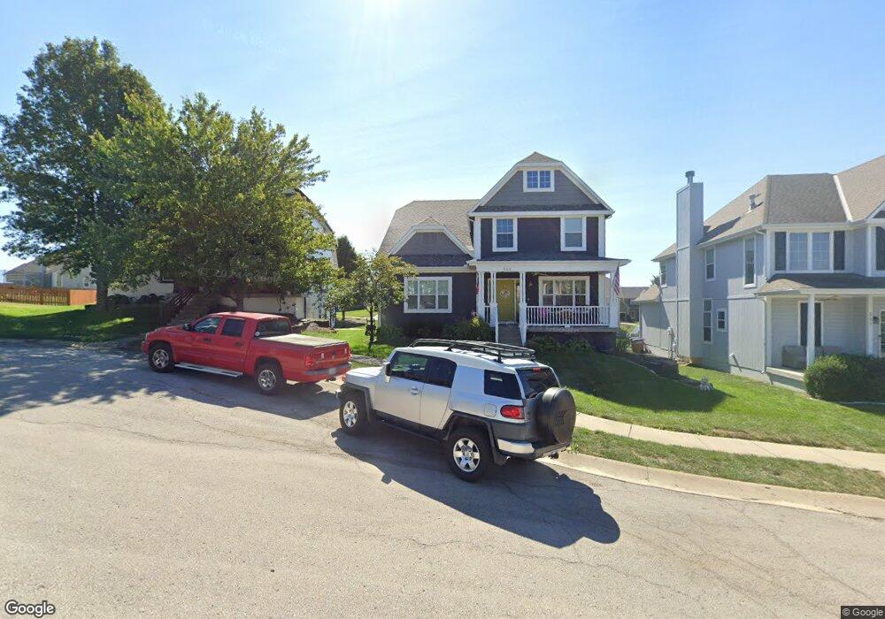
329 S Adams St Raymore, MO 64083
Estimated Value: $428,000 - $480,000
4
Beds
3
Baths
2,936
Sq Ft
$154/Sq Ft
Est. Value
About This Home
This home is located at 329 S Adams St, Raymore, MO 64083 and is currently estimated at $451,035, approximately $153 per square foot. 329 S Adams St is a home located in Cass County with nearby schools including Raymore Elementary School, Raymore-Peculiar East Middle School, and Raymore-Peculiar Senior High School.
Ownership History
Date
Name
Owned For
Owner Type
Purchase Details
Closed on
Jul 5, 2018
Sold by
Clark Nicholas A and Clark Rody
Bought by
Randolph Randy D and Randolph Velvet M
Current Estimated Value
Home Financials for this Owner
Home Financials are based on the most recent Mortgage that was taken out on this home.
Original Mortgage
$304,735
Outstanding Balance
$262,989
Interest Rate
4.5%
Mortgage Type
VA
Estimated Equity
$188,046
Purchase Details
Closed on
May 26, 2015
Sold by
Sweeten John and Sweeten Patricia
Bought by
Clark Nicholas A and Clark Rody
Purchase Details
Closed on
Jul 19, 2006
Sold by
Richard Mather Builders Inc
Bought by
Sweeten John and Sweeten Patricia
Home Financials for this Owner
Home Financials are based on the most recent Mortgage that was taken out on this home.
Original Mortgage
$172,000
Interest Rate
6.6%
Mortgage Type
New Conventional
Create a Home Valuation Report for This Property
The Home Valuation Report is an in-depth analysis detailing your home's value as well as a comparison with similar homes in the area
Home Values in the Area
Average Home Value in this Area
Purchase History
| Date | Buyer | Sale Price | Title Company |
|---|---|---|---|
| Randolph Randy D | -- | Secured Title Of Kansas City | |
| Clark Nicholas A | -- | None Available | |
| Sweeten John | -- | -- |
Source: Public Records
Mortgage History
| Date | Status | Borrower | Loan Amount |
|---|---|---|---|
| Open | Randolph Randy D | $304,735 | |
| Previous Owner | Sweeten John | $172,000 |
Source: Public Records
Tax History
| Year | Tax Paid | Tax Assessment Tax Assessment Total Assessment is a certain percentage of the fair market value that is determined by local assessors to be the total taxable value of land and additions on the property. | Land | Improvement |
|---|---|---|---|---|
| 2025 | $4,416 | $62,010 | $5,090 | $56,920 |
| 2024 | $4,416 | $54,260 | $4,630 | $49,630 |
| 2023 | $4,410 | $54,260 | $4,630 | $49,630 |
| 2022 | $3,988 | $48,740 | $4,630 | $44,110 |
| 2021 | $3,988 | $48,740 | $4,630 | $44,110 |
| 2020 | $3,965 | $47,600 | $4,630 | $42,970 |
| 2019 | $3,828 | $47,600 | $4,630 | $42,970 |
| 2018 | $3,072 | $36,890 | $3,850 | $33,040 |
| 2017 | $2,834 | $36,890 | $3,850 | $33,040 |
| 2016 | $2,834 | $35,330 | $3,850 | $31,480 |
| 2015 | $2,836 | $35,330 | $3,850 | $31,480 |
| 2014 | $2,838 | $35,330 | $3,850 | $31,480 |
| 2013 | -- | $35,330 | $3,850 | $31,480 |
Source: Public Records
Map
Nearby Homes
- 804 S Washington St
- 605 S Franklin St
- 512 S Washington St
- 503 S Harrison Ave
- 506 S Adams St
- 507 S Washington St
- 713 S Sunset Ln
- 405 S Monroe St
- 205 W Olive St
- 528 S Saturn Dr
- 211 S Franklin St
- 302 E Olive St
- 901 W Lucy Webb Rd
- 1103 Carlisle Dr
- 204 N Pointe Ln
- 1108 Yokley Dr
- 222 N Madison St
- 108 Rainbow Cir
- 1112 Carlisle Dr
- 219 Pointe Ln
- 329 S Adams Ct
- 331 S Adams St
- 331 S Adams Ct
- 327 S Adams Ct
- 326 Mulberry Dr
- 325 S Adams Ct
- 322 Mulberry Dr
- 332 Mulberry Dr
- 328 Mulberry Dr
- 330 S Adams Ct
- 324 S Adams Ct
- 330 S Adams St
- 332 S Adams St
- 326 S Adams Ct
- 328 S Adams Ct
- 332 S Adams Ct
- 326 S Adams Ct
- 320 Mulberry Dr
- 802 S Adams St
- 808 S Adams St