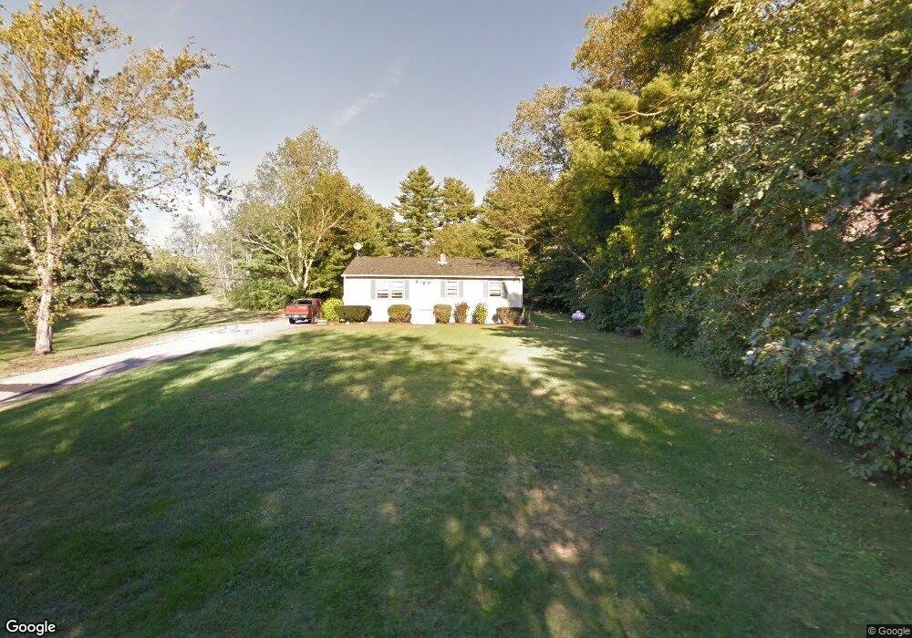
33 Gilbert Rd Allenstown, NH 03275
Estimated Value: $358,000 - $428,000
3
Beds
1
Bath
1,301
Sq Ft
$306/Sq Ft
Est. Value
About This Home
This home is located at 33 Gilbert Rd, Allenstown, NH 03275 and is currently estimated at $398,220, approximately $306 per square foot. 33 Gilbert Rd is a home located in Merrimack County with nearby schools including Allenstown Elementary School, Armand R. Dupont School, and Tender Years Child Care & Learning Center.
Ownership History
Date
Name
Owned For
Owner Type
Purchase Details
Closed on
Mar 29, 1988
Bought by
Gilbert Richard and Gilbert Pamela
Current Estimated Value
Create a Home Valuation Report for This Property
The Home Valuation Report is an in-depth analysis detailing your home's value as well as a comparison with similar homes in the area
Home Values in the Area
Average Home Value in this Area
Purchase History
| Date | Buyer | Sale Price | Title Company |
|---|---|---|---|
| Gilbert Richard | -- | -- |
Source: Public Records
Mortgage History
| Date | Status | Borrower | Loan Amount |
|---|---|---|---|
| Open | Gilbert Richard | $154,990 | |
| Closed | Gilbert Richard | $60,000 |
Source: Public Records
Tax History Compared to Growth
Tax History
| Year | Tax Paid | Tax Assessment Tax Assessment Total Assessment is a certain percentage of the fair market value that is determined by local assessors to be the total taxable value of land and additions on the property. | Land | Improvement |
|---|---|---|---|---|
| 2024 | $8,287 | $326,000 | $140,300 | $185,700 |
| 2023 | $6,911 | $326,000 | $140,300 | $185,700 |
| 2022 | $6,357 | $326,000 | $140,300 | $185,700 |
| 2021 | $6,404 | $203,300 | $84,200 | $119,100 |
| 2020 | $5,957 | $203,300 | $84,200 | $119,100 |
| 2019 | $6,323 | $203,300 | $84,200 | $119,100 |
| 2018 | $6,129 | $203,300 | $84,200 | $119,100 |
| 2017 | $6,528 | $203,300 | $84,200 | $119,100 |
| 2016 | $5,705 | $168,500 | $60,300 | $108,200 |
| 2015 | $5,437 | $165,600 | $60,300 | $105,300 |
| 2014 | $5,594 | $165,600 | $60,300 | $105,300 |
| 2013 | $5,221 | $165,600 | $60,300 | $105,300 |
Source: Public Records
Map
Nearby Homes
- 11 Presidential Dr
- 43 Catamount Hill Dr
- 8 Bush Ave
- 1 Jefferson Ave
- 5 Catamount Hill Dr
- 9 Pine Acres Rd
- 370 River Rd
- 101 4th Range Rd Unit 4
- 0 Poor Town Rd Unit 4
- 307 Dearborn Rd
- 425 Grady Ln Unit 28
- 441 Blane Cir Unit 12
- 452 Blane Cir Unit 45
- 233 Pembroke St
- 9 Princess Ln
- 14 Queens Ln
- 259 Pembroke St
- 1 1/2 Bartlett St
- 111 Glass St
- 19 Sullivan Dr
- 29 Gilbert Rd
- 15 Deerfield Rd
- 2 Verville Rd
- 6 Verville Rd
- 23 Gilbert Rd
- 3 Verville Rd
- 26 Gilbert Rd Unit 28
- 1 Verville Rd
- 19 Gilbert Rd
- 1 Gilbert Rd
- 16 Gilbert Rd
- 9 Brookside Terrace
- 7 Brookside Terrace
- 15 Brookside Terrace
- 5 Brookside Terrace
- 3 Brookside Terrace
- 19 Brookside Terrace
- 27 Brookside Terrace
- 11 Gilbert Rd
- 11 Old Bear Brook Rd