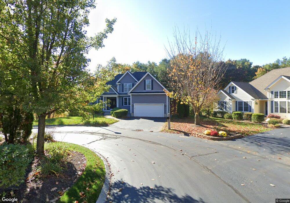
33 Laurmand Way Manchester, NH 03104
Straw-Smyth NeighborhoodEstimated Value: $620,028 - $739,000
3
Beds
2
Baths
2,306
Sq Ft
$299/Sq Ft
Est. Value
About This Home
This home is located at 33 Laurmand Way, Manchester, NH 03104 and is currently estimated at $688,757, approximately $298 per square foot. 33 Laurmand Way is a home located in Hillsborough County with nearby schools including Smyth Road School, Hillside Middle School, and Manchester Central High School.
Ownership History
Date
Name
Owned For
Owner Type
Purchase Details
Closed on
Sep 4, 2007
Sold by
972 Mammoth Road Dev
Bought by
Berry Kenneth
Current Estimated Value
Home Financials for this Owner
Home Financials are based on the most recent Mortgage that was taken out on this home.
Original Mortgage
$229,000
Interest Rate
6.71%
Create a Home Valuation Report for This Property
The Home Valuation Report is an in-depth analysis detailing your home's value as well as a comparison with similar homes in the area
Home Values in the Area
Average Home Value in this Area
Purchase History
| Date | Buyer | Sale Price | Title Company |
|---|---|---|---|
| Berry Kenneth | $369,900 | -- |
Source: Public Records
Mortgage History
| Date | Status | Borrower | Loan Amount |
|---|---|---|---|
| Open | Berry Kenneth | $265,000 | |
| Closed | Berry Kenneth | $277,500 | |
| Closed | Berry Kenneth | $227,000 | |
| Closed | Berry Kenneth | $229,000 |
Source: Public Records
Tax History Compared to Growth
Tax History
| Year | Tax Paid | Tax Assessment Tax Assessment Total Assessment is a certain percentage of the fair market value that is determined by local assessors to be the total taxable value of land and additions on the property. | Land | Improvement |
|---|---|---|---|---|
| 2024 | $10,035 | $512,500 | $0 | $512,500 |
| 2023 | $9,666 | $512,500 | $0 | $512,500 |
| 2022 | $9,348 | $512,500 | $0 | $512,500 |
| 2021 | $9,061 | $512,500 | $0 | $512,500 |
| 2020 | $8,937 | $362,400 | $0 | $362,400 |
| 2019 | $8,814 | $362,400 | $0 | $362,400 |
| 2018 | $8,582 | $362,400 | $0 | $362,400 |
| 2017 | $8,451 | $362,400 | $0 | $362,400 |
| 2016 | $8,386 | $362,400 | $0 | $362,400 |
| 2015 | $8,516 | $363,300 | $0 | $363,300 |
| 2014 | $8,538 | $363,300 | $0 | $363,300 |
| 2013 | -- | $363,300 | $0 | $363,300 |
Source: Public Records
Map
Nearby Homes
- 905 Mammoth Rd Unit 10
- 75 W Haven Rd
- 158 Bruce Rd
- 312 Whittington St
- 71 Bruce Rd
- 1515 Belmont St
- 899 Hall St
- 265 Edward J Roy Dr Unit 207
- 534 Fox Hollow Way
- 541 Pickering St
- 362 Pearl St
- 224 Merritt Nyberg Ln
- 26 Reservoir Ave
- 50 Edward J Roy Dr Unit 10
- 50 Edward J Roy Dr Unit 50
- 330 Bridge St
- 269 Orange St
- 841 Beech St
- 260 Bridge St
- 601 Hall St
- 36 Laurmand Way
- 32 Laurmand Way
- 32 Laurmand Way Unit 32
- 23 Laurmand Way Unit 23
- 23 Laurmand Way
- 23 Laurmand Way
- 23 Laurmand Way Unit 7
- 0 Laurmand Way
- 14 Laurmand Way
- 17 Laurmand Way
- 996 Mammoth Rd
- 988 Mammoth Rd
- 9 Laurmand Way
- 9 Laurmand Way Unit 9
- 9 Laurmand Way Unit 1
- 9 Laurmand Way
- 8 Laurmand Way
- 8 Laurmand Way Unit 8
- 8 Laurmand Way Unit 1
- 7 Laurmand Way