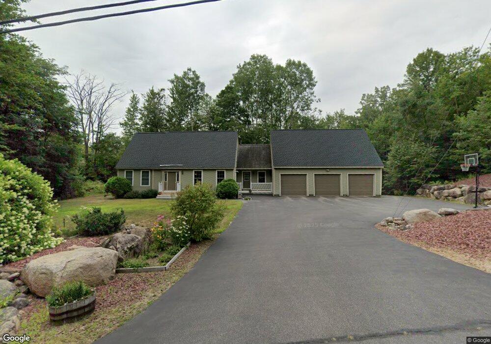
33 Littlefield Rd Bartlett, NH 03812
Estimated Value: $711,368 - $859,000
3
Beds
3
Baths
3,020
Sq Ft
$252/Sq Ft
Est. Value
About This Home
This home is located at 33 Littlefield Rd, Bartlett, NH 03812 and is currently estimated at $761,342, approximately $252 per square foot. 33 Littlefield Rd is a home with nearby schools including Josiah Bartlett Elementary School.
Ownership History
Date
Name
Owned For
Owner Type
Purchase Details
Closed on
Aug 25, 2011
Sold by
Kim E Minasalli Ret
Bought by
Copsey Devin T and Copsey Leigh M
Current Estimated Value
Home Financials for this Owner
Home Financials are based on the most recent Mortgage that was taken out on this home.
Original Mortgage
$280,000
Outstanding Balance
$193,507
Interest Rate
4.53%
Mortgage Type
Purchase Money Mortgage
Estimated Equity
$567,835
Purchase Details
Closed on
Aug 5, 2002
Sold by
Blodgett Thomas C and Blodgett Sally A
Bought by
Minasalli Charles J and Minasalli Kim E
Create a Home Valuation Report for This Property
The Home Valuation Report is an in-depth analysis detailing your home's value as well as a comparison with similar homes in the area
Home Values in the Area
Average Home Value in this Area
Purchase History
| Date | Buyer | Sale Price | Title Company |
|---|---|---|---|
| Copsey Devin T | $295,000 | -- | |
| Minasalli Charles J | $45,000 | -- |
Source: Public Records
Mortgage History
| Date | Status | Borrower | Loan Amount |
|---|---|---|---|
| Open | Minasalli Charles J | $280,000 |
Source: Public Records
Tax History Compared to Growth
Tax History
| Year | Tax Paid | Tax Assessment Tax Assessment Total Assessment is a certain percentage of the fair market value that is determined by local assessors to be the total taxable value of land and additions on the property. | Land | Improvement |
|---|---|---|---|---|
| 2024 | $3,573 | $640,400 | $144,500 | $495,900 |
| 2023 | $3,304 | $640,400 | $144,500 | $495,900 |
| 2022 | $3,183 | $640,400 | $144,500 | $495,900 |
| 2021 | $3,151 | $330,600 | $106,200 | $224,400 |
| 2020 | $3,194 | $330,600 | $106,200 | $224,400 |
| 2019 | $3,088 | $330,600 | $106,200 | $224,400 |
| 2018 | $3,018 | $330,600 | $106,200 | $224,400 |
| 2016 | $2,895 | $304,700 | $74,200 | $230,500 |
| 2015 | $2,907 | $304,700 | $74,200 | $230,500 |
| 2014 | $2,983 | $304,700 | $74,200 | $230,500 |
| 2010 | $3,083 | $336,900 | $81,900 | $255,000 |
Source: Public Records
Map
Nearby Homes
- 17 Pickering Rd
- 41 Linden Rd
- 17 The Meadows Rd
- 791 W Side Rd
- 166 U S 302
- 12G Seasons at Attitash Rd
- 4 Seasons at Attitash Rd Unit D
- 1 Seasons at Attitash Rd
- 2 Seasons at Attitash Rd
- 31 Cave Mountain Rd
- 30 Top Notch Rd Unit 30
- 419 Glen Ledge Rd
- N2 Sandtrap Loop Unit 2
- 22 Sandtrap Loop Unit N3
- 46 Ammonoosuc Dr
- 18 Bunker Ln
- 201 Glen Ledge Rd
- 2E/F River Run Dr Unit E/F
- 8 River Run Dr Unit J
- 8 River Run Dr Unit H
- 21 Littlefield Rd
- 27 Mount Stanton Rd
- 16 Hamlin Way
- 19 Humphfrey Rd
- 21 Littlefield Rd
- 12 Hamlin Way
- 33 Littlefield Rd
- 33 Mt Stanton
- Lot 11 Mount Stanton Rd
- 11 Littlefield Rd
- 18 Hamlin Way
- 50 Littlefield Rd
- 14 Popple Hill Rd
- 18 Mount Stanton Rd
- 12 Hamlin Way
- 00 Popple Hill Rd
- 20 Hamlin Way
- 7 Littlefield Rd
- 10 Pickering Rd
- 32 Humphfrey Rd