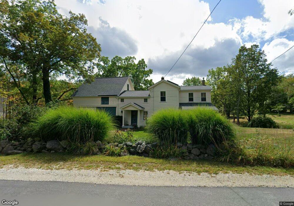
33 Locust Ln Lyndeborough, NH 03082
Estimated Value: $366,000 - $525,000
4
Beds
4
Baths
2,666
Sq Ft
$181/Sq Ft
Est. Value
About This Home
This home is located at 33 Locust Ln, Lyndeborough, NH 03082 and is currently estimated at $482,356, approximately $180 per square foot. 33 Locust Ln is a home located in Hillsborough County with nearby schools including Lyndeborough Central School, Wilton-Lyndeborough Cooperative Middle School, and Wilton-Lyndeborough Cooperative High School.
Ownership History
Date
Name
Owned For
Owner Type
Purchase Details
Closed on
Jul 3, 1997
Sold by
Brown Archie W and Brown Donna
Bought by
Ames Michael P and Ames Enid J
Current Estimated Value
Home Financials for this Owner
Home Financials are based on the most recent Mortgage that was taken out on this home.
Original Mortgage
$86,250
Interest Rate
7.86%
Create a Home Valuation Report for This Property
The Home Valuation Report is an in-depth analysis detailing your home's value as well as a comparison with similar homes in the area
Home Values in the Area
Average Home Value in this Area
Purchase History
| Date | Buyer | Sale Price | Title Company |
|---|---|---|---|
| Ames Michael P | $115,000 | -- |
Source: Public Records
Mortgage History
| Date | Status | Borrower | Loan Amount |
|---|---|---|---|
| Open | Ames Michael P | $61,700 | |
| Open | Ames Michael P | $140,000 | |
| Closed | Ames Michael P | $150,000 | |
| Closed | Ames Michael P | $86,250 |
Source: Public Records
Tax History
| Year | Tax Paid | Tax Assessment Tax Assessment Total Assessment is a certain percentage of the fair market value that is determined by local assessors to be the total taxable value of land and additions on the property. | Land | Improvement |
|---|---|---|---|---|
| 2025 | $8,202 | $483,300 | $149,100 | $334,200 |
| 2024 | $7,409 | $286,500 | $81,200 | $205,300 |
| 2023 | $6,810 | $286,500 | $81,200 | $205,300 |
| 2022 | $6,332 | $286,500 | $81,200 | $205,300 |
| 2021 | $6,332 | $286,500 | $81,200 | $205,300 |
| 2020 | $2,250 | $286,500 | $81,200 | $205,300 |
| 2019 | $6,895 | $236,600 | $77,800 | $158,800 |
| 2018 | $6,674 | $236,600 | $77,800 | $158,800 |
| 2017 | $0 | $236,600 | $77,800 | $158,800 |
| 2016 | $6,563 | $236,600 | $77,800 | $158,800 |
| 2015 | $5,984 | $236,600 | $77,800 | $158,800 |
| 2013 | $5,808 | $242,000 | $84,000 | $158,000 |
Source: Public Records
Map
Nearby Homes
- 41 Cooper Ln
- 6 Mottau Dr
- 58-6-2 Duggin Rd
- 58-2 Davisville Rd
- 113 Gulf Rd
- 77 Salisbury Rd
- 25 Burns Hill Rd
- F88-9 McGettigan Rd
- F/88-5 McGettigan Rd
- F/88-4 McGettigan Rd
- 143 Falcon Ridge Rd Unit 23
- F88-10 McGettigan Rd
- Lots 4 & 7 Gibbons & Robbins Rd
- 33 Falcon Ridge Rd Unit 33
- 85 Intervale Rd
- 13 Dow Rd
- 7 Dow Rd
- 31 Blanchard Hill Rd
- 16 Cortland Rd
- F-88-11 Aria Hill Dr
- Lot 3-70 Locust Ln
- 27 Locust Ln
- 36 Locust Ln
- 42 Locust Ln
- 45 Locust Ln
- 24 Locust Ln
- 9 Locust Ln
- 57 Locust Ln
- 2-2 Emery Holt Rd
- 113 Putnam Hill Rd
- 125 Putnam Hill Rd
- 232 Locust Ln
- 74 Locust Ln
- 232-54-1 Putnam Hill Rd
- 144 Putnam Hill Rd
- 149 Putnam Hill Rd
- 52 Locust Ln
- 122 Putnam Hill Rd
- 154 Putnam Hill Rd
- 154 Putnam Hill Rd
Your Personal Tour Guide
Ask me questions while you tour the home.