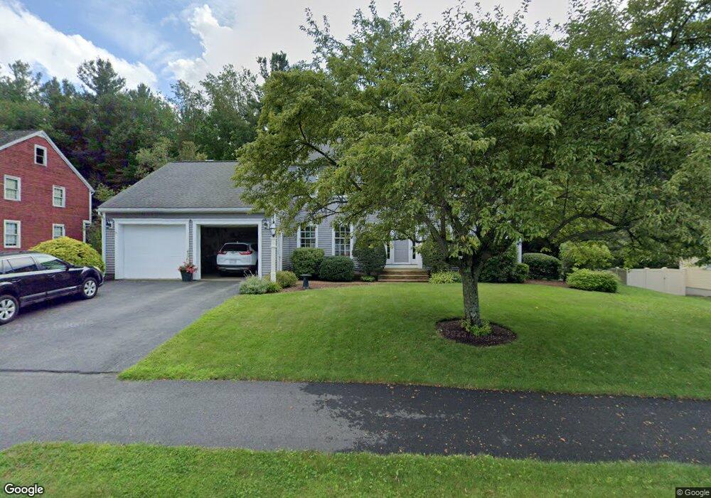
33 Ottoson Way Holden, MA 01520
Estimated Value: $675,348 - $763,000
4
Beds
3
Baths
2,320
Sq Ft
$312/Sq Ft
Est. Value
About This Home
This home is located at 33 Ottoson Way, Holden, MA 01520 and is currently estimated at $722,837, approximately $311 per square foot. 33 Ottoson Way is a home located in Worcester County with nearby schools including Wachusett Regional High School and Bancroft School.
Ownership History
Date
Name
Owned For
Owner Type
Purchase Details
Closed on
Jun 21, 1995
Sold by
Mackay Bruce and Mackay Kathleen
Bought by
Hammer Barbara
Current Estimated Value
Home Financials for this Owner
Home Financials are based on the most recent Mortgage that was taken out on this home.
Original Mortgage
$105,000
Interest Rate
7.82%
Mortgage Type
Purchase Money Mortgage
Create a Home Valuation Report for This Property
The Home Valuation Report is an in-depth analysis detailing your home's value as well as a comparison with similar homes in the area
Home Values in the Area
Average Home Value in this Area
Purchase History
| Date | Buyer | Sale Price | Title Company |
|---|---|---|---|
| Hammer Barbara | $192,000 | -- |
Source: Public Records
Mortgage History
| Date | Status | Borrower | Loan Amount |
|---|---|---|---|
| Open | Hammer Barbara | $150,000 | |
| Closed | Hammer Barbara | $105,000 |
Source: Public Records
Tax History Compared to Growth
Tax History
| Year | Tax Paid | Tax Assessment Tax Assessment Total Assessment is a certain percentage of the fair market value that is determined by local assessors to be the total taxable value of land and additions on the property. | Land | Improvement |
|---|---|---|---|---|
| 2025 | $7,992 | $576,600 | $185,600 | $391,000 |
| 2024 | $7,705 | $544,500 | $180,100 | $364,400 |
| 2023 | $7,303 | $487,200 | $156,600 | $330,600 |
| 2022 | $6,972 | $421,000 | $126,700 | $294,300 |
| 2021 | $6,840 | $393,100 | $124,800 | $268,300 |
| 2020 | $6,627 | $389,800 | $118,900 | $270,900 |
| 2019 | $6,444 | $369,300 | $118,900 | $250,400 |
| 2018 | $5,852 | $332,300 | $113,300 | $219,000 |
| 2017 | $5,699 | $324,000 | $117,000 | $207,000 |
| 2016 | $5,498 | $318,700 | $111,500 | $207,200 |
| 2015 | $5,590 | $308,500 | $111,500 | $197,000 |
| 2014 | $5,476 | $308,500 | $111,500 | $197,000 |
Source: Public Records
Map
Nearby Homes
- 81 Mount View Dr
- 250 Shrewsbury St
- 15 Lowell Ave
- 206 Wachusett St
- 24 John Alden St
- 23 Gail Dr
- 83 Stoneleigh Rd
- 21 Wyoming Dr
- 93 Winfield Rd
- 8 (Lot 1) Holmes Dr
- 29 Glenwood St
- 156 Newell Rd
- 27 Tea Party Cir Unit 27
- 8 Dawson Cir
- 48 Lexington Cir
- 33 Meadow Wood Dr
- 535 Prospect St
- 9 Holmes Dr
- 42 N Worcester Ave
- 7 (Lot 5) Holmes Dr
- 27 Ottoson Way
- 41 Ottoson Way
- 19 Ottoson Way
- 28 Ottoson Way
- 45 Ottoson Way
- 86 Chapel St
- 86 Chapel St Unit all
- 36 Ottoson Way
- 42 Ottoson Way
- 22 Ottoson Way
- 48 Ottoson Way
- 49 Ottoson Way
- 100 Chapel St
- 100 Chapel St Unit 1
- 92 Chapel St
- 92 Chapel St Unit 1
- 132 Mount View Dr
- 129 Mount View Dr
- 98 Chapel St
- 112 Chapel St