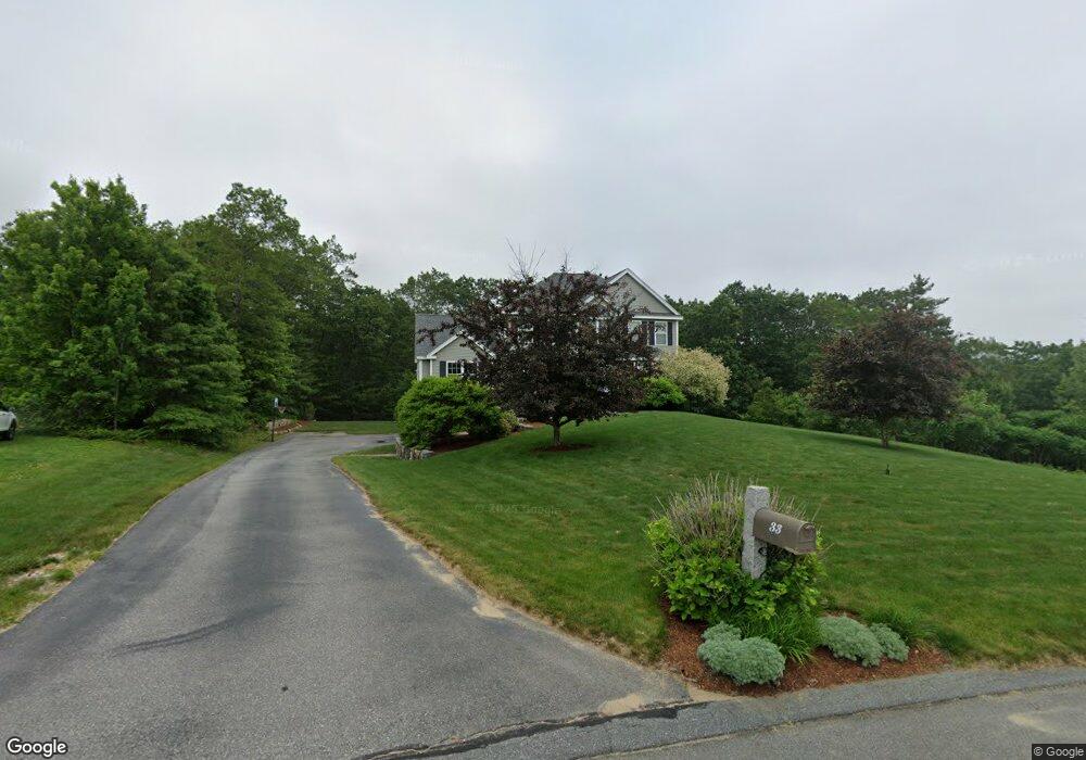
33 Ryan Farm Rd Windham, NH 03087
Estimated Value: $936,768 - $1,330,000
3
Beds
4
Baths
2,597
Sq Ft
$456/Sq Ft
Est. Value
About This Home
This home is located at 33 Ryan Farm Rd, Windham, NH 03087 and is currently estimated at $1,183,692, approximately $455 per square foot. 33 Ryan Farm Rd is a home with nearby schools including Golden Brook Elementary School, Windham Middle School, and Windham High School.
Ownership History
Date
Name
Owned For
Owner Type
Purchase Details
Closed on
Jul 24, 2014
Sold by
Weick Adam D and Weick Dena M
Bought by
Weick Adam D
Current Estimated Value
Home Financials for this Owner
Home Financials are based on the most recent Mortgage that was taken out on this home.
Original Mortgage
$367,000
Outstanding Balance
$279,754
Interest Rate
4.18%
Mortgage Type
Purchase Money Mortgage
Estimated Equity
$903,938
Purchase Details
Closed on
Sep 2, 2011
Sold by
Great Mountain View Es
Bought by
Weick Adam D and Weick Dena M
Home Financials for this Owner
Home Financials are based on the most recent Mortgage that was taken out on this home.
Original Mortgage
$375,770
Interest Rate
4.52%
Mortgage Type
Purchase Money Mortgage
Purchase Details
Closed on
Jun 17, 2004
Sold by
Rowell Rd Rt
Bought by
Newbury North Dev Corp
Create a Home Valuation Report for This Property
The Home Valuation Report is an in-depth analysis detailing your home's value as well as a comparison with similar homes in the area
Home Values in the Area
Average Home Value in this Area
Purchase History
| Date | Buyer | Sale Price | Title Company |
|---|---|---|---|
| Weick Adam D | -- | -- | |
| Weick Adam D | $469,800 | -- | |
| Newbury North Dev Corp | $62,500 | -- |
Source: Public Records
Mortgage History
| Date | Status | Borrower | Loan Amount |
|---|---|---|---|
| Open | Weick Adam D | $367,000 | |
| Previous Owner | Newbury North Dev Corp | $375,000 | |
| Previous Owner | Newbury North Dev Corp | $375,770 |
Source: Public Records
Tax History
| Year | Tax Paid | Tax Assessment Tax Assessment Total Assessment is a certain percentage of the fair market value that is determined by local assessors to be the total taxable value of land and additions on the property. | Land | Improvement |
|---|---|---|---|---|
| 2024 | $14,893 | $657,800 | $250,400 | $407,400 |
| 2023 | $14,077 | $657,800 | $250,400 | $407,400 |
| 2022 | $12,998 | $657,800 | $250,400 | $407,400 |
| 2021 | $12,248 | $657,800 | $250,400 | $407,400 |
| 2020 | $12,584 | $657,800 | $250,400 | $407,400 |
| 2019 | $11,654 | $516,800 | $204,400 | $312,400 |
| 2018 | $11,680 | $501,500 | $204,400 | $297,100 |
| 2017 | $10,130 | $501,500 | $204,400 | $297,100 |
| 2016 | $10,943 | $501,500 | $204,400 | $297,100 |
| 2015 | $10,893 | $501,500 | $204,400 | $297,100 |
| 2014 | $11,758 | $489,900 | $227,000 | $262,900 |
| 2013 | $11,953 | $506,500 | $227,000 | $279,500 |
Source: Public Records
Map
Nearby Homes
- 23 Ryan Farm Rd
- 2 Cypress Ln
- 7 Cypress Ln Unit 5
- 4 Cypress Ln Unit 10
- 84, 86, 88 Ryan Farm Rd Unit 1, 2, 3
- 1102 Mammoth Rd Unit A&B
- 11 Venus Way
- 7 Venus Way Unit 22
- 1109 Mammoth Rd Unit A
- 63 Mammoth Rd
- 51 Brookview Rd
- 51 Brookview Rd Unit 4.1
- 13B Hedgerow Dr
- 10 Lund Dr
- 47 Cobbetts Pond Rd
- 48 Marblehead Rd
- 94 Tanager Cir Unit 94
- 9 York Rd
- 6 Hemlock Dr
- 4 Elijah Hill Ln
- 31 Ryan Farm Rd
- 35 Ryan Farm Rd
- Lot 633 Ryan Farm Rd
- Lot 613 Ryan Farm Rd
- 34 Ryan Farm Rd
- 29 Ryan Farm Rd
- L308 Ryan Farm Rd
- 37 Ryan Farm Rd
- 30 Ryan Farm Rd
- 27 Ryan Farm Rd
- 38 Ryan Farm Rd
- 28 Ryan Farm Rd
- 39 Ryan Farm Rd
- 25 Ryan Farm Rd
- 7 Ryan Farm Rd
- 41 Ryan Farm Rd
- 9 Ryan Farm Rd
- 26 Ryan Farm Rd
- Lot 630 Ryan Farm Rd
- 5 Ryan Farm Rd
Your Personal Tour Guide
Ask me questions while you tour the home.