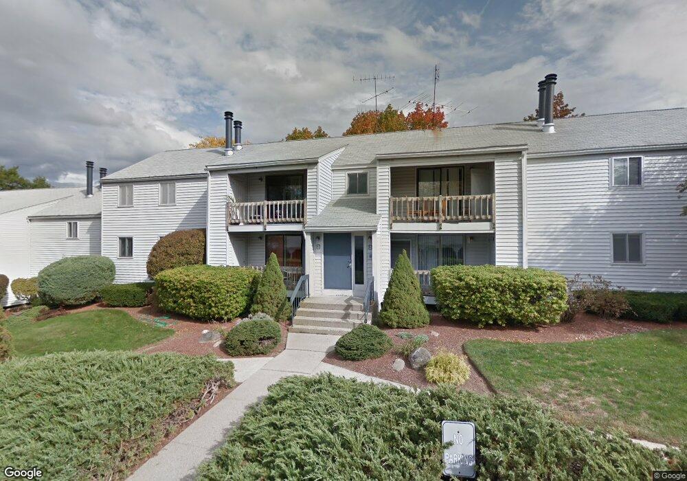
33 Spit Brook Rd Unit UA24 Nashua, NH 03060
Southeast Nashua NeighborhoodEstimated Value: $342,223 - $368,000
2
Beds
1
Bath
1,106
Sq Ft
$321/Sq Ft
Est. Value
About This Home
This home is located at 33 Spit Brook Rd Unit UA24, Nashua, NH 03060 and is currently estimated at $355,556, approximately $321 per square foot. 33 Spit Brook Rd Unit UA24 is a home located in Hillsborough County with nearby schools including Sunset Heights Elementary School, Elm Street Middle School, and Nashua High School South.
Ownership History
Date
Name
Owned For
Owner Type
Purchase Details
Closed on
Mar 15, 2018
Sold by
Watler F Dawson Ret
Bought by
Dawson Watler F and Dawson Mary J
Current Estimated Value
Purchase Details
Closed on
May 18, 2017
Sold by
Hanifa Mohamedarif
Bought by
Walter F Dawson Ret
Purchase Details
Closed on
Jun 3, 2014
Sold by
Cushing Karen B and Loos William D B
Bought by
Hanifa Mohanedarif
Purchase Details
Closed on
Sep 26, 2012
Sold by
Nugent Leonard M and Nugent Mary
Bought by
Cushing Karen B and Loos William D B
Purchase Details
Closed on
Jul 25, 2006
Sold by
Brien Roger and Brien Barbara M
Bought by
Nugent Leonard M and Nugent Mary
Create a Home Valuation Report for This Property
The Home Valuation Report is an in-depth analysis detailing your home's value as well as a comparison with similar homes in the area
Home Values in the Area
Average Home Value in this Area
Purchase History
| Date | Buyer | Sale Price | Title Company |
|---|---|---|---|
| Dawson Watler F | -- | -- | |
| Dawson Watler F | -- | -- | |
| Walter F Dawson Ret | $165,000 | -- | |
| Walter F Dawson Ret | $165,000 | -- | |
| Hanifa Mohanedarif | $136,000 | -- | |
| Hanifa Mohanedarif | $136,000 | -- | |
| Cushing Karen B | $134,000 | -- | |
| Cushing Karen B | $134,000 | -- | |
| Nugent Leonard M | $209,900 | -- | |
| Nugent Leonard M | $209,900 | -- |
Source: Public Records
Mortgage History
| Date | Status | Borrower | Loan Amount |
|---|---|---|---|
| Closed | Nugent Leonard M | $0 |
Source: Public Records
Tax History Compared to Growth
Tax History
| Year | Tax Paid | Tax Assessment Tax Assessment Total Assessment is a certain percentage of the fair market value that is determined by local assessors to be the total taxable value of land and additions on the property. | Land | Improvement |
|---|---|---|---|---|
| 2024 | $4,668 | $293,600 | $0 | $293,600 |
| 2023 | $4,401 | $241,400 | $0 | $241,400 |
| 2022 | $4,362 | $241,400 | $0 | $241,400 |
| 2021 | $3,836 | $165,200 | $0 | $165,200 |
| 2020 | $3,735 | $165,200 | $0 | $165,200 |
| 2019 | $3,595 | $165,200 | $0 | $165,200 |
| 2018 | $3,504 | $165,200 | $0 | $165,200 |
| 2017 | $3,177 | $123,200 | $0 | $123,200 |
| 2016 | $3,089 | $123,200 | $0 | $123,200 |
| 2015 | $3,022 | $123,200 | $0 | $123,200 |
| 2014 | $2,963 | $123,200 | $0 | $123,200 |
Source: Public Records
Map
Nearby Homes
- 1 Louisburg Square Unit 2
- 113 Bluestone Dr
- H2 Black Oak Dr Unit 2
- 6 Heritage Village Dr Unit U408
- 73 Bluestone Dr
- 9 Louisburg Square Unit U12
- 12 Strawberry Bank Rd Unit 14
- 5 Autumn Leaf Dr Unit 13
- 10 Sutherland Way Unit U20
- 43b River Rd
- 29 Hawthorne Village Rd Unit U357
- 84 Hawthorne Village Rd Unit U414
- 116 Lille Rd
- 10 Mountain Laurels Dr Unit 606
- 97 Hawthorne Village Rd Unit U390
- 16 Mountain Laurels Dr Unit 402
- 4 April Dr
- 98 Peele Rd
- 10 Lamb Rd
- 1 Wintergreen Dr
- 33 Spit Brook Rd Unit UA9
- 33 Spit Brook Rd Unit UA8
- 33 Spit Brook Rd Unit UA7
- 33 Spit Brook Rd Unit UA6
- 33 Spit Brook Rd Unit UA5
- 33 Spit Brook Rd Unit UA4
- 33 Spit Brook Rd Unit UA3
- 33 Spit Brook Rd Unit UA25
- 33 Spit Brook Rd Unit UA23
- 33 Spit Brook Rd Unit UA22
- 33 Spit Brook Rd Unit UA21
- 33 Spit Brook Rd Unit UA20
- 33 Spit Brook Rd Unit UA2
- 33 Spit Brook Rd Unit UA19
- 33 Spit Brook Rd Unit UA18
- 33 Spit Brook Rd Unit UA17
- 33 Spit Brook Rd Unit UA16
- 33 Spit Brook Rd Unit UA15
- 33 Spit Brook Rd Unit UA14
- 33 Spit Brook Rd Unit UA12