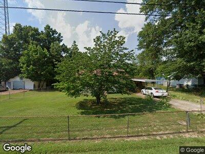
330 Atwood St Trezevant, TN 38258
Estimated Value: $70,436 - $131,000
--
Bed
1
Bath
1,236
Sq Ft
$74/Sq Ft
Est. Value
About This Home
This home is located at 330 Atwood St, Trezevant, TN 38258 and is currently estimated at $91,109, approximately $73 per square foot. 330 Atwood St is a home located in Carroll County with nearby schools including West Carroll Primary School, West Carroll Elementary School, and West Carroll Junior/Senior High School.
Ownership History
Date
Name
Owned For
Owner Type
Purchase Details
Closed on
Jun 19, 2012
Sold by
Richardson Shirley Baker
Bought by
Baker Tony and O Shirley Richard C
Current Estimated Value
Purchase Details
Closed on
Apr 18, 2006
Sold by
Melton Josaphine
Bought by
Richardson Shirley B
Purchase Details
Closed on
Aug 10, 1957
Bought by
Melton Josaphine
Create a Home Valuation Report for This Property
The Home Valuation Report is an in-depth analysis detailing your home's value as well as a comparison with similar homes in the area
Home Values in the Area
Average Home Value in this Area
Purchase History
| Date | Buyer | Sale Price | Title Company |
|---|---|---|---|
| Baker Tony | $38,400 | -- | |
| Richardson Shirley B | -- | -- | |
| Melton Josaphine | -- | -- |
Source: Public Records
Tax History Compared to Growth
Tax History
| Year | Tax Paid | Tax Assessment Tax Assessment Total Assessment is a certain percentage of the fair market value that is determined by local assessors to be the total taxable value of land and additions on the property. | Land | Improvement |
|---|---|---|---|---|
| 2024 | $339 | $10,325 | $1,000 | $9,325 |
| 2023 | $339 | $10,325 | $1,000 | $9,325 |
| 2022 | $339 | $10,325 | $1,000 | $9,325 |
| 2021 | $213 | $10,325 | $1,000 | $9,325 |
| 2020 | $339 | $10,325 | $1,000 | $9,325 |
| 2019 | $319 | $8,850 | $1,000 | $7,850 |
| 2018 | $319 | $8,850 | $1,000 | $7,850 |
| 2017 | $319 | $8,850 | $1,000 | $7,850 |
| 2016 | $438 | $8,850 | $1,000 | $7,850 |
| 2015 | $328 | $8,850 | $1,000 | $7,850 |
| 2014 | $363 | $8,850 | $1,000 | $7,850 |
| 2013 | $363 | $9,608 | $0 | $0 |
Source: Public Records
Map
Nearby Homes
- 0 Broad St S
- 290 Hurt St
- 45 Johnson St
- 160 Peggy Ln
- 13600 Church St
- 0 Jax Rd
- 5190 Clay Farm Rd
- 383 Big Buck Rd
- 675 Pilgrims Rest Rd
- 1570 Mccullough Rd
- 1810 Hinkledale Rd
- 740 Gann Rd
- 512 W Mitchell Rd
- 1946 Independence Rd
- 00 Idlewild Hollyleaf Rd
- 0 Bluebird Ln
- 00 Bluebird Ln
- 396 Windy Pines Ln
- 0 Windy Pines Ln Unit 2501569
- 45 Sydnor Rd
