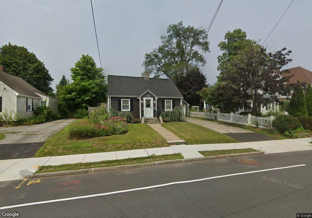
330 Burncoat St Worcester, MA 01606
Greendale NeighborhoodEstimated Value: $410,000 - $451,000
3
Beds
2
Baths
1,260
Sq Ft
$339/Sq Ft
Est. Value
About This Home
This home is located at 330 Burncoat St, Worcester, MA 01606 and is currently estimated at $426,891, approximately $338 per square foot. 330 Burncoat St is a home located in Worcester County with nearby schools including Jacob Hiatt Magnet School, Chandler Magnet, and Thorndyke Road School.
Ownership History
Date
Name
Owned For
Owner Type
Purchase Details
Closed on
May 28, 2002
Sold by
Pino Kimberly M and Jarvis Kimberly M
Bought by
Daughdrill Stephen and Beaudry Amy M
Current Estimated Value
Home Financials for this Owner
Home Financials are based on the most recent Mortgage that was taken out on this home.
Original Mortgage
$164,000
Outstanding Balance
$70,322
Interest Rate
7.01%
Mortgage Type
Purchase Money Mortgage
Estimated Equity
$356,569
Purchase Details
Closed on
May 6, 1999
Sold by
Ting Andrew J and Ting Mary E
Bought by
Jarvis Kimberly M
Home Financials for this Owner
Home Financials are based on the most recent Mortgage that was taken out on this home.
Original Mortgage
$117,800
Interest Rate
6.92%
Mortgage Type
Purchase Money Mortgage
Create a Home Valuation Report for This Property
The Home Valuation Report is an in-depth analysis detailing your home's value as well as a comparison with similar homes in the area
Home Values in the Area
Average Home Value in this Area
Purchase History
| Date | Buyer | Sale Price | Title Company |
|---|---|---|---|
| Daughdrill Stephen | $205,000 | -- | |
| Jarvis Kimberly M | $124,000 | -- |
Source: Public Records
Mortgage History
| Date | Status | Borrower | Loan Amount |
|---|---|---|---|
| Open | Jarvis Kimberly M | $164,000 | |
| Previous Owner | Jarvis Kimberly M | $117,800 | |
| Previous Owner | Jarvis Kimberly M | $25,000 |
Source: Public Records
Tax History
| Year | Tax Paid | Tax Assessment Tax Assessment Total Assessment is a certain percentage of the fair market value that is determined by local assessors to be the total taxable value of land and additions on the property. | Land | Improvement |
|---|---|---|---|---|
| 2025 | $5,028 | $381,200 | $117,700 | $263,500 |
| 2024 | $4,927 | $358,300 | $117,700 | $240,600 |
| 2023 | $4,725 | $329,500 | $102,400 | $227,100 |
| 2022 | $4,330 | $284,700 | $81,900 | $202,800 |
| 2021 | $4,169 | $256,100 | $65,500 | $190,600 |
| 2020 | $4,061 | $238,900 | $65,500 | $173,400 |
| 2019 | $3,859 | $214,400 | $58,900 | $155,500 |
| 2018 | $3,863 | $204,300 | $58,900 | $145,400 |
| 2017 | $3,696 | $192,300 | $58,900 | $133,400 |
| 2016 | $3,636 | $176,400 | $42,900 | $133,500 |
| 2015 | $3,540 | $176,400 | $42,900 | $133,500 |
| 2014 | $3,447 | $176,400 | $42,900 | $133,500 |
Source: Public Records
Map
Nearby Homes
- 331 Burncoat St
- 323 Burncoat St
- 66 Eunice Ave
- 169 Whitmarsh Ave
- 58 Osceola Ave
- 39 Whitmarsh Ave
- 30 Danielles Way
- 13 Fatima Ln
- 15 Ericsson St
- 3205 Halcyon Dr Unit 3205
- 53 Collins St
- 12 Erie Ave
- 45 Goldthwaite Rd
- 41 Mohave Rd
- 37 Mohave Rd
- 44 Boardman St
- 22 Huron Ave
- 31 Boardman St
- 30 Melrose St
- 39 Mountainshire Dr
- 332 Burncoat St
- 328 Burncoat St
- 336 Burncoat St
- 20 Chatham Village Rd
- 326 Burncoat St
- 18 Chatham Village Rd
- 154 Fairhaven Rd
- 324 Burncoat St
- 327 Burncoat St
- 325 Burncoat St
- 158 Fairhaven Rd
- 338 Burncoat St
- 16 Chatham Village Rd
- 22 Chatham Village Rd
- 148 Fairhaven Rd
- 321 Burncoat St
- 14 Chatham Village Rd
- 322 Burncoat St
- 166 Fairhaven Rd
- 319 Burncoat St
Your Personal Tour Guide
Ask me questions while you tour the home.