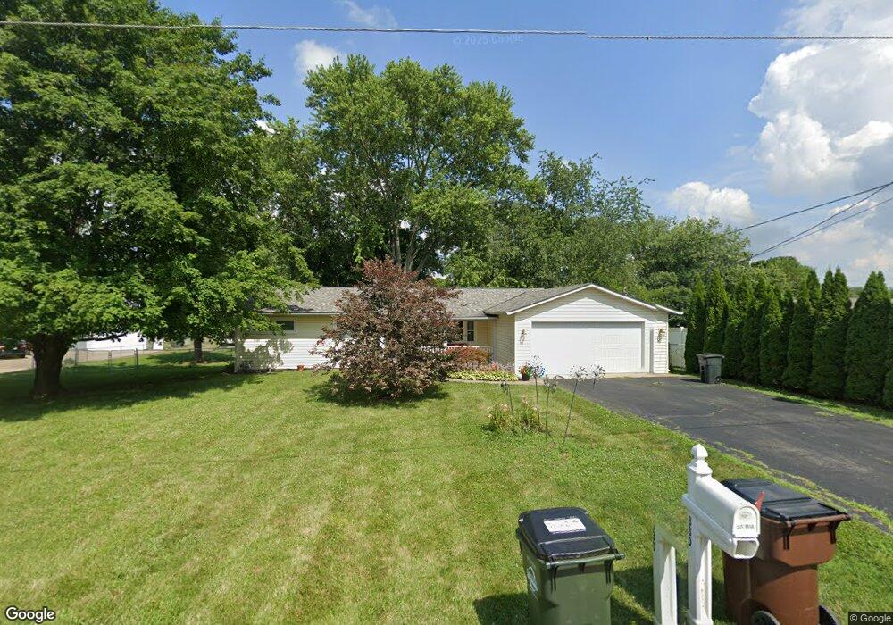
330 Maple Ave Franklin, OH 45005
Estimated Value: $187,000 - $228,000
3
Beds
2
Baths
1,469
Sq Ft
$144/Sq Ft
Est. Value
About This Home
This home is located at 330 Maple Ave, Franklin, OH 45005 and is currently estimated at $211,100, approximately $143 per square foot. 330 Maple Ave is a home located in Warren County with nearby schools including Alden R Brown Elementary School, Chamberlain Middle School, and Carlisle High School.
Ownership History
Date
Name
Owned For
Owner Type
Purchase Details
Closed on
Jun 21, 2019
Sold by
Putman Robert A and Putman Diane
Bought by
Dwyer Dennis G and Dwyer Rebecca M
Current Estimated Value
Home Financials for this Owner
Home Financials are based on the most recent Mortgage that was taken out on this home.
Original Mortgage
$115,560
Outstanding Balance
$100,540
Interest Rate
4%
Mortgage Type
New Conventional
Estimated Equity
$110,560
Purchase Details
Closed on
Dec 7, 1988
Sold by
Townsend Richard D and Townsend Deb
Bought by
Putman and Putman Robert A
Purchase Details
Closed on
Jul 16, 1979
Sold by
Kirkpatrick Kirkpatrick and Kirkpatrick Bobby R
Purchase Details
Closed on
Apr 12, 1978
Sold by
Hall Hall and Hall Steven Michael
Create a Home Valuation Report for This Property
The Home Valuation Report is an in-depth analysis detailing your home's value as well as a comparison with similar homes in the area
Home Values in the Area
Average Home Value in this Area
Purchase History
| Date | Buyer | Sale Price | Title Company |
|---|---|---|---|
| Dwyer Dennis G | $128,400 | None Available | |
| Putman | $51,800 | -- | |
| -- | $38,900 | -- | |
| -- | $30,000 | -- |
Source: Public Records
Mortgage History
| Date | Status | Borrower | Loan Amount |
|---|---|---|---|
| Open | Dwyer Dennis G | $115,560 |
Source: Public Records
Tax History
| Year | Tax Paid | Tax Assessment Tax Assessment Total Assessment is a certain percentage of the fair market value that is determined by local assessors to be the total taxable value of land and additions on the property. | Land | Improvement |
|---|---|---|---|---|
| 2025 | $2,243 | $57,410 | $17,850 | $39,560 |
| 2024 | $2,243 | $57,410 | $17,850 | $39,560 |
| 2023 | $1,853 | $43,186 | $11,623 | $31,563 |
| 2022 | $1,841 | $43,187 | $11,624 | $31,563 |
| 2021 | $1,778 | $43,187 | $11,624 | $31,563 |
| 2020 | $1,658 | $35,109 | $9,450 | $25,659 |
| 2019 | $1,681 | $35,109 | $9,450 | $25,659 |
| 2018 | $1,686 | $35,109 | $9,450 | $25,659 |
| 2017 | $1,616 | $31,112 | $8,495 | $22,617 |
| 2016 | $1,415 | $31,112 | $8,495 | $22,617 |
| 2015 | $1,419 | $31,112 | $8,495 | $22,617 |
| 2014 | $1,387 | $31,110 | $8,490 | $22,620 |
| 2013 | $1,382 | $38,450 | $10,500 | $27,950 |
Source: Public Records
Map
Nearby Homes
- 5711 Fairview Dr
- 150 Dalton Ave
- 114 Fairview Dr
- 122 Arthur Ave
- 118 Arthur Ave
- 1909 Cleopatra Dr
- 180 Chestnut Ave
- 6071 1st Ave
- 6040 6th Ave
- 571 Elm Dr
- 812 Victoria Dr
- 228 Bridge St
- 165 Elaine Dr
- 533 Clay St
- 533 Spring Ave
- 0 Victoria Dr Unit 942075
- 0 Victoria Dr Unit 1852824
- 3 Chestnut St
- 616 Lake Ave
- 1512 Knightsbridge Ct
Your Personal Tour Guide
Ask me questions while you tour the home.