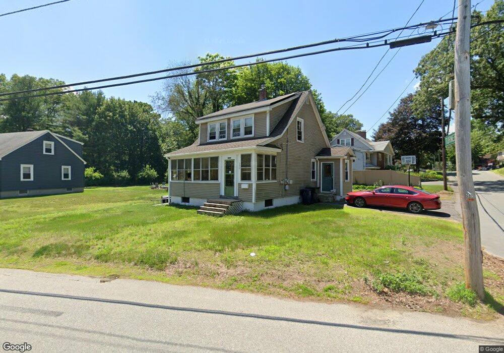
330 Sladen St Dracut, MA 01826
Estimated Value: $458,000 - $566,000
4
Beds
2
Baths
1,248
Sq Ft
$404/Sq Ft
Est. Value
About This Home
This home is located at 330 Sladen St, Dracut, MA 01826 and is currently estimated at $503,932, approximately $403 per square foot. 330 Sladen St is a home located in Middlesex County with nearby schools including George H. Englesby Elementary School, Richardson Middle School, and Dracut Senior High School.
Ownership History
Date
Name
Owned For
Owner Type
Purchase Details
Closed on
Jul 31, 1998
Sold by
Bean Marc W and Bean Patricia M
Bought by
Cotton Michael H and Cotton Lori A
Current Estimated Value
Purchase Details
Closed on
Sep 27, 1996
Sold by
Tardiff Ft
Bought by
Bean Marc W and Golden Patricia
Purchase Details
Closed on
Aug 31, 1993
Sold by
Tardiff Grace M
Bought by
Tardiff Ft
Create a Home Valuation Report for This Property
The Home Valuation Report is an in-depth analysis detailing your home's value as well as a comparison with similar homes in the area
Home Values in the Area
Average Home Value in this Area
Purchase History
| Date | Buyer | Sale Price | Title Company |
|---|---|---|---|
| Cotton Michael H | $127,900 | -- | |
| Bean Marc W | $96,400 | -- | |
| Tardiff Ft | $100,000 | -- |
Source: Public Records
Mortgage History
| Date | Status | Borrower | Loan Amount |
|---|---|---|---|
| Open | Tardiff Ft | $228,709 | |
| Closed | Tardiff Ft | $162,000 | |
| Closed | Tardiff Ft | $156,716 |
Source: Public Records
Tax History Compared to Growth
Tax History
| Year | Tax Paid | Tax Assessment Tax Assessment Total Assessment is a certain percentage of the fair market value that is determined by local assessors to be the total taxable value of land and additions on the property. | Land | Improvement |
|---|---|---|---|---|
| 2025 | $3,860 | $381,400 | $178,900 | $202,500 |
| 2024 | $3,846 | $368,000 | $170,400 | $197,600 |
| 2023 | $3,677 | $317,500 | $148,100 | $169,400 |
| 2022 | $3,650 | $297,000 | $134,600 | $162,400 |
| 2021 | $3,678 | $282,700 | $122,400 | $160,300 |
| 2020 | $3,686 | $276,100 | $118,900 | $157,200 |
| 2019 | $3,388 | $246,400 | $113,200 | $133,200 |
| 2018 | $13,528 | $236,000 | $113,200 | $122,800 |
| 2017 | $13,635 | $236,000 | $113,200 | $122,800 |
| 2016 | $3,067 | $206,700 | $108,800 | $97,900 |
| 2015 | $2,946 | $197,300 | $108,800 | $88,500 |
| 2014 | $2,769 | $191,100 | $108,800 | $82,300 |
Source: Public Records
Map
Nearby Homes
- 157 Old Rd
- 174 Old Rd
- 11 Mountain View Dr
- 100 Cass Ave Unit A13
- 190 Old Rd
- 14 Louis Farm Rd Unit 14
- 999 Hildreth St
- 20 Dean Ave
- 15 Louis Farm Rd Unit 15
- 81 Spring Park Ave
- 1572 Bridge St
- 94 Hampson St
- 26 Frank St
- 18 Stone St
- 148 Flower Ln Unit 14
- 83 Turgeon Ave
- 161 Flower Ln Unit 5
- 101 Donohue Rd Unit 19
- 101 Donohue Rd Unit 3
- 363 Hildreth St Unit 11
- 320 Sladen St
- 63 Turner Ave
- 333 Sladen St
- 319 Sladen St
- 312 Sladen St
- 60 Turner Ave
- 339 Sladen St
- 344 Sladen St
- 59 Turner Ave
- 318 Sladen St
- 345 Sladen St
- 304 Sladen St
- 44 Turner Ave
- 42 Turner Ave
- 23 Stevens St
- 27 Stevens St
- 31 Bolton Ave
- 303 Sladen St
- 309 Sladen St Unit Right-B
- 309 Sladen St Unit Left-A