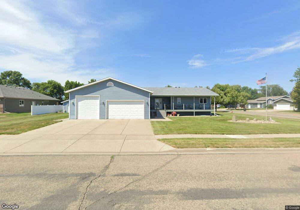
3304 Devon Place Bismarck, ND 58504
Southwest Bismarck NeighborhoodEstimated Value: $475,000 - $510,464
4
Beds
4
Baths
1,888
Sq Ft
$265/Sq Ft
Est. Value
About This Home
This home is located at 3304 Devon Place, Bismarck, ND 58504 and is currently estimated at $499,866, approximately $264 per square foot. 3304 Devon Place is a home located in Burleigh County with nearby schools including Victor Solheim Elementary School, Wachter Middle School, and Bismarck High School.
Ownership History
Date
Name
Owned For
Owner Type
Purchase Details
Closed on
Sep 29, 2025
Sold by
Mcgraw Paul L and Mcgraw Colleen M
Bought by
Mcgraw Paul L and Mcgraw Colleen M
Current Estimated Value
Purchase Details
Closed on
Dec 30, 2015
Sold by
Hanson Charles A and Hanson Linda J
Bought by
Mcgraw Paul L and Mcgraw Colleen M
Home Financials for this Owner
Home Financials are based on the most recent Mortgage that was taken out on this home.
Original Mortgage
$65,000
Interest Rate
3.96%
Mortgage Type
New Conventional
Create a Home Valuation Report for This Property
The Home Valuation Report is an in-depth analysis detailing your home's value as well as a comparison with similar homes in the area
Home Values in the Area
Average Home Value in this Area
Purchase History
| Date | Buyer | Sale Price | Title Company |
|---|---|---|---|
| Mcgraw Paul L | -- | None Listed On Document | |
| Mcgraw Paul L | -- | First Dakota Title |
Source: Public Records
Mortgage History
| Date | Status | Borrower | Loan Amount |
|---|---|---|---|
| Previous Owner | Mcgraw Paul L | $65,000 |
Source: Public Records
Tax History
| Year | Tax Paid | Tax Assessment Tax Assessment Total Assessment is a certain percentage of the fair market value that is determined by local assessors to be the total taxable value of land and additions on the property. | Land | Improvement |
|---|---|---|---|---|
| 2025 | $3,307 | $228,200 | $31,000 | $197,200 |
| 2024 | $3,534 | $210,300 | $28,000 | $182,300 |
| 2023 | $5,166 | $210,300 | $28,000 | $182,300 |
| 2022 | $4,741 | $207,000 | $28,000 | $179,000 |
| 2021 | $3,971 | $163,900 | $26,000 | $137,900 |
| 2020 | $3,843 | $163,900 | $26,000 | $137,900 |
| 2019 | $3,677 | $161,500 | $0 | $0 |
| 2018 | $3,389 | $161,500 | $26,000 | $135,500 |
| 2017 | $3,056 | $161,500 | $26,000 | $135,500 |
| 2016 | $3,056 | $161,500 | $21,000 | $140,500 |
| 2014 | -- | $145,800 | $0 | $0 |
Source: Public Records
Map
Nearby Homes
- 34 Rutland Dr
- 41 Rutland Dr
- 29 Rutland Dr
- 3402 Rutland Dr
- 3308 Kenner Loop
- 3312 Kenner Loop
- 3304 Kenner Loop
- 3214 Kenner Loop
- 110 Kenner Loop
- 127 Kenner Loop
- 2872 Warwick Loop Unit 2872
- 203 Kenner Loop
- 3708 Downing St
- 3200 Dortmund Dr
- 2831 Warwick Loop
- 3724 Poseidon Loop
- 51/52 Fisher Ln
- 57/58 Fisher Ln
- 59/60 Fisher Ln
- 53/54 Fisher Ln
- 3301 Devon Place
- 3216 Manchester St
- 3250 Devon Dr
- 3312 Devon Place
- 3219 Manchester St
- 3208 Manchester St
- 3309 Devon Place
- 3213 Manchester St
- 3311 Manchester St
- 3249 Devon Dr
- 3315 Devon Place
- 3160 Manchester Place
- 3318 Devon Place
- 3240 Devon Dr
- 3207 Manchester St
- 3144 Hampton St
- 3326 Devon Place
- 3150 Manchester Place
- 3243 Devon Dr
- 3138 Hampton St
Your Personal Tour Guide
Ask me questions while you tour the home.